
Mistelgau Rundwanderweg - Hohenbuche and Eckersdorf - Grosser Rundwanderweg
Download
3D Flyover
Add to list
More
12.0 km
~2 hrs 57 min
332 m
Loop
“Explore the scenic 12 km Mistelgau Rundwanderweg, blending natural beauty, historical landmarks, and diverse wildlife.”
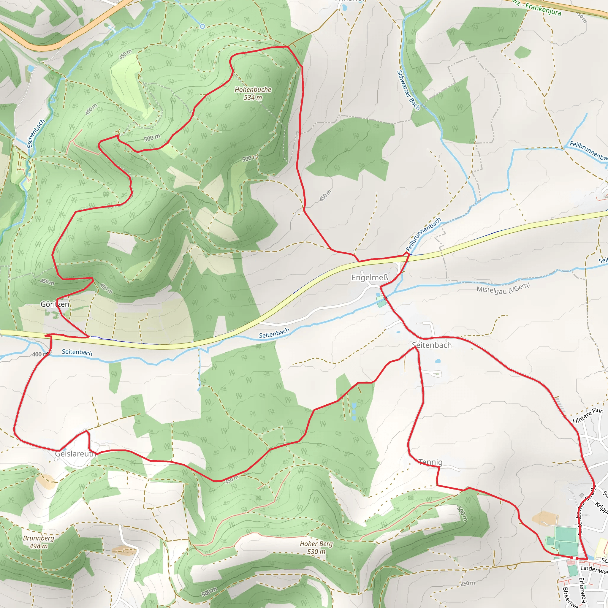
Starting near Bayreuth, Germany, the Mistelgau Rundwanderweg - Hohenbuche and Eckersdorf - Grosser Rundwanderweg is a scenic loop trail that spans approximately 12 kilometers (7.5 miles) with an elevation gain of around 300 meters (984 feet). This medium-difficulty trail offers a blend of natural beauty, historical landmarks, and diverse wildlife, making it a rewarding experience for hikers.
Getting There
To reach the trailhead, you can either drive or use public transport. If driving, head towards Bayreuth and follow signs to Mistelgau. There is ample parking available near the starting point. For those using public transport, take a train to Bayreuth Hauptbahnhof and then a bus to Mistelgau. The nearest significant landmark to the trailhead is the Mistelgau Town Hall.
Trail Overview
The trail begins with a gentle ascent through lush forests, offering a serene start to your hike. As you progress, you'll encounter a mix of deciduous and coniferous trees, providing ample shade and a cool environment even during warmer months. The first significant landmark is the Hohenbuche viewpoint, approximately 3 kilometers (1.9 miles) into the hike. Here, you can take a moment to enjoy panoramic views of the surrounding countryside.
Historical Significance
Around the 5-kilometer (3.1 miles) mark, you'll come across the ruins of an old castle, a testament to the region's rich history. This area was once a strategic point during medieval times, and the remnants of the castle walls offer a glimpse into the past. Information boards provide historical context, making it a great spot for a brief educational break.
Wildlife and Nature
As you continue, the trail meanders through open meadows and dense woodlands, home to a variety of wildlife. Keep an eye out for deer, foxes, and a plethora of bird species. The diverse flora includes wildflowers, ferns, and moss-covered rocks, adding to the trail's natural charm.
Navigation and Safety
The trail is well-marked, but it's always a good idea to have a reliable navigation tool. HiiKER is recommended for its detailed maps and real-time updates. The path can be muddy after rain, so sturdy hiking boots are advisable. There are a few steep sections, particularly as you approach the highest point of the trail, but they are manageable with moderate fitness levels.
Points of Interest
At around 8 kilometers (5 miles), you'll reach Eckersdorf, a quaint village that offers a perfect spot for a rest. Here, you can explore local shops and perhaps grab a snack before continuing. The village church, dating back to the 18th century, is worth a visit for its beautiful architecture and serene atmosphere.
Final Stretch
The last 4 kilometers (2.5 miles) take you through rolling hills and farmland, gradually descending back towards Mistelgau. The trail offers a mix of open landscapes and shaded paths, providing a pleasant end to your hike. As you near the trailhead, you'll pass by a small lake, a perfect spot for a final rest and reflection on your journey.
This trail offers a well-rounded hiking experience with its combination of natural beauty, historical landmarks, and diverse wildlife. Whether you're a seasoned hiker or a casual walker, the Mistelgau Rundwanderweg - Hohenbuche and Eckersdorf - Grosser Rundwanderweg promises a memorable adventure.
Comments and Reviews
User comments, reviews and discussions about the Mistelgau Rundwanderweg - Hohenbuche and Eckersdorf - Grosser Rundwanderweg, Germany.
5.0
average rating out of 5
1 rating(s)
