Download
3D Flyover
Add to list
More
14.9 km
~4 hrs 44 min
1067 m
Loop
“Discover breathtaking views and rich history on this challenging Bavarian Alps hiking loop.”
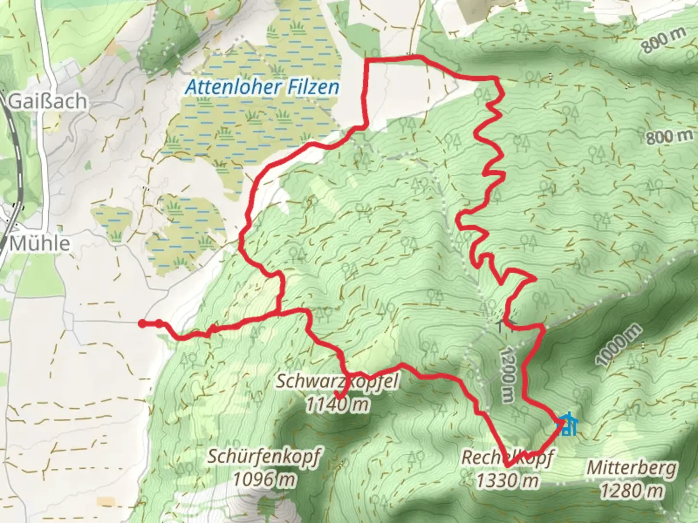
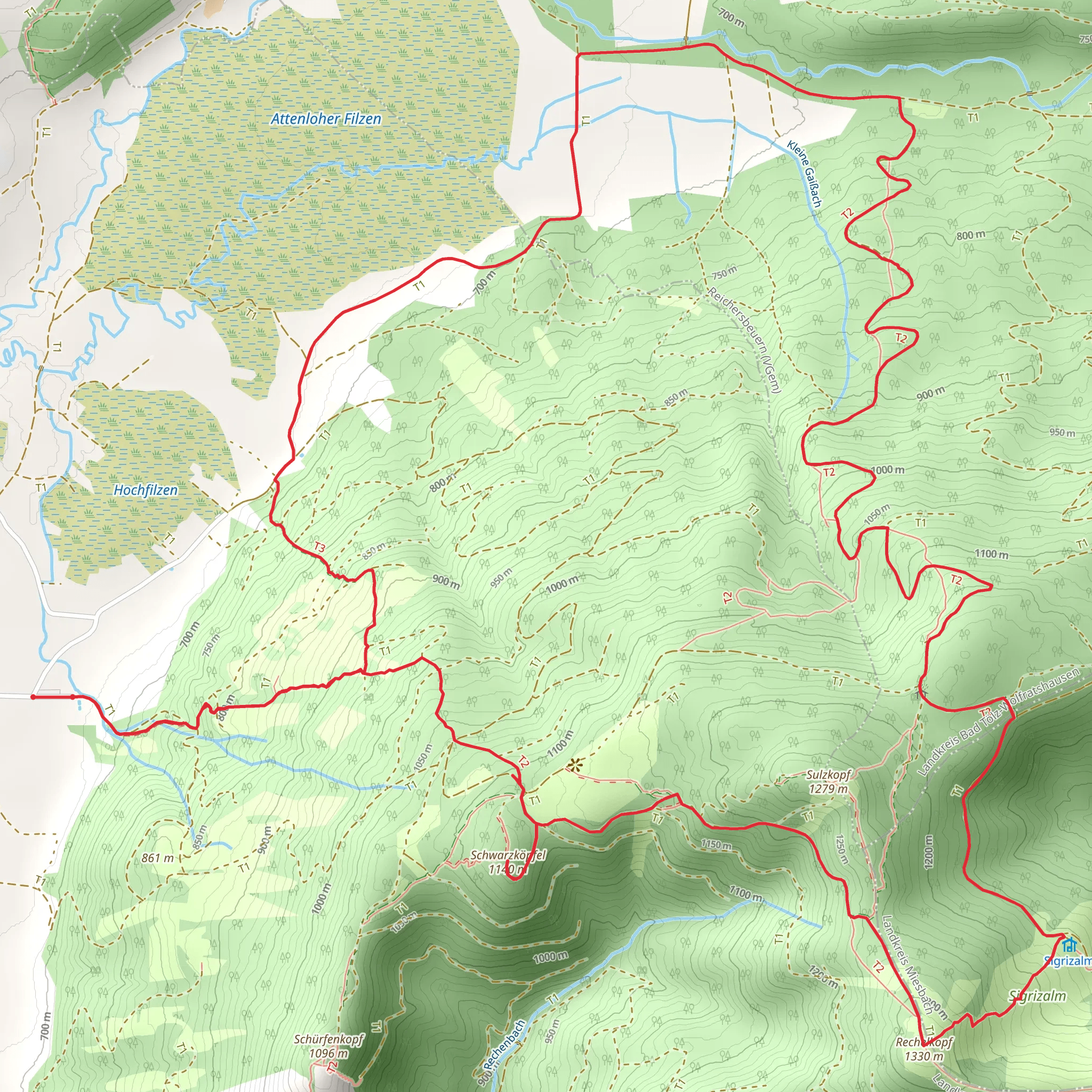
Nestled in the picturesque Bavarian Alps, the Schwarzkopfel and Rechelkopf Loop via Lehen offers a challenging yet rewarding hiking experience. This 15 km (approximately 9.3 miles) loop trail boasts an elevation gain of around 1000 meters (3280 feet), making it a demanding trek suitable for experienced hikers. The trailhead is conveniently located near Bad Tölz-Wolfratshausen, Germany, a charming town known for its rich history and stunning landscapes.
Getting There
To reach the trailhead, hikers can opt for public transport or drive. If traveling by train, the nearest major station is Bad Tölz, which is well-connected to Munich. From Bad Tölz, local buses or taxis can take you to the starting point near Lehen. For those driving, ample parking is available near the trailhead, with clear signage directing you to the start of the loop.
Trail Overview
The loop begins with a gradual ascent through dense forests, where the scent of pine fills the air. As you climb, the trail becomes steeper, offering glimpses of the surrounding valleys and distant peaks. The first significant landmark is the Schwarzkopfel summit, which provides breathtaking panoramic views of the Bavarian Alps. At this point, you've covered roughly 7 km (4.3 miles) and gained about 500 meters (1640 feet) in elevation.
Nature and Wildlife
The trail is a haven for nature enthusiasts, with diverse flora and fauna. Keep an eye out for deer and various bird species, including the majestic golden eagle. In spring and summer, the meadows burst into color with wildflowers, while autumn paints the landscape in vibrant hues of red and gold.
Historical Significance
The region around Bad Tölz has a rich history, dating back to Roman times. The trail itself passes through areas that were once significant trade routes. As you hike, imagine the footsteps of traders and travelers who once traversed these paths. The nearby town of Bad Tölz is also worth exploring for its well-preserved medieval architecture and historical sites.
Navigation and Safety
Given the trail's difficulty, it's crucial to be well-prepared. Use HiiKER for accurate navigation and trail maps. Weather conditions can change rapidly in the mountains, so pack appropriate gear, including layers, rain protection, and sturdy hiking boots. Ensure you have enough water and snacks, as there are limited facilities along the route.
Completing the Loop
After reaching the Rechelkopf summit, the trail descends back towards the starting point. This section offers a mix of open meadows and forested paths, providing a serene end to your hike. The entire loop typically takes between 5 to 7 hours to complete, depending on pace and weather conditions.
This trail promises an unforgettable adventure through one of Germany's most beautiful regions, combining natural beauty, challenging terrain, and a touch of history.
Comments and Reviews
User comments, reviews and discussions about the Schwarzkopfel and Rechelkopf Loop via Lehen, Germany.
average rating out of 5
0 rating(s)
