
Download
3D Flyover
Add to list
More
4.0 km
~1 hrs 22 min
346 m
Out and Back
“Embark on a 4 km hike near Bad Tölz, rewarding you with panoramic Bavarian Alps views.”
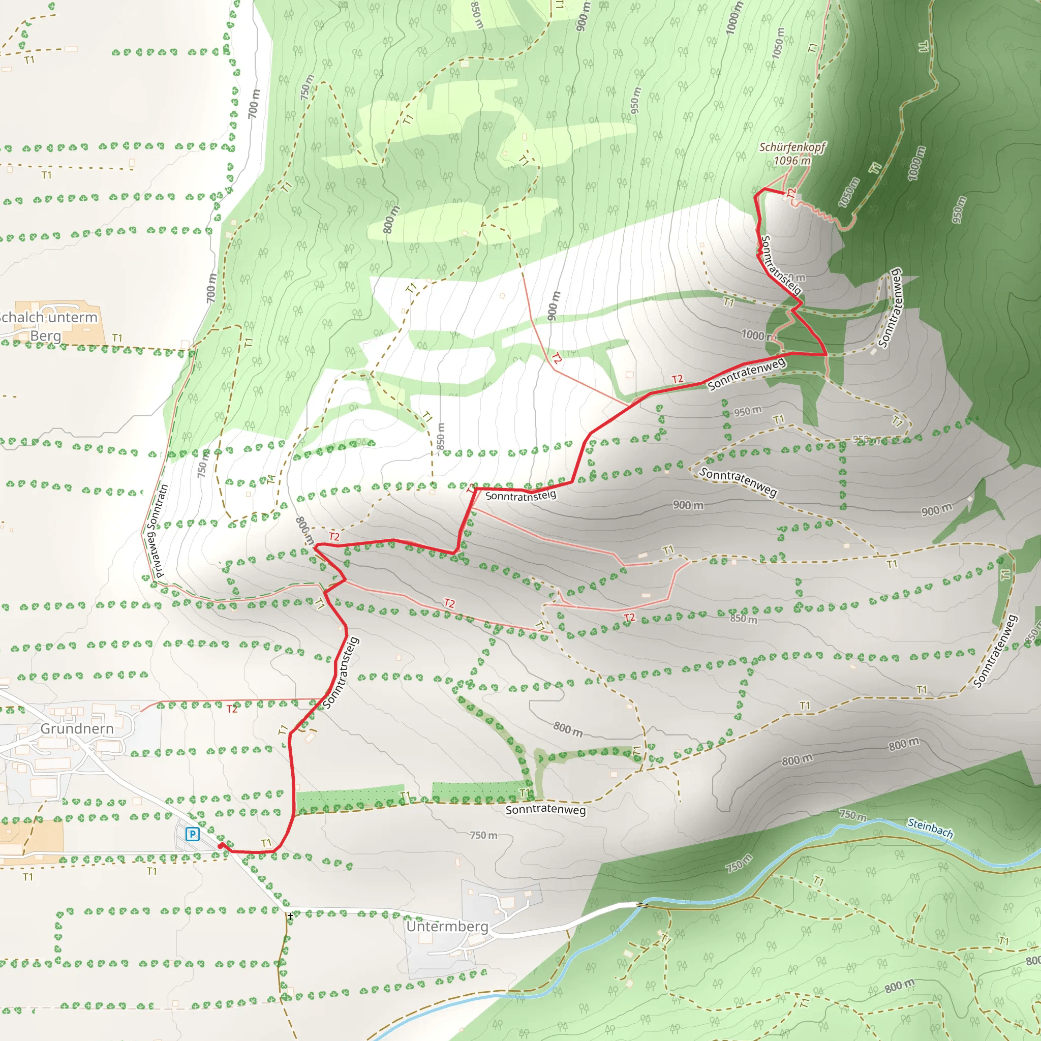
Starting your hike near Bad Tölz-Wolfratshausen, Germany, the Schürfenkopf via Sonntratnsteig trail offers a delightful 4 km (2.5 miles) out-and-back journey with an elevation gain of approximately 300 meters (984 feet). This medium-difficulty trail is perfect for those looking to enjoy a moderately challenging hike with rewarding views.
Getting There
To reach the trailhead, you can either drive or use public transport. If driving, head towards Bad Tölz-Wolfratshausen and look for parking near the trailhead, which is conveniently located close to the town. For those using public transport, take a train to Bad Tölz station. From there, you can catch a local bus or taxi to the trailhead.
Trail Overview
The trail begins with a gentle ascent through a lush forest, providing ample shade and a serene atmosphere. As you progress, the path becomes steeper, offering a good workout for your legs. The trail is well-marked, but it's always a good idea to have a navigation tool like HiiKER to ensure you stay on track.
Significant Landmarks and Nature
About 1 km (0.6 miles) into the hike, you'll come across a charming wooden bridge crossing a small stream. This is a great spot to take a short break and enjoy the sound of flowing water. Continuing on, the trail winds through a mix of deciduous and coniferous trees, offering a diverse range of flora.
At around the 2 km (1.2 miles) mark, you'll reach a scenic viewpoint that offers panoramic views of the surrounding Bavarian Alps. This is one of the highlights of the hike, so take some time to soak in the scenery and snap a few photos.
Wildlife and Flora
The area is home to a variety of wildlife, including deer, foxes, and a wide range of bird species. Keep an eye out for the European robin and the great spotted woodpecker, both of which are commonly seen along this trail. The forest floor is often carpeted with wildflowers in the spring and summer, adding a splash of color to your hike.
Historical Significance
The region around Bad Tölz has a rich history dating back to the Roman era. The town itself was an important trading post in medieval times, and remnants of its historical significance can still be seen today. While the trail itself doesn't have specific historical landmarks, the surrounding area is steeped in history, making it a fascinating place to explore.
Final Stretch
As you approach the final ascent to Schürfenkopf, the trail becomes steeper and more rugged. The effort is well worth it, as the summit offers breathtaking views of the Bavarian countryside. After taking in the views, retrace your steps back to the trailhead, enjoying the descent through the beautiful forest.
This hike is a wonderful way to experience the natural beauty and historical richness of the Bad Tölz-Wolfratshausen region. Make sure to bring plenty of water, wear sturdy hiking boots, and check the weather forecast before setting out.
What to expect?
Activity types
Comments and Reviews
User comments, reviews and discussions about the Schürfenkopf via Sonntratnsteig, Germany.
4.5
average rating out of 5
4 rating(s)
