Download
Preview
Add to list
More
13.6 km
~4 hrs 28 min
1046 m
Out and Back
“Embark on a scenic, moderately challenging 14 km hike to Herzogstand Peak for breathtaking Bavarian Alps views.”
Starting your hike near Bad Tölz-Wolfratshausen, Germany, the Herzogstand Peak via Rauchkopf trail offers a rewarding journey through the Bavarian Alps. This out-and-back trail spans approximately 14 km (8.7 miles) with an elevation gain of around 1000 meters (3280 feet), making it a moderately challenging adventure suitable for hikers with a decent level of fitness.
Getting There
To reach the trailhead, you can drive or use public transport. If driving, head towards the town of Kochel am See, which is the closest significant landmark. From there, follow signs to the Herzogstandbahn cable car station, where you can park your car. For those using public transport, take a train to Kochel am See station and then a bus or taxi to the Herzogstandbahn cable car station.
Trail Overview
The trail begins near the Herzogstandbahn cable car station. Initially, you'll follow a well-marked path that gradually ascends through dense forest. This section is relatively gentle, allowing you to warm up as you make your way towards the first significant landmark, the Fahrenbergkopf.
Fahrenbergkopf to Rauchkopf
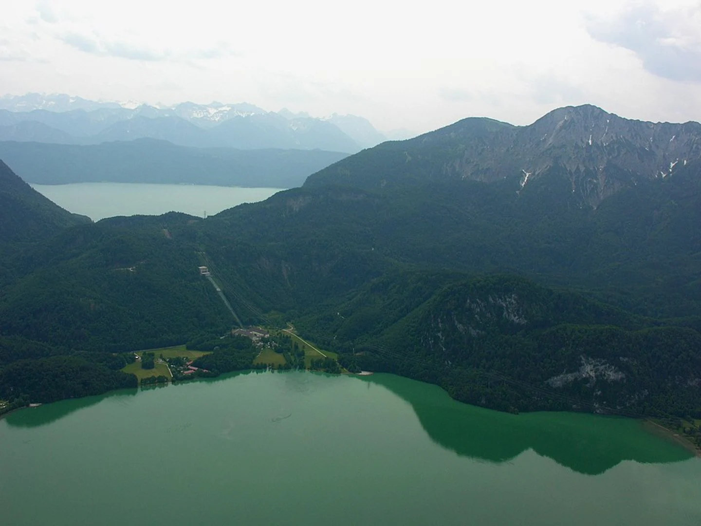
After approximately 3 km (1.9 miles) and an elevation gain of about 300 meters (984 feet), you'll reach Fahrenbergkopf. This spot offers your first panoramic views of the surrounding mountains and lakes, including the picturesque Walchensee. Take a moment to enjoy the scenery before continuing your ascent.
From Fahrenbergkopf, the trail becomes steeper and more rugged as you head towards Rauchkopf. This section is about 2 km (1.2 miles) long with an additional elevation gain of 400 meters (1312 feet). The path here is narrower and rockier, so be sure to watch your footing. Along the way, you'll pass through alpine meadows, which are particularly beautiful in the spring and summer when wildflowers are in bloom.
Rauchkopf to Herzogstand Peak
Upon reaching Rauchkopf, you'll have covered approximately 5 km (3.1 miles) and gained around 700 meters (2296 feet) in elevation. From here, the trail continues to climb towards Herzogstand Peak. This final stretch is about 2 km (1.2 miles) long with an elevation gain of 300 meters (984 feet). The path is steep and exposed in places, so take care, especially in wet or windy conditions.
Herzogstand Peak
At the summit of Herzogstand Peak, you'll be rewarded with breathtaking 360-degree views of the Bavarian Alps, including the Karwendel and Wetterstein mountain ranges. On a clear day, you can even see as far as Munich. The summit also features a small hut where you can rest and enjoy a snack before beginning your descent.
Historical Significance
The Herzogstand area has a rich history, dating back to the time of King Ludwig II of Bavaria, who had a hunting lodge built here in the 19th century. The region has long been a popular destination for hikers and nature enthusiasts, drawn by its stunning landscapes and historical charm.
Wildlife and Nature
Throughout your hike, keep an eye out for local wildlife, including chamois, marmots, and various bird species. The diverse flora ranges from dense forests at lower elevations to alpine meadows and rocky outcrops higher up. In the spring and summer, the trail is adorned with colorful wildflowers, adding to the scenic beauty of the hike.
Navigation
For navigation, it's highly recommended to use the HiiKER app, which provides detailed maps and real-time updates to ensure you stay on the correct path. The trail is well-marked, but having a reliable navigation tool can enhance your hiking experience and provide peace of mind.
Prepare adequately with sturdy hiking boots, sufficient water, and weather-appropriate clothing. The Herzogstand Peak via Rauchkopf trail offers a memorable adventure through one of Germany's most beautiful alpine regions.

What to expect?
Activity types
Comments and Reviews
User comments, reviews and discussions about the Herzogstand Peak via Rauchkopf, Germany.
4.75
average rating out of 5
4 rating(s)