Download
3D Flyover
Add to list
More
12.2 km
~3 hrs 51 min
857 m
Loop
“Explore the Fahrtkopf, Angerlkopf, and Hollerkopf Loop for scenic views, historical charm, and moderate hiking challenges.”
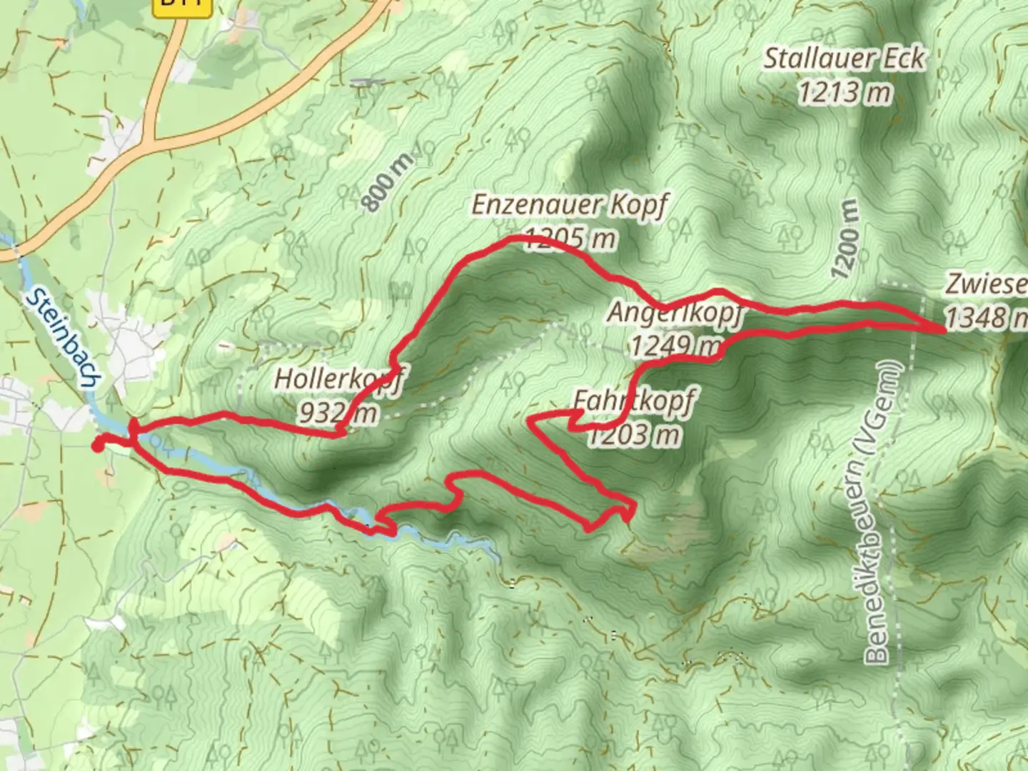
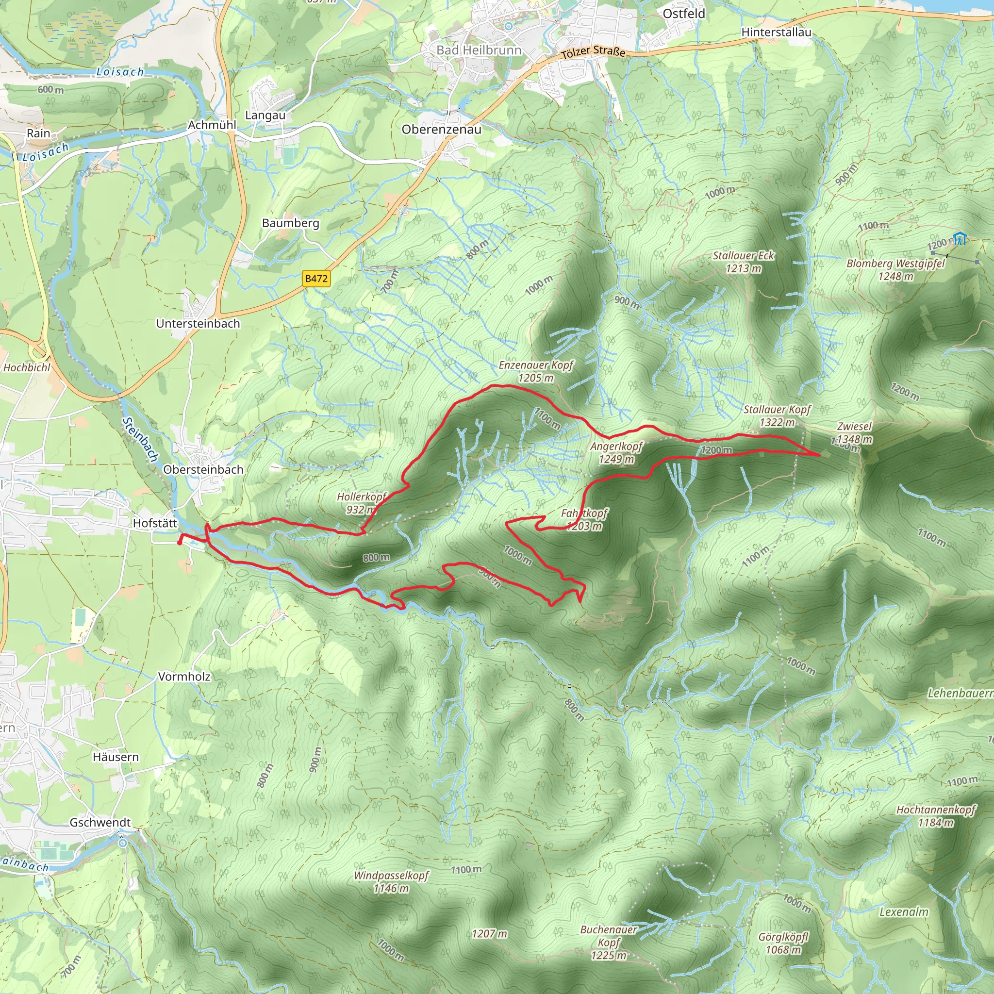
Starting your adventure near Bad Tölz-Wolfratshausen, Germany, the Fahrtkopf, Angerlkopf, and Hollerkopf Loop is a captivating 12 km (7.5 miles) loop trail with an elevation gain of approximately 800 meters (2,625 feet). This medium-difficulty trail offers a blend of natural beauty, historical significance, and a moderate challenge for hikers.
Getting There
To reach the trailhead, you can either drive or use public transport. If driving, head towards Bad Tölz-Wolfratshausen and look for parking near the trailhead, which is conveniently located close to the town center. For those using public transport, take a train to Bad Tölz station and then a local bus or taxi to the trailhead.
Trail Overview
The loop begins with a gentle ascent through lush forests, offering a serene start to your hike. As you progress, the trail becomes steeper, leading you to the first peak, Fahrtkopf. This section is approximately 4 km (2.5 miles) into the hike and offers stunning panoramic views of the surrounding Bavarian Alps.
Significant Landmarks and Nature
Continuing from Fahrtkopf, the trail descends slightly before ascending again towards Angerlkopf. This part of the trail is rich in flora and fauna, with opportunities to spot local wildlife such as deer and various bird species. The forested areas are particularly beautiful in autumn when the leaves change color.
At around the 7 km (4.3 miles) mark, you'll reach Angerlkopf. Here, the landscape opens up, providing expansive views of the valleys below. This is a great spot for a break and some photography.
Historical Significance
The region around Bad Tölz-Wolfratshausen has a rich history dating back to medieval times. The town of Bad Tölz itself is known for its historic architecture and traditional Bavarian culture. As you hike, you may come across old stone markers and remnants of ancient pathways that were once used by traders and pilgrims.
Final Stretch
The final peak, Hollerkopf, is reached after another 2 km (1.2 miles) of hiking. This section is the most challenging, with a steep ascent that rewards you with breathtaking views at the summit. From Hollerkopf, the trail descends back towards the starting point, completing the loop.
Navigation and Safety
Given the varying terrain and elevation changes, it's advisable to use a reliable navigation tool like HiiKER to stay on track. The trail is well-marked, but having a digital map can be very helpful, especially in foggy or low-visibility conditions.
Wildlife and Flora
Throughout the hike, you'll encounter a diverse range of plant life, from dense forests to alpine meadows. Keep an eye out for wildflowers in the spring and summer months. Wildlife is abundant, so be respectful of the natural habitat and maintain a safe distance from any animals you encounter.
Preparation
Ensure you have sturdy hiking boots, sufficient water, and snacks. Weather in the Bavarian Alps can be unpredictable, so pack layers and a rain jacket. Trekking poles can be useful for the steeper sections of the trail.
This loop trail offers a perfect blend of natural beauty, moderate challenge, and historical intrigue, making it a must-do for any hiking enthusiast visiting the Bad Tölz-Wolfratshausen area.
What to expect?
Activity types
Comments and Reviews
User comments, reviews and discussions about the Fahrtkopf, Angerlkopf and Hollerkopf Loop, Germany.
4.75
average rating out of 5
4 rating(s)
