Download
3D Flyover
Add to list
More
234.7 km
~10 days
4737 m
Multi-Day
“Embark on the Westerwaldsteig for a historic and scenic trek through Germany's diverse heartland.”
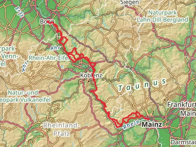
The Westerwaldsteig is a captivating long-distance hiking trail that spans approximately 235 kilometers (about 146 miles) and ascends roughly 4700 meters (about 15,420 feet) in elevation. This point-to-point trail begins near the charming town of Bad Hönningen, Germany, and weaves its way through the heart of the Westerwald region, offering a medium difficulty level that is suitable for hikers with some experience.
Getting to the Trailhead
To reach the starting point of the Westerwaldsteig, hikers can utilize public transportation or drive. The nearest significant landmark to the trailhead is the historic town of Bad Hönningen, which is accessible by train from major cities like Cologne and Frankfurt. Upon arrival in Bad Hönningen, the trailhead is just a short walk from the train station, making it convenient for those who prefer not to drive. For those arriving by car, parking is available in the area, and the trail is well-signposted from the town center.
Navigating the Trail
Hikers can rely on the HiiKER app for detailed maps and navigation assistance throughout their journey on the Westerwaldsteig. The trail is well-marked with signs, but having a digital tool like HiiKER can enhance the hiking experience by providing real-time location tracking and additional information about the trail.
Landmarks and Nature
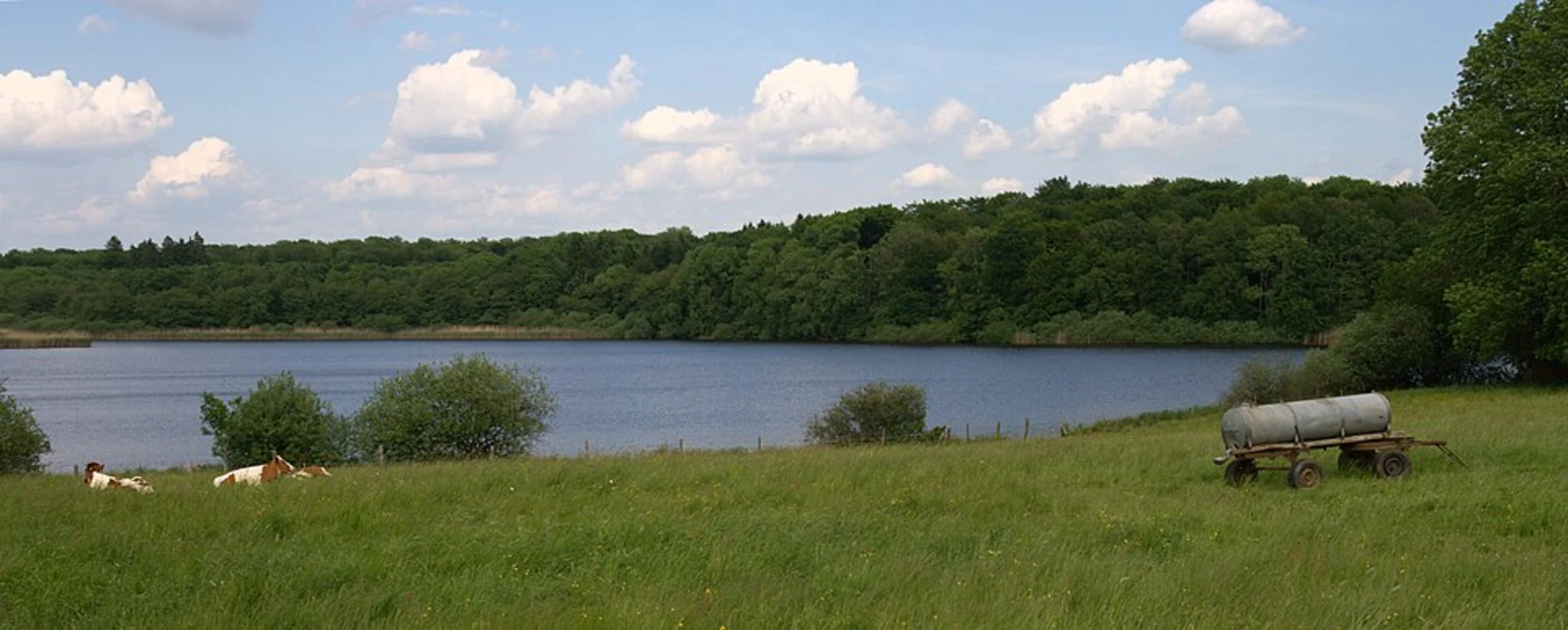
As you embark on the Westerwaldsteig, you'll traverse a variety of landscapes, including dense forests, open meadows, and high plateaus that offer stunning panoramic views. The trail leads you through the Fuchskaute, the highest peak in the Westerwald, where you can enjoy breathtaking vistas of the surrounding countryside.
Wildlife and Flora
The Westerwald region is rich in biodiversity. Hikers may encounter a variety of wildlife, including deer, foxes, and numerous bird species. The trail also passes through areas of natural beauty, such as the Holzbachschlucht, a picturesque gorge with cascading waterfalls and lush vegetation.
Historical Significance
The Westerwaldsteig is steeped in history, with several points of interest along the way that reflect the region's past. The trail passes near the monastery at Marienstatt, which dates back to the 13th century and is a testament to the area's religious heritage. Additionally, the Westerwald has been known for its pottery and ceramic industry for centuries, and hikers will find opportunities to learn about this craft in towns like Höhr-Grenzhausen along the route.
Preparation and Planning
Before setting out on the Westerwaldsteig, hikers should ensure they are well-prepared with appropriate gear, including sturdy hiking boots, weather-appropriate clothing, and sufficient water and food supplies. Given the trail's length and elevation gain, it's advisable to plan for multiple days of hiking and to arrange accommodations in advance. There are numerous guesthouses and inns along the trail that offer comfortable lodging and local cuisine.
Conclusion
The Westerwaldsteig is a trail that promises a rich blend of natural beauty, wildlife encounters, and historical exploration. With its moderate difficulty level, it's an inviting challenge for hikers looking to immerse themselves in the heart of Germany's Westerwald region. Whether you're drawn to the serenity of the forests, the allure of the high peaks, or the echoes of history, this trail offers a rewarding experience for every adventurer.

Frequently asked questions
Where does the Westerwaldsteig start and finish?
The Westerwaldsteig starts in Herborn in Hesse and runs west across the Westerwald to Bad Hönningen on the Rhine. The full route is about 234.73 km long, so it is normally walked as a multi-day point-to-point hike rather than a day trail.
How many stages does the Westerwaldsteig have?
The Westerwaldsteig is divided into 16 official stages across roughly 235 km. The first stage runs from Herborn to Breitscheid, and the final stage leads from Waldbreitbach down into the Rhine Valley at Bad Hönningen, which makes the route easy to break into manageable daily sections.
How difficult is the Westerwaldsteig and is it suitable for beginners?
The Westerwaldsteig is generally rated medium, with about 4,737 m of total ascent over the full route. It suits hikers with some experience more than complete beginners, especially because the trail is long and several stages include sustained climbs, descents, and full-day distances.
How long does it take to hike the full Westerwaldsteig?
Most hikers complete the full Westerwaldsteig in around 16 days if they follow the official stage breakdown. At 234.73 km in total, that works out to an average of roughly 14 to 20 km per day, depending on the stage and how much elevation is packed into it.
Is the Westerwaldsteig well marked, or is a map needed?
The Westerwaldsteig is well waymarked throughout with a green W on a white background, and the route is signposted at junctions and crossings. Access routes to stations, parking areas, and sights use a green W on a yellow background, so navigation on the main trail is usually straightforward.
Are there circular walks connected to the Westerwaldsteig?
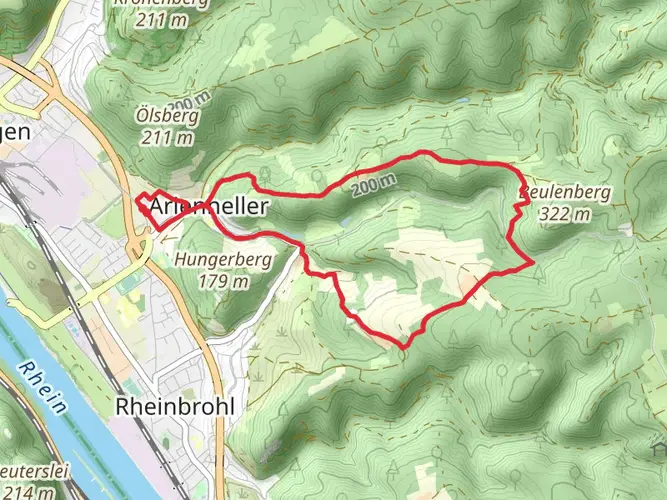
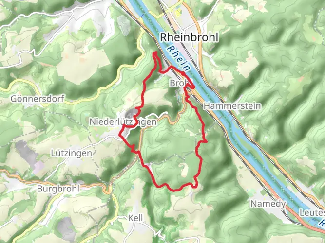
Yes. In addition to the full long-distance trail, there are Westerwaldsteig experience loops designed as circular day hikes with the same start and finish point. Examples include the Romantic Lake District loop at 16 km, the Basalt Arch loop at 11 km, and the Wiedblick Tour at 11 km.
Can the Westerwaldsteig be hiked with luggage transfer or stage accommodation?
Yes. Accommodation along the Westerwaldsteig includes properties geared to stage hikers, and some offer shuttle or baggage services. There are also route packages in the region that combine overnight stays, luggage transport, and transfers, which makes the trail practical for hikers who do not want to carry a full pack every day.
Comments and Reviews
User comments, reviews and discussions about the Westerwaldsteig, Germany.
4.63
average rating out of 5
8 rating(s)