Download
Preview
Add to list
More
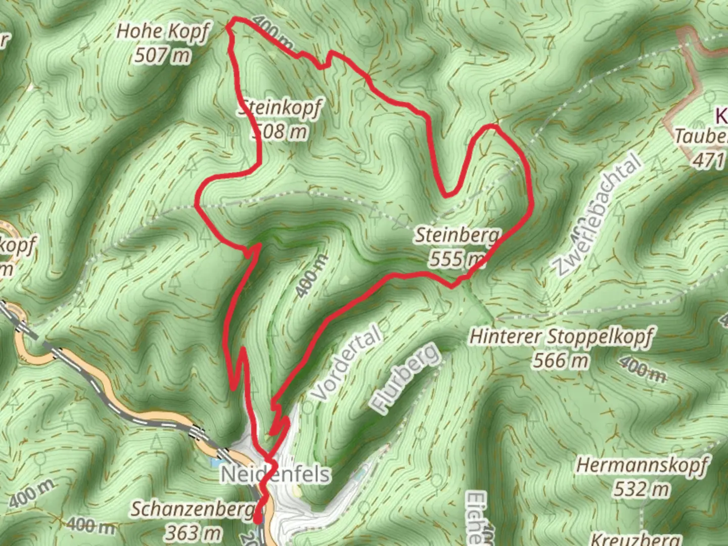
12.5 km
~3 hrs 31 min
612 m
Loop
“The Pfaelzer Huettensteig Loop near Bad Dürkheim promises a scenic and moderately challenging 13 km hike through the Palatinate Forest.”
Starting near the charming town of Bad Dürkheim in Germany, the Pfaelzer Huettensteig Loop offers a delightful 13 km (8 miles) journey through the picturesque Palatinate Forest. With an elevation gain of approximately 600 meters (1,970 feet), this loop trail is rated as medium difficulty, making it suitable for moderately experienced hikers.
Getting There
To reach the trailhead, you can either drive or use public transport. If driving, set your GPS to Bad Dürkheim, where ample parking is available near the trailhead. For those using public transport, take a train to Bad Dürkheim station. From there, it's a short walk to the starting point of the trail.
Trail Highlights
Initial Ascent
The trail begins with a gradual ascent through dense forest, offering a serene start to your hike. As you climb, you'll encounter a mix of deciduous and coniferous trees, providing ample shade and a cool environment even during warmer months. The first 3 km (1.9 miles) will see you gaining about 200 meters (656 feet) in elevation.
Historical Significance
Around the 4 km (2.5 miles) mark, you'll come across the ruins of Hardenburg Castle. This medieval fortress, dating back to the 13th century, offers a glimpse into the region's rich history. Take some time to explore the ruins and enjoy panoramic views of the surrounding landscape.
Midway Point
At approximately 6 km (3.7 miles), you'll reach the highest point of the trail, with an elevation gain of around 400 meters (1,312 feet). Here, you'll find a well-maintained hut, perfect for a rest stop. The hut is often stocked with refreshments, and it's a great spot to refuel and take in the stunning vistas.
Flora and Fauna
As you continue along the trail, you'll notice a diverse range of flora and fauna. The Palatinate Forest is home to various species of birds, including woodpeckers and owls. Keep an eye out for deer and wild boar, which are commonly spotted in this area. The forest floor is often carpeted with wildflowers, especially in spring and early summer.
Descent and Return
The descent begins around the 9 km (5.6 miles) mark, where the trail starts to wind back towards Bad Dürkheim. This section is less steep but requires careful footing, especially after rain when the path can be slippery. You'll pass through several clearings that offer beautiful views of the valley below.
Navigation
For navigation, it's highly recommended to use the HiiKER app, which provides detailed maps and real-time updates. The trail is well-marked, but having a reliable navigation tool ensures you stay on track and can fully enjoy the hike without any worries.
Final Stretch
The last 2 km (1.2 miles) of the trail are relatively flat, leading you back to the starting point near Bad Dürkheim. This section takes you through a mix of open fields and forested areas, offering a gentle and scenic end to your hike.
Practical Tips
- Wear sturdy hiking boots, as the trail can be rocky and uneven in places.
- Bring plenty of water and snacks, especially if you plan to spend time exploring the castle ruins.
- Check the weather forecast before you go, as conditions can change rapidly in the forest.
- If hiking in the fall, be prepared for cooler temperatures and potentially muddy trails.
This loop trail offers a perfect blend of natural beauty, historical intrigue, and moderate physical challenge, making it a rewarding experience for any hiker.

What to expect?
Activity types
Comments and Reviews
User comments, reviews and discussions about the Pfaelzer Huettensteig Loop, Germany.
4.0
average rating out of 5
2 rating(s)