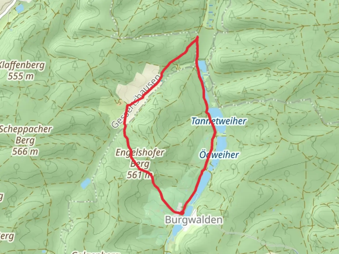
Bruckmahdweiher and Tannetweiher via Schwaebisch Allgaeuer Weitwanderweg
Download
Preview
Add to list
More
6.4 km
~1 hrs 27 min
106 m
Loop
“Explore lush forests, historical landmarks, and serene ponds on this moderately challenging 6 km hike near Augsburg.”
Starting your hike near Augsburg in the district of Germany, the Bruckmahdweiher and Tannetweiher via Schwaebisch Allgaeuer Weitwanderweg is a delightful 6 km (3.7 miles) loop trail with an elevation gain of around 100 meters (328 feet). This trail is rated as medium difficulty, making it suitable for moderately experienced hikers.
Getting There To reach the trailhead, you can either drive or use public transport. If you're driving, set your GPS to the nearest significant landmark, which is the town of Schwabmünchen. From there, follow local signage to the trailhead. For those using public transport, take a train to Schwabmünchen station and then a local bus or taxi to the trailhead.
Trail Overview The trail begins with a gentle ascent through a mixed forest, offering a serene start to your hike. As you progress, you'll encounter the first significant landmark, Bruckmahdweiher, a picturesque pond surrounded by lush greenery. This is an excellent spot for a short break and some nature photography.
Flora and Fauna The area is rich in biodiversity. Keep an eye out for various bird species, including woodpeckers and songbirds. The forest floor is often carpeted with wildflowers in the spring and summer, adding a splash of color to your hike. Deer and small mammals like foxes are also commonly spotted.
Historical Significance The Schwaebisch Allgaeuer Weitwanderweg is steeped in history. This long-distance trail has been used for centuries, originally serving as a trade route. Along the way, you'll find informational plaques detailing the historical significance of the area, including its role in medieval trade and local folklore.
Midway Point: Tannetweiher Approximately 3 km (1.86 miles) into the hike, you'll reach Tannetweiher, another beautiful pond. This is a great spot to rest and enjoy a packed lunch. The pond is often frequented by ducks and other waterfowl, making it a peaceful place to relax.
Navigation For navigation, it's highly recommended to use the HiiKER app, which provides detailed maps and real-time updates. The trail is well-marked, but having a reliable navigation tool will ensure you stay on track.
Final Stretch The final leg of the hike takes you through more dense forest and gradually descends back towards the starting point. This section is particularly scenic in the autumn when the leaves change color, creating a vibrant canopy overhead.
Safety and Preparation Given the moderate difficulty of the trail, it's advisable to wear sturdy hiking boots and bring plenty of water. The trail can be muddy after rain, so waterproof gear is also recommended. Always check the weather forecast before heading out and let someone know your plans.
By the end of this 6 km loop, you'll have experienced a rich tapestry of natural beauty and historical intrigue, making it a rewarding hike for anyone looking to explore the German countryside.

What to expect?
Activity types
Comments and Reviews
User comments, reviews and discussions about the Bruckmahdweiher and Tannetweiher via Schwaebisch Allgaeuer Weitwanderweg, Germany.
average rating out of 5
0 rating(s)