Download
3D Flyover
Add to list
More
8.9 km
~1 hrs 53 min
67 m
Loop
“The Heilsbronner Rundweg is a charming 9 km loop offering picturesque scenery and historical landmarks near Ansbach.”
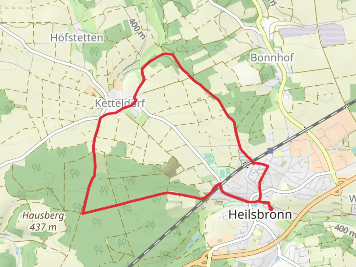
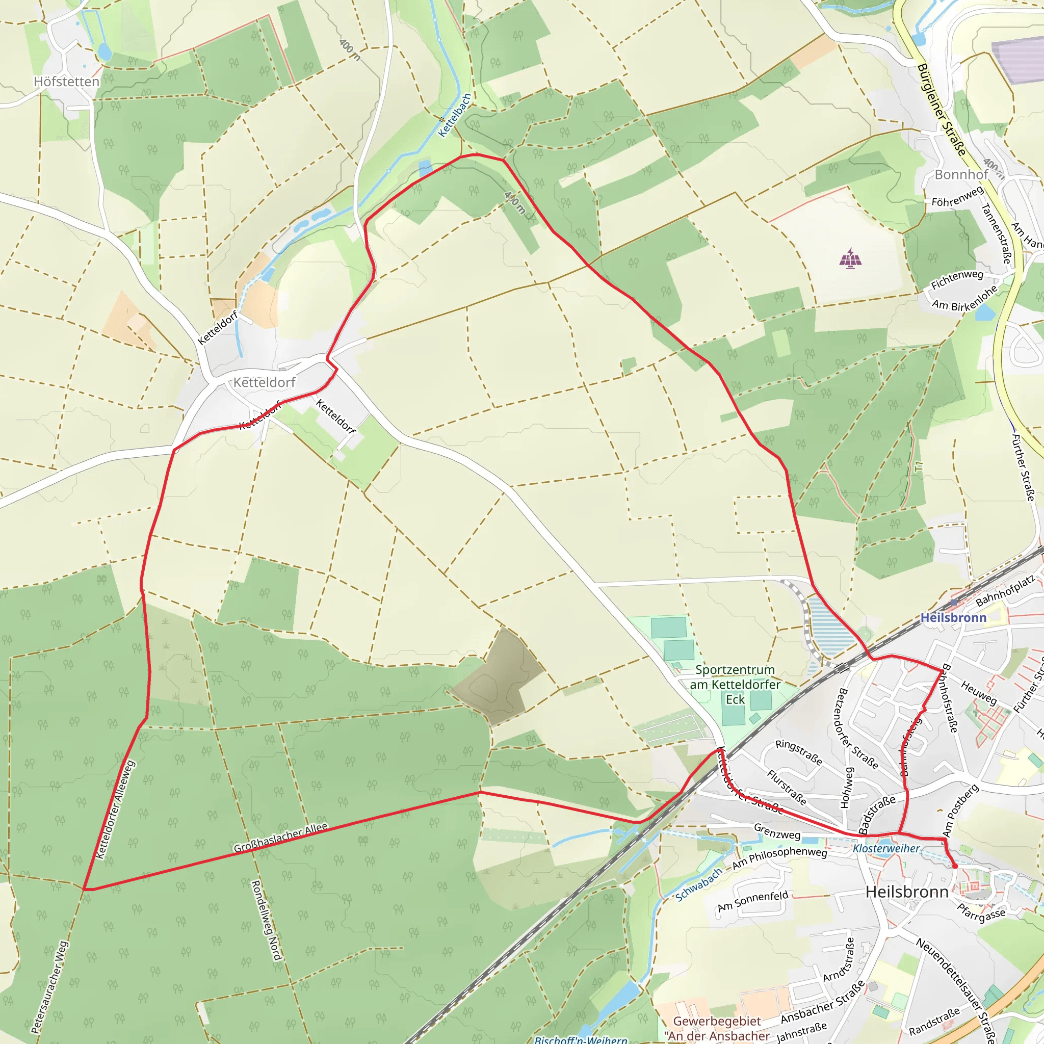
Starting near the charming town of Ansbach in the district of Middle Franconia, Germany, the Heilsbronner Rundweg is a delightful 9 km (approximately 5.6 miles) loop trail that offers a moderate challenge suitable for most hikers. With virtually no elevation gain, this trail is perfect for those looking to enjoy a leisurely hike through the picturesque German countryside.
Getting There
To reach the trailhead, you can either drive or use public transportation. If you're driving, set your GPS to Heilsbronn, a small town near Ansbach. There are several parking options available in Heilsbronn, particularly near the Heilsbronn Abbey, which is a convenient starting point. For those using public transport, take a train to Heilsbronn Station. The trailhead is a short walk from the station, making it easily accessible.
Trail Highlights
Heilsbronn Abbey
One of the most significant landmarks along the Heilsbronner Rundweg is the Heilsbronn Abbey. Founded in 1132, this former Cistercian monastery is steeped in history and offers a fascinating glimpse into medieval monastic life. The abbey complex includes a stunning church, cloisters, and various outbuildings, all of which are worth exploring before or after your hike.
Scenic Countryside
As you embark on the trail, you'll be greeted by the serene beauty of the Franconian landscape. The route meanders through lush meadows, dense woodlands, and charming agricultural fields. Keep an eye out for local wildlife such as deer, foxes, and a variety of bird species. The trail is well-marked, but it's always a good idea to have a reliable navigation tool like HiiKER to ensure you stay on track.
Local Flora and Fauna
The Heilsbronner Rundweg is a haven for nature enthusiasts. Depending on the season, you might encounter a variety of wildflowers, including orchids and lilies, which add vibrant splashes of color to the landscape. The woodlands are home to ancient oak and beech trees, providing ample shade and a sense of tranquility.
Practical Information
Trail Conditions
The trail is generally well-maintained and marked with clear signage. However, after heavy rains, some sections may become muddy, so appropriate footwear is recommended. Given the moderate difficulty rating, the trail is suitable for families and hikers of all skill levels.
Refreshments and Facilities
While the trail itself does not have any facilities, the town of Heilsbronn offers several options for refreshments. There are cafes, bakeries, and restaurants where you can enjoy a meal or a snack before or after your hike. Make sure to carry enough water and snacks, especially if you plan to take your time exploring the trail.
Historical Significance
The region around Heilsbronn is rich in history. Apart from the abbey, the area has been inhabited since prehistoric times, and you may come across various historical markers and information boards along the trail. These provide insights into the local history, including the medieval period and the impact of the Cistercian monks on the region's development.
Navigation
For navigation, HiiKER is an excellent tool to use. It provides detailed maps and real-time tracking, ensuring you can enjoy your hike without worrying about losing your way. The app also offers information on points of interest, making it easier to plan your stops and learn more about the landmarks you encounter.
The Heilsbronner Rundweg is a delightful trail that combines natural beauty with historical intrigue, making it a rewarding experience for any hiker. Whether you're a local resident or a visitor to the region, this trail offers a perfect escape into the serene Franconian countryside.
What to expect?
Activity types
Comments and Reviews
User comments, reviews and discussions about the Heilsbronner Rundweg, Germany.
4.2
average rating out of 5
5 rating(s)
