
Download
3D Flyover
Add to list
More
11.2 km
~2 hrs 26 min
120 m
Point to Point
“"Experience Franconian charm on this 11 km scenic hike from Dietenhofe to Adelsdorf via Rotpunkt."”
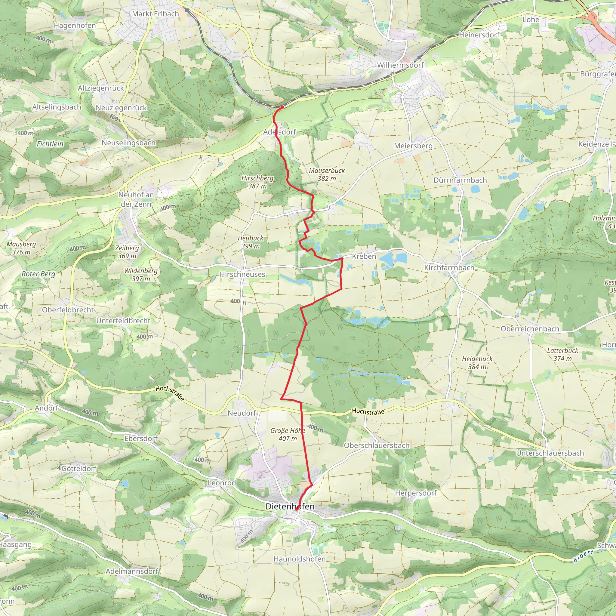
Starting near the district of Ansbach in Germany, this 11 km (approximately 6.8 miles) point-to-point trail from Dietenhofe to Adelsdorf via Rotpunkt offers a moderately challenging hike with an elevation gain of around 100 meters (328 feet). The trailhead is easily accessible by both public transport and car. If you're traveling by train, the nearest major station is Ansbach, from where you can take a local bus to Dietenhofe. For those driving, there are parking facilities available near the trailhead in Dietenhofe.
Trail Overview
The trail begins in the quaint village of Dietenhofe, known for its picturesque half-timbered houses and serene countryside. As you set off, you'll be greeted by gently rolling hills and expansive fields, typical of the Franconian landscape. The initial part of the trail is relatively flat, making it a good warm-up for the more undulating terrain ahead.
Nature and Wildlife
As you progress, the trail meanders through mixed forests and open meadows. Keep an eye out for local wildlife such as deer, foxes, and a variety of bird species. The forested sections provide ample shade, making it a pleasant hike even during warmer months. In spring and early summer, the meadows are often adorned with wildflowers, adding a splash of color to your journey.
Significant Landmarks
Around the 5 km (3.1 miles) mark, you'll come across the Rotpunkt, a notable waypoint that offers panoramic views of the surrounding countryside. This is a great spot to take a break and enjoy the scenery. The Rotpunkt area is also rich in history, with remnants of old fortifications that date back to medieval times. These ruins offer a glimpse into the region's past and are a fascinating stop for history enthusiasts.
Elevation and Terrain
The trail features a gradual elevation gain of about 100 meters (328 feet), with the most significant climbs occurring in the middle section. The terrain varies from well-maintained dirt paths to rocky sections, so sturdy hiking boots are recommended. The trail is well-marked, but it's always a good idea to have a reliable navigation tool like HiiKER to ensure you stay on track.
Final Stretch to Adelsdorf
As you approach Adelsdorf, the trail descends gently, leading you through more agricultural land and small wooded areas. Adelsdorf itself is a charming village with several amenities, including cafes and restaurants where you can relax and refuel after your hike. The village is also home to some historical buildings, including a beautiful baroque church that is worth a visit.
Getting Back
For your return journey, Adelsdorf is well-connected by public transport. You can catch a local bus back to Ansbach or arrange for a taxi. If you drove to the trailhead, you might want to plan a car shuttle or use public transport to retrieve your vehicle from Dietenhofe.
This trail offers a delightful mix of natural beauty, historical intrigue, and moderate physical challenge, making it a rewarding experience for hikers of all levels.
What to expect?
Activity types
Comments and Reviews
User comments, reviews and discussions about the Dietenhofe to Adelsdorf via Rotpunkt, Germany.
average rating out of 5
0 rating(s)
