Download
Preview
Add to list
More
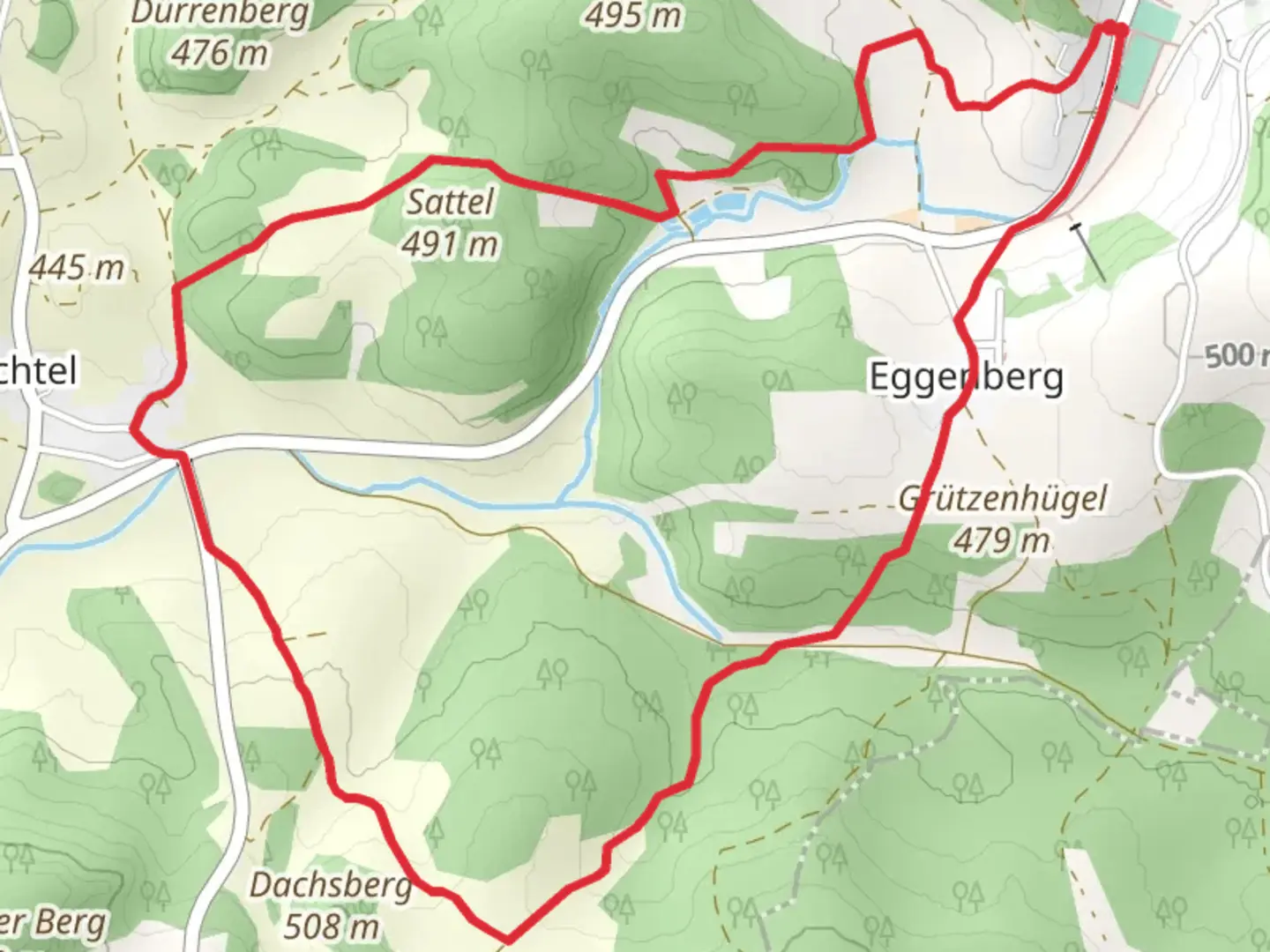
6.4 km
~1 hrs 37 min
200 m
Loop
“Explore the scenic Eschenfelden Rundweg 6, a 6 km trail with natural beauty and historical landmarks.”
Starting near the picturesque town of Amberg-Sulzbach in Germany, the Eschenfelden Rundweg 6 is a delightful loop trail that spans approximately 6 km (3.7 miles) with an elevation gain of around 200 meters (656 feet). This medium-difficulty trail offers a blend of natural beauty, historical landmarks, and a touch of local wildlife, making it a rewarding experience for hikers of various skill levels.
Getting There
To reach the trailhead, you can either drive or use public transport. If you're driving, set your GPS to Eschenfelden, a small village near Amberg-Sulzbach. There is ample parking available near the village center. For those using public transport, take a train to Amberg station. From there, you can catch a local bus to Eschenfelden, which is well-connected and offers a scenic route through the Bavarian countryside.
Trail Navigation
For navigation, it's highly recommended to use the HiiKER app, which provides detailed maps and real-time updates to ensure you stay on track. The trail is well-marked, but having a reliable navigation tool can enhance your hiking experience.
Trail Highlights
Initial Ascent
The trail begins with a gentle ascent through a mixed forest of oak and beech trees. This section is relatively easy, allowing you to warm up as you gradually climb. After about 1 km (0.6 miles), you'll reach a small clearing that offers your first panoramic view of the surrounding landscape. The elevation gain here is around 50 meters (164 feet), making it a good spot to catch your breath and take in the scenery.
Historical Landmarks
As you continue, you'll come across the ruins of an old watchtower, approximately 2 km (1.2 miles) into the hike. This tower dates back to the medieval period and served as a lookout point for the local lords. It's a fascinating glimpse into the region's history and offers a unique photo opportunity.
Midway Point
Around the 3 km (1.9 miles) mark, the trail levels out and you’ll find yourself walking along a ridge. This section provides stunning views of the Amberg-Sulzbach district, with its rolling hills and patchwork of fields. The elevation here is at its peak, around 200 meters (656 feet) above the starting point.
Flora and Fauna
The trail then descends into a lush valley, where you’ll encounter a variety of flora and fauna. Keep an eye out for deer and wild boar, which are commonly spotted in this area. The valley is also home to several species of wildflowers, particularly in the spring and summer months.
Final Stretch
The last 2 km (1.2 miles) of the trail take you through a serene forest path, gradually descending back towards Eschenfelden. This section is relatively easy and allows you to cool down as you approach the end of your hike. The trail loops back to the starting point, completing the circuit.
Practical Tips
- Footwear: Given the mixed terrain, sturdy hiking boots are recommended.
- Weather: Check the weather forecast before you set out, as conditions can change rapidly.
- Water and Snacks: Carry enough water and some snacks, especially if you plan to take breaks and enjoy the scenery.
- Wildlife: Be mindful of local wildlife and maintain a respectful distance.
This trail offers a perfect blend of natural beauty, historical intrigue, and moderate physical challenge, making it a must-visit for anyone in the Amberg-Sulzbach area.

Comments and Reviews
User comments, reviews and discussions about the Eschenfelden Rundweg 6, Germany.
average rating out of 5
0 rating(s)