Download
Preview
Add to list
More
7.4 km
~1 hrs 57 min
283 m
Loop
“Explore the serene Bavarian countryside on a 7 km loop trail offering stunning views and historical intrigue.”
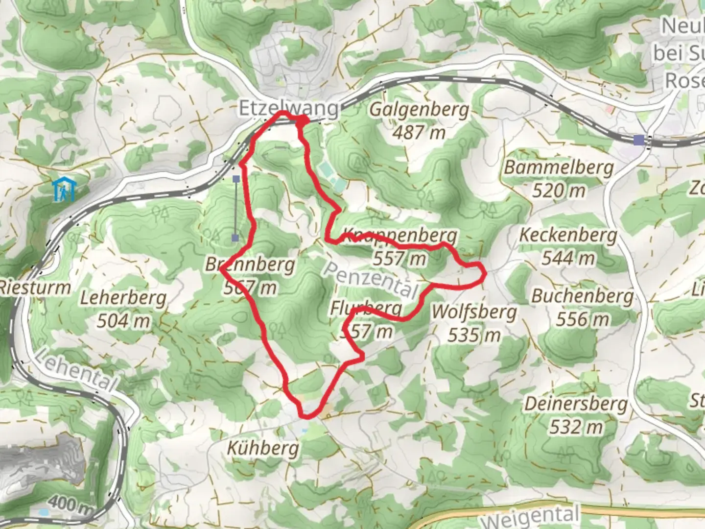
Starting near the picturesque town of Amberg-Sulzbach in Germany, the Brennberg and Flurberg Loop via Etzelwang is a delightful 7 km (approximately 4.3 miles) loop trail that offers a moderate challenge with an elevation gain of around 200 meters (656 feet). This trail is perfect for those looking to immerse themselves in the serene beauty of the Bavarian countryside.
Getting There
To reach the trailhead, you can either drive or use public transport. If driving, set your GPS to Etzelwang, a small village near Amberg-Sulzbach. There is ample parking available near the village center. For those using public transport, take a train to Etzelwang station, which is well-connected from major cities like Nuremberg and Amberg. From the station, the trailhead is just a short walk away.
Trail Navigation
The trail is well-marked, but it's always a good idea to have a reliable navigation tool like HiiKER to ensure you stay on track. The loop starts and ends in Etzelwang, making it easy to follow.
Trail Highlights
As you begin your hike, you'll be greeted by lush forests and rolling hills. The first significant landmark is the Brennberg, a hill that offers stunning panoramic views of the surrounding countryside. This section of the trail is relatively steep, contributing to the overall elevation gain, but the effort is well worth it for the vistas you'll encounter.
Flora and Fauna
The trail is rich in biodiversity. Keep an eye out for native wildlife such as deer, foxes, and a variety of bird species. The forested areas are home to ancient oak and beech trees, providing a canopy of shade that makes the hike pleasant even on warmer days.
Historical Significance
The region around Amberg-Sulzbach has a rich history dating back to medieval times. As you hike, you'll come across remnants of old fortifications and possibly even ancient boundary stones that marked territories centuries ago. The area was historically significant for its iron ore mining, which played a crucial role in the development of the local economy.
Midpoint: Flurberg
At approximately the halfway point, you'll reach Flurberg, another hill that offers equally impressive views. This is a great spot to take a break, have a snack, and enjoy the natural beauty around you. The terrain here is a bit more forgiving, allowing you to catch your breath before continuing.
Final Stretch
The descent back to Etzelwang is gentle and meanders through open meadows and small patches of forest. This section of the trail is particularly scenic during the spring and summer months when wildflowers are in full bloom.
Practical Tips
- Wear sturdy hiking boots as some sections can be rocky and uneven.
- Bring plenty of water and snacks, especially if you plan to take your time and enjoy the scenery.
- Check the weather forecast before heading out; the trail can be slippery after rain.
- Use HiiKER for real-time navigation and updates on trail conditions.
This loop trail offers a perfect blend of natural beauty, moderate physical challenge, and historical intrigue, making it a must-visit for any hiking enthusiast exploring the Bavarian region.

What to expect?
Activity types
Comments and Reviews
User comments, reviews and discussions about the Brennberg and Flurberg Loop via Etzelwang, Germany.
average rating out of 5
0 rating(s)