Download
3D Flyover
Add to list
More
9.3 km
~2 hrs 23 min
312 m
Loop
“The Kreuztelle and Winterbuhl Loop in Alb-Donau-Kreis blends scenic beauty, history, and moderate adventure.”
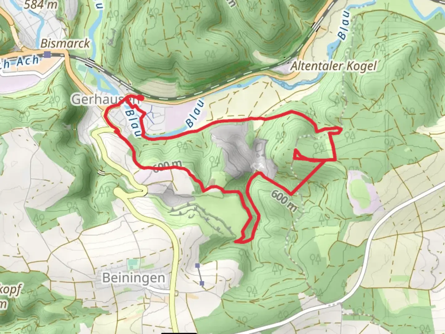
Starting your adventure near Alb-Donau-Kreis, Germany, the Kreuztelle and Winterbuhl Loop via Gerhausen is a captivating 9 km (5.6 miles) loop trail with an elevation gain of approximately 300 meters (984 feet). This medium-difficulty trail offers a blend of natural beauty, historical significance, and a touch of adventure.
Getting There
To reach the trailhead, you can drive or use public transport. If driving, set your GPS to Gerhausen, a small town in the Alb-Donau-Kreis district. For those using public transport, take a train to Blaubeuren station, which is well-connected to major cities like Ulm. From Blaubeuren, a short bus ride or taxi will get you to Gerhausen.
Trail Overview
The trail begins near Gerhausen, a quaint town known for its picturesque landscapes and historical charm. As you start your hike, you'll be greeted by lush forests and rolling hills. The initial part of the trail is relatively gentle, allowing you to ease into the hike.
Significant Landmarks and Nature
Around the 2 km (1.2 miles) mark, you'll encounter the first significant landmark: the Kreuztelle. This area offers stunning panoramic views of the surrounding valleys and forests. It's a perfect spot for a short break and some photography.
Continuing on, the trail gradually ascends towards Winterbuhl. The climb is steady but manageable, with the elevation gain becoming more noticeable around the 4 km (2.5 miles) point. As you hike, keep an eye out for local wildlife, including deer and various bird species that inhabit the region.
Historical Significance
The Alb-Donau-Kreis region is steeped in history. The trail passes through areas that have been inhabited since prehistoric times. Near the 6 km (3.7 miles) mark, you'll find remnants of ancient settlements and possibly even some archaeological sites. These areas offer a glimpse into the lives of early inhabitants and their connection to the land.
Navigation and Safety
The trail is well-marked, but it's always a good idea to have a reliable navigation tool. HiiKER is an excellent app for this purpose, providing detailed maps and real-time tracking to ensure you stay on course. The trail can be muddy and slippery after rain, so sturdy hiking boots are recommended.
Flora and Fauna
As you make your way back towards Gerhausen, the trail descends through dense forests rich with diverse flora. Depending on the season, you might see wildflowers, mushrooms, and a variety of trees, including oak and beech. The final stretch of the trail is relatively flat, allowing for a leisurely walk back to the starting point.
This loop trail offers a perfect blend of natural beauty, historical intrigue, and moderate physical challenge, making it an ideal choice for hikers looking to explore the scenic and historical richness of the Alb-Donau-Kreis region.

What to expect?
Activity types
Comments and Reviews
User comments, reviews and discussions about the Kreuztelle and Winterbuhl Loop via Gerhausen, Germany.
5.0
average rating out of 5
1 rating(s)