Download
3D Flyover
Add to list
More
9.8 km
~2 hrs 30 min
328 m
Loop
“Embark on the Blaubeuren Loop, a captivating 10 km trail featuring stunning vistas and rich historical sites.”
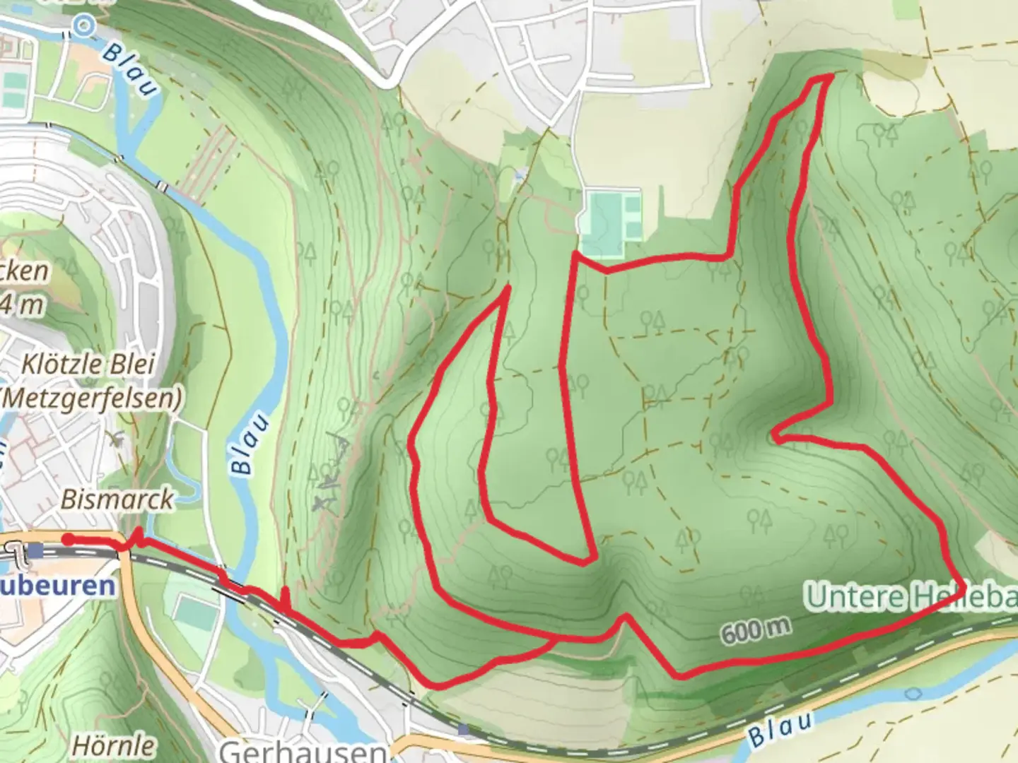
Starting near Alb-Donau-Kreis in Germany, the Blaubeuren Loop is a captivating 10 km (6.2 miles) trail with an elevation gain of approximately 300 meters (984 feet). This loop trail is rated as medium difficulty, making it suitable for moderately experienced hikers.
Getting There
To reach the trailhead, you can either drive or use public transport. If you're driving, you can park near the Blautopf, a famous spring in Blaubeuren, which is a convenient starting point. For those using public transport, take a train to Blaubeuren station, which is well-connected from major cities like Ulm. From the station, it's a short walk to the trailhead.
Trail Highlights
The trail begins near the Blautopf, a stunning blue spring that is one of the deepest and most beautiful in Germany. The spring's vibrant blue color is due to the high limestone content in the water, making it a perfect spot for some initial photographs.
As you start the hike, you'll ascend gradually through dense forests, gaining about 150 meters (492 feet) in the first 3 km (1.9 miles). The forest is home to a variety of wildlife, including deer and numerous bird species, so keep your eyes and ears open.
Historical Significance
Around the 4 km (2.5 miles) mark, you'll come across the Ruins of Rusenschloss, a medieval castle that dates back to the 11th century. The ruins offer a glimpse into the region's rich history and provide panoramic views of the surrounding Swabian Jura landscape. This is a great spot to take a break and soak in the historical ambiance.
Navigating the Trail
Continuing on, the trail takes you through a mix of open meadows and forested areas. The terrain can be uneven, so sturdy hiking boots are recommended. The trail is well-marked, but it's always a good idea to have a reliable navigation tool like HiiKER to ensure you stay on track.
Flora and Fauna
As you hike, you'll notice a diverse range of flora, from wildflowers in the meadows to ancient beech and oak trees in the forested sections. The area is also known for its karst formations, including caves and sinkholes, which add an element of geological interest to your hike.
Final Stretch
The last 3 km (1.9 miles) of the trail involve a gentle descent back towards Blaubeuren. This section offers more open views and is less forested, giving you a different perspective of the landscape. You'll eventually loop back to the Blautopf, where you can relax and perhaps enjoy a meal at one of the nearby restaurants.
Practical Tips
- Wear sturdy hiking boots due to uneven terrain.
- Bring water and snacks, as there are limited facilities along the trail.
- Use HiiKER for navigation to ensure you stay on the correct path.
- Check the weather forecast before you go, as conditions can change rapidly.
This trail offers a perfect blend of natural beauty, historical landmarks, and moderate physical challenge, making it a rewarding experience for any hiker.

What to expect?
Activity types
Comments and Reviews
User comments, reviews and discussions about the Blaubeuren Loop, Germany.
4.67
average rating out of 5
3 rating(s)