Download
3D Flyover
Add to list
More
12.7 km
~3 hrs 22 min
499 m
Loop
“Experience nature, history, and panoramic views on the moderately challenging 13 km Weidenhard and Moenchsberg Loop.”
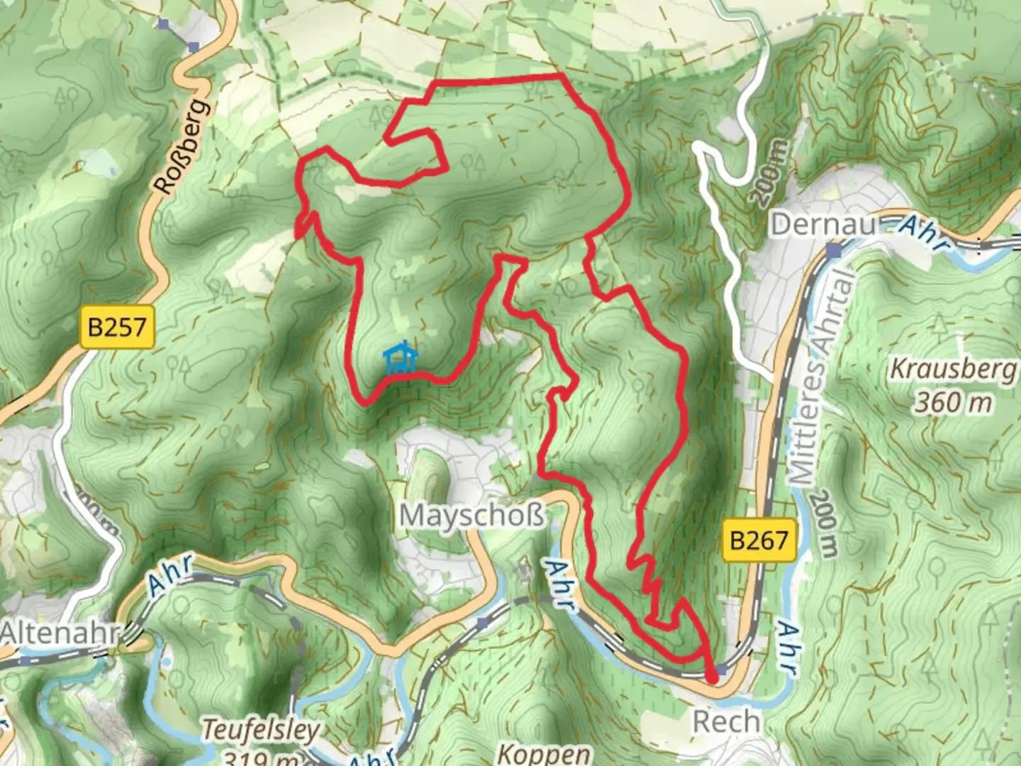
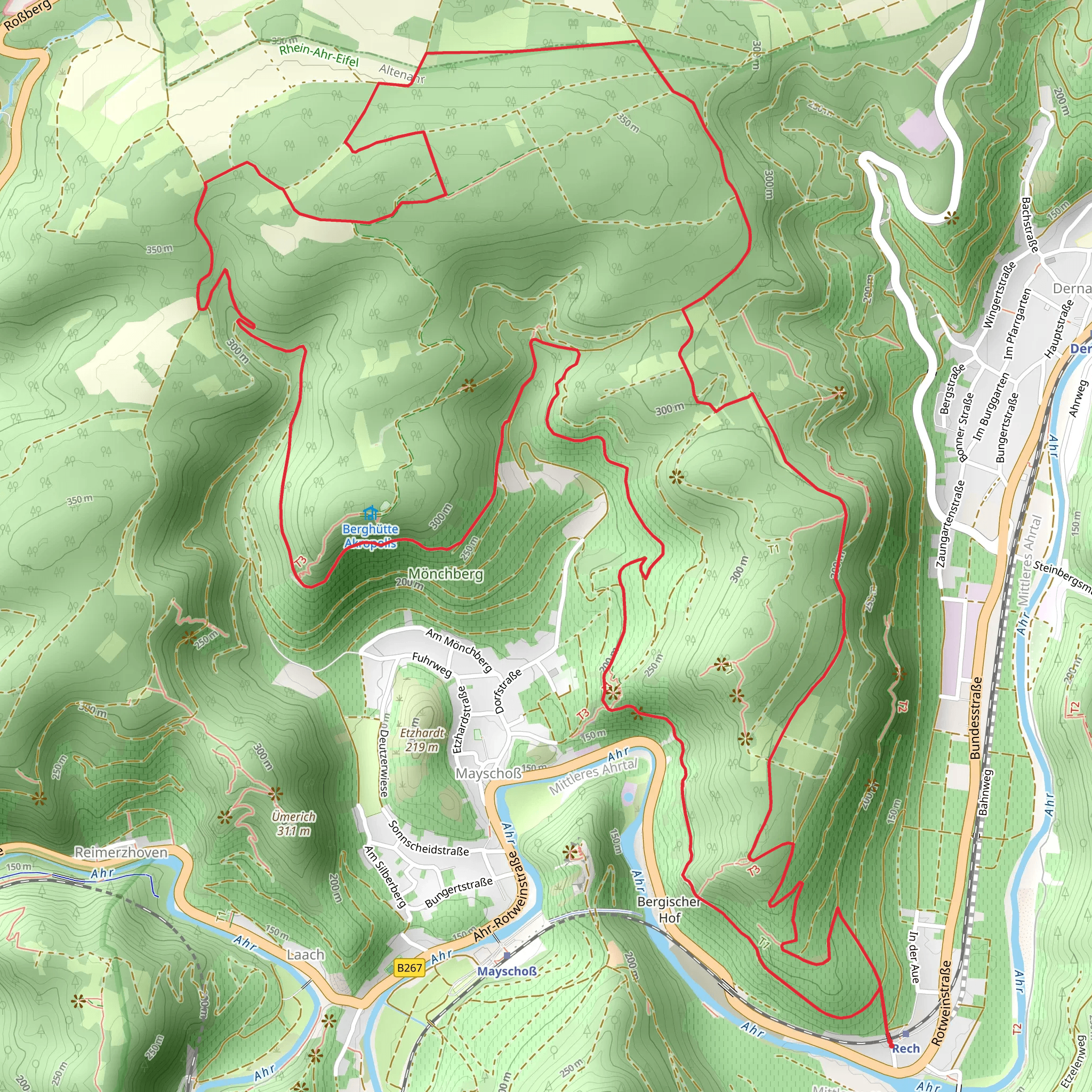
Starting near the picturesque town of Ahrweiler in Germany, the Weidenhard and Moenchsberg Loop is a captivating 13 km (8 miles) journey with an elevation gain of approximately 500 meters (1,640 feet). This loop trail offers a medium difficulty rating, making it suitable for moderately experienced hikers.
Getting There
To reach the trailhead, you can either drive or use public transport. If driving, set your GPS to Ahrweiler, a charming town known for its medieval architecture and vineyards. There is ample parking available near the trailhead. For those using public transport, take a train to Ahrweiler Station. From there, it's a short walk to the starting point of the trail.
Trail Overview
The trail begins with a gentle ascent through lush forests, providing a serene atmosphere as you make your way up. Early on, you'll encounter a mix of deciduous and coniferous trees, offering a rich tapestry of greens and the occasional burst of wildflowers in the spring and summer months.
Significant Landmarks
Around the 3 km (1.9 miles) mark, you'll come across the first significant landmark, the Weidenhard Forest. This area is known for its dense canopy and the soothing sounds of birdsong. Keep an eye out for local wildlife such as deer and various bird species.
Continuing on, the trail gradually ascends to the Moenchsberg, the highest point of the loop. At approximately 6 km (3.7 miles) into the hike, you'll reach an elevation of around 500 meters (1,640 feet). Here, you'll be rewarded with panoramic views of the Ahr Valley and the surrounding hills. This is an excellent spot for a break and some photography.
Historical Significance
The region around Ahrweiler is steeped in history. As you hike, you'll notice remnants of ancient Roman walls and medieval fortifications. Ahrweiler itself is a historic town with roots dating back to Roman times. The town's well-preserved medieval walls and gates are a testament to its rich past.
Navigation and Safety
The trail is well-marked, but it's always a good idea to have a reliable navigation tool. HiiKER is an excellent app for this purpose, providing detailed maps and real-time location tracking. Make sure to carry enough water, especially during the warmer months, and wear sturdy hiking boots as some sections can be rocky and uneven.
Flora and Fauna
As you descend from Moenchsberg, the trail meanders through open meadows and vineyards. This area is particularly beautiful in the late summer and early autumn when the grapevines are heavy with fruit. The diversity of plant life is impressive, with everything from wild herbs to towering oaks.
Final Stretch
The last few kilometers of the trail take you back through the forest, eventually looping back to the starting point near Ahrweiler. This section is relatively flat and offers a peaceful end to your hike.
Whether you're a history buff, a nature enthusiast, or simply looking for a moderately challenging hike, the Weidenhard and Moenchsberg Loop has something to offer.
What to expect?
Activity types
Comments and Reviews
User comments, reviews and discussions about the Weidenhard and Moenchsberg Loop, Germany.
4.5
average rating out of 5
2 rating(s)
