Download
3D Flyover
Add to list
More
13.9 km
~3 hrs 33 min
466 m
Loop
“Explore Ahrweiler's scenic beauty and history on the captivating, medium-difficulty Teufelsley via Teufelsleyweg trail.”
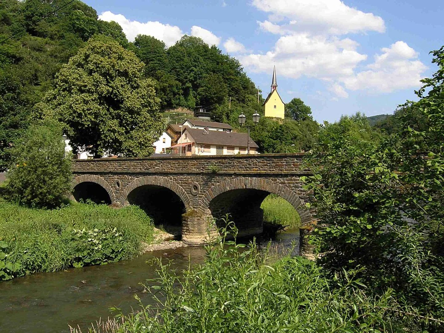
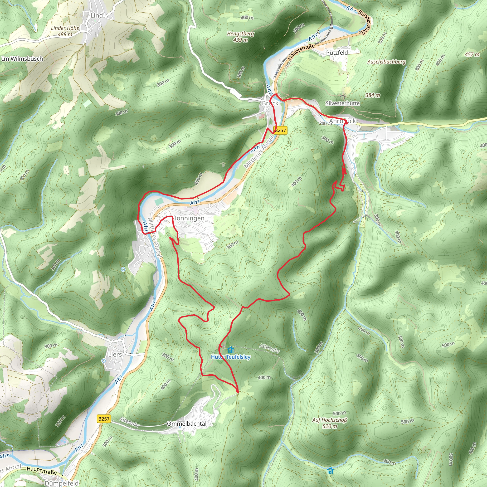
Starting near the picturesque town of Ahrweiler, Germany, the Teufelsley via Teufelsleyweg trail offers a captivating 14 km (8.7 miles) loop with an elevation gain of approximately 400 meters (1,312 feet). This medium-difficulty hike is perfect for those looking to explore the natural beauty and historical richness of the region.
Getting There
To reach the trailhead, you can either drive or use public transport. If driving, set your GPS to Ahrweiler, a charming town known for its medieval architecture and vineyards. There is ample parking available near the trailhead. For those using public transport, take a train to Ahrweiler station. From there, it's a short walk to the starting point of the trail.
Trail Navigation
For navigation, it's highly recommended to use the HiiKER app, which provides detailed maps and real-time updates to ensure you stay on track.
Trail Highlights
Nature and Wildlife
The trail meanders through lush forests, open meadows, and rocky outcrops, offering a diverse range of flora and fauna. Keep an eye out for deer, foxes, and a variety of bird species. The forested sections are particularly enchanting, with tall trees providing a canopy that filters the sunlight, creating a serene atmosphere.
Significant Landmarks
One of the most notable landmarks along the trail is the Teufelsley rock formation. This striking geological feature is a must-see, offering panoramic views of the surrounding landscape. The rock formation is located approximately 7 km (4.3 miles) into the hike, making it a perfect spot for a mid-hike break.
Historical Significance
The region around Ahrweiler is steeped in history. As you hike, you'll come across remnants of ancient Roman settlements and medieval fortifications. The town of Ahrweiler itself is a historical gem, with its well-preserved city walls and gates dating back to the 13th century. Make sure to allocate some time to explore the town either before or after your hike.
Trail Sections
Initial Ascent
The trail begins with a gentle ascent through a mixed forest. This section is relatively easy and serves as a good warm-up. After about 3 km (1.9 miles), the trail starts to climb more steeply, gaining approximately 200 meters (656 feet) in elevation over the next 2 km (1.2 miles).
Mid-Trail Plateau
Around the 5 km (3.1 miles) mark, the trail levels out, offering a respite from the climb. This plateau section is characterized by open meadows and offers stunning views of the Ahr Valley. It's an excellent spot for a picnic or a short rest.
Final Ascent to Teufelsley
The last major climb takes you to the Teufelsley rock formation. This section is the most challenging part of the hike, with a steep ascent over rocky terrain. However, the effort is well worth it for the breathtaking views from the top.
Descent and Return
The descent begins after you leave Teufelsley, winding through dense forest and gradually easing into a more gentle slope. The final 4 km (2.5 miles) of the trail take you through scenic vineyards and back to the trailhead near Ahrweiler.
Preparation Tips
- Wear sturdy hiking boots with good ankle support.
- Bring plenty of water and snacks, especially if you plan to picnic at the Teufelsley rock formation.
- Check the weather forecast and dress in layers, as the weather can change rapidly in this region.
- Use the HiiKER app for navigation to ensure you stay on the correct path.
This trail offers a perfect blend of natural beauty, challenging terrain, and historical intrigue, making it a rewarding experience for any hiker.
Comments and Reviews
User comments, reviews and discussions about the Teufelsley via Teufelsleyweg, Germany.
4.0
average rating out of 5
5 rating(s)
