
Download
3D Flyover
Add to list
More
5.9 km
~1 hrs 26 min
153 m
Loop
“A gently challenging Pyrenean ramble through pastoral lanes, riverside paths, and history-soaked woodland above Athas.”
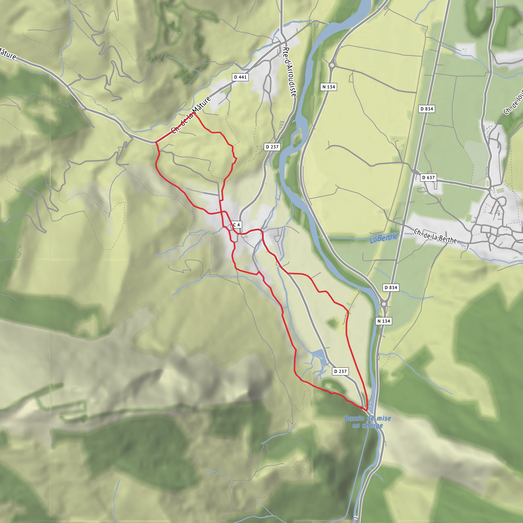
This medium-rated walk of about 6 km / 3.7 miles with roughly 200 m / 656 ft of ascent explores the lower slopes and riverside country around Lées-Athas in the Aspe Valley of the western French Pyrenees. The route sits in a landscape shaped by mountain water, old rural tracks, and the long history of timber transport in the valley, with Pont de la Bigue serving as a useful landmark near the start area and the hamlet roads around Athas giving the walk a distinctly pastoral feel. Lées-Athas itself is a small commune in Pyrénées-Atlantiques, and local access references commonly point hikers toward Athas, Pont de la Bigue, and the road network above the Gave d’Aspe. (mapcarta.com)
Expect a route that feels varied rather than extreme: short climbs, sections of lane or farm access track, and quieter footpaths where the terrain can change with the season. On a hike of this length and elevation, the uphill tends to come in manageable bursts rather than one sustained mountain ascent, but the “medium” rating is still justified by uneven ground, potentially slippery patches after rain, and the need to stay attentive at junctions. Good footwear is important, especially if the path includes leaf litter, damp grass, loose stones, or muddy edges near streams and shaded woodland. Using HiiKER before setting out is the best way to confirm the exact line of the route and identify any turns near bridges, hamlets, or track splits. (tourisme64.com)
Getting to the start
The nearest significant access point is Lées-Athas, near Pont de la Bigue and the village of Athas, in the Aspe Valley south of Oloron-Sainte-Marie. For drivers, the usual approach is via the valley road system from Oloron-Sainte-Marie toward Bedous, then local roads into Lées-Athas; official local hiking directions for nearby routes reference turning toward Lées after the Bedous bypass and using village access roads around Athas. (tourisme64.com)
For public transport, the most practical rail access is Bedous station, which functions as the main nearby TER arrival point. From there, valley transport connections continue by road, and local visitor information notes both the bus line 550 between Bedous and Canfranc and a transport-on-demand service in the Vallée d’Aspe that serves villages including Lées-Athas. Some local hiking material also references Pont d’Esquit / Lées-Athas as a bus access point for walks in this area. If arriving without a car, it is wise to check the latest schedules and then plan the final approach carefully, since rural services can be limited. (ter.sncf.com)
What the route feels like
The opening part is likely to be the gentlest, with access through or near the settled edges of Athas before the route begins to rise. In this part of the valley, paths often pass old troughs, bridges, gravel tracks, and small agricultural features, so the first kilometre or so can feel more cultural than wild. As height is gained, even modestly, the views begin to open across the Aspe Valley, with a mix of pasture, wooded slopes, and the larger mountain backdrop beyond. (tourisme64.com)
With only around 200 m / 656 ft of ascent, this is not a high-alpine outing, but it still gives a good sense of Pyrenean relief. A climb of that size over 6 km / 3.7 miles usually means a steady rolling profile, perhaps with one or two more noticeable uphill sections. Hikers should expect some narrow stretches where roots, stones
Surfaces
Unknown
Asphalt
Comments and Reviews
User comments, reviews and discussions about the Lees Athas to Pont de la Bigue and Moulin Blade, France.
average rating out of 5
0 rating(s)
