
Download
3D Flyover
Add to list
More
14.7 km
~4 hrs 32 min
963 m
Out and Back
“A demanding Pyrenean climb through pastoral valleys to wild border passes rewards strong hikers with grandeur.”
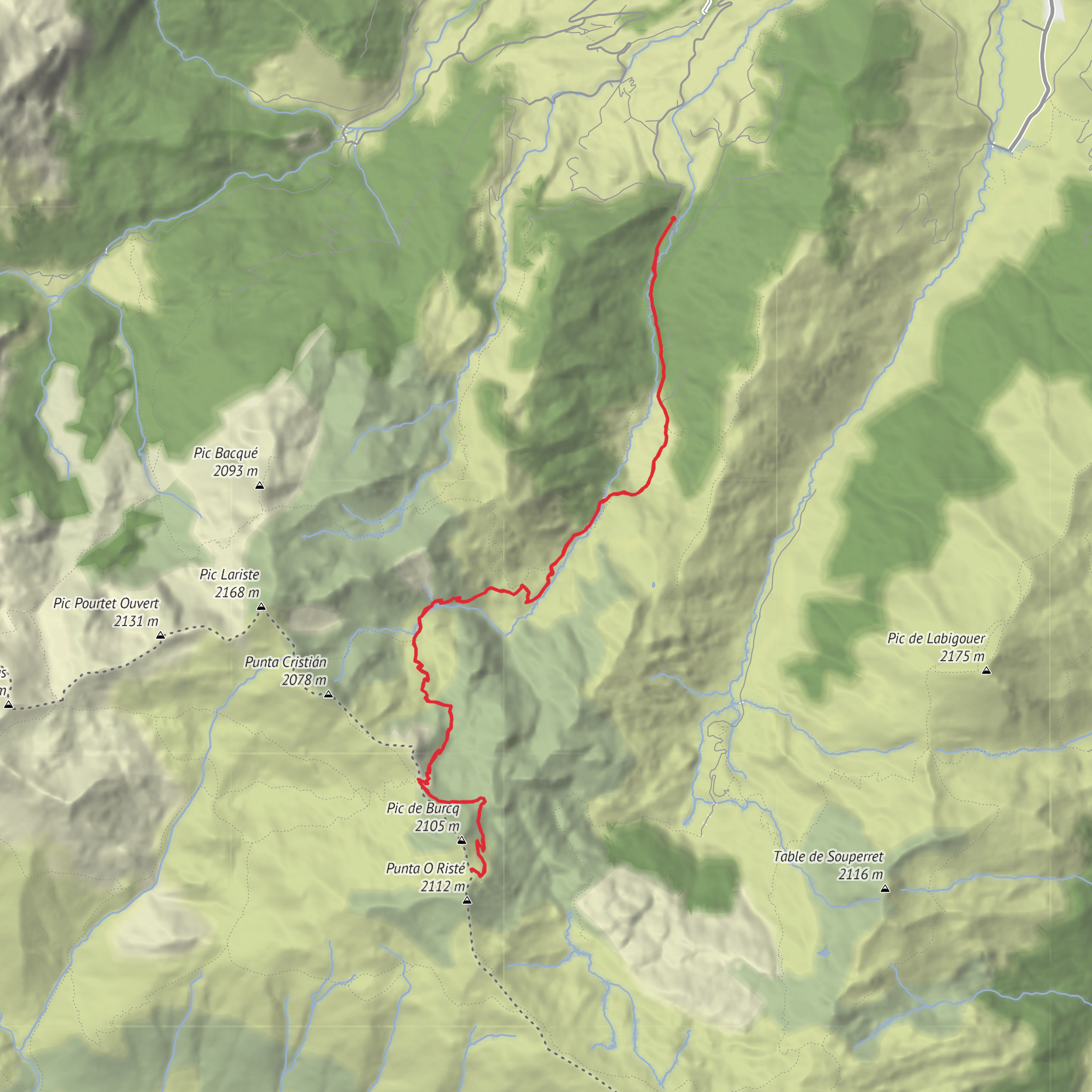
This difficult out-and-back circuit in the upper Aspe Valley climbs from the Labrénère parking area above Lescun to two high border passes on the French-Spanish divide: Col de Pau at about 1,942 m / 6,371 ft and Col de Burcq at about 2,063 m / 6,768 ft. The full hike is roughly 13.7 to 15 km / 8.5 to 9.3 miles depending on the exact start point and any short detours, with around 960 to 1,000 m / 3,150 to 3,280 ft of ascent. It is generally rated difficult because the climb is sustained, the upper mountain terrain is exposed to weather, and the return still demands concentration after the main ascent. (visorando.com)
The usual start is the Parking de Labrénère, a small trailhead parking area reached by the Route du Col de Pau above Lescun in the commune of Lescun, Pyrénées-Atlantiques. The nearest significant village and services are in Lescun, 64490 France, in the Cirque de Lescun area of the Béarn Pyrenees. The route lies in the Vallon de Labrénère, south of the village and close to the boundary of the Parc national des Pyrénées. (visorando.com)
By car, the standard approach is from Oloron-Sainte-Marie toward the Somport corridor, then via the Pont de Lescun/Pont du Roy area onto the mountain roads leading toward Lescun and the Route du Col de Pau, continuing to the small Labrénère parking area. Roads are narrow and winding in the final section, so allow extra time and avoid assuming there will be abundant parking at the trailhead. (visorando.com)
Public transport is more limited. Lescun is the key access point, and onward travel to the trailhead usually requires a taxi, local shuttle if operating seasonally, or a long walk from the village. Before setting out, it is sensible to confirm current regional bus links into Lescun and local onward options through the Lescun mairie or Haut-Béarn tourist services, as mountain transport can be seasonal and sparse. (lescun.fr)
The opening section is comparatively gentle. From the parking area at about 1,104 m / 3,622 ft, the path heads up-valley through pastoral terrain, crossing tracks and passing the Fontaine de Lamatche at around 1.4 km / 0.9 mile. Soon after, the route reaches a footbridge and then the boundary of the national park at roughly 2.3 km / 1.4 miles. This lower part is useful for settling into pace before the steeper climbing begins. (visorando.com)
Terrain and route character
Beyond the park boundary, the trail continues on the left bank of the stream and climbs toward the cabanes of Pénot and Itchaxe, reached at roughly 3.3 km / 2.1 miles. These shepherd shelters are a strong reminder that this is still a working pastoral landscape, not just a hiking corridor. The valley broadens in places, with grass, rock, and streamside vegetation giving way to more open mountain slopes. (visorando.com)
From there, the route continues southwest and then south to the Cabanes de Bonaris, around 4.2 km / 2.6 miles from the start at about 1,700 m / 5,577 ft. This is often where the hike begins to feel more serious: the terrain opens up, the gradient becomes more sustained, and the upper mountain skyline comes into view. If cloud is building, wind is increasing, or legs already feel overworked, this is a sensible place to reassess before committing to the higher passes. (visorando.com
Comments and Reviews
User comments, reviews and discussions about the Col de Pau and Col de Burcq, France.
average rating out of 5
0 rating(s)


