
Download
3D Flyover
Add to list
More
16.7 km
~5 hrs 17 min
1176 m
Loop
“A sweeping Pyrenean mountain journey through shepherds’ pastures, airy ridges, and grand summit panoramas.”
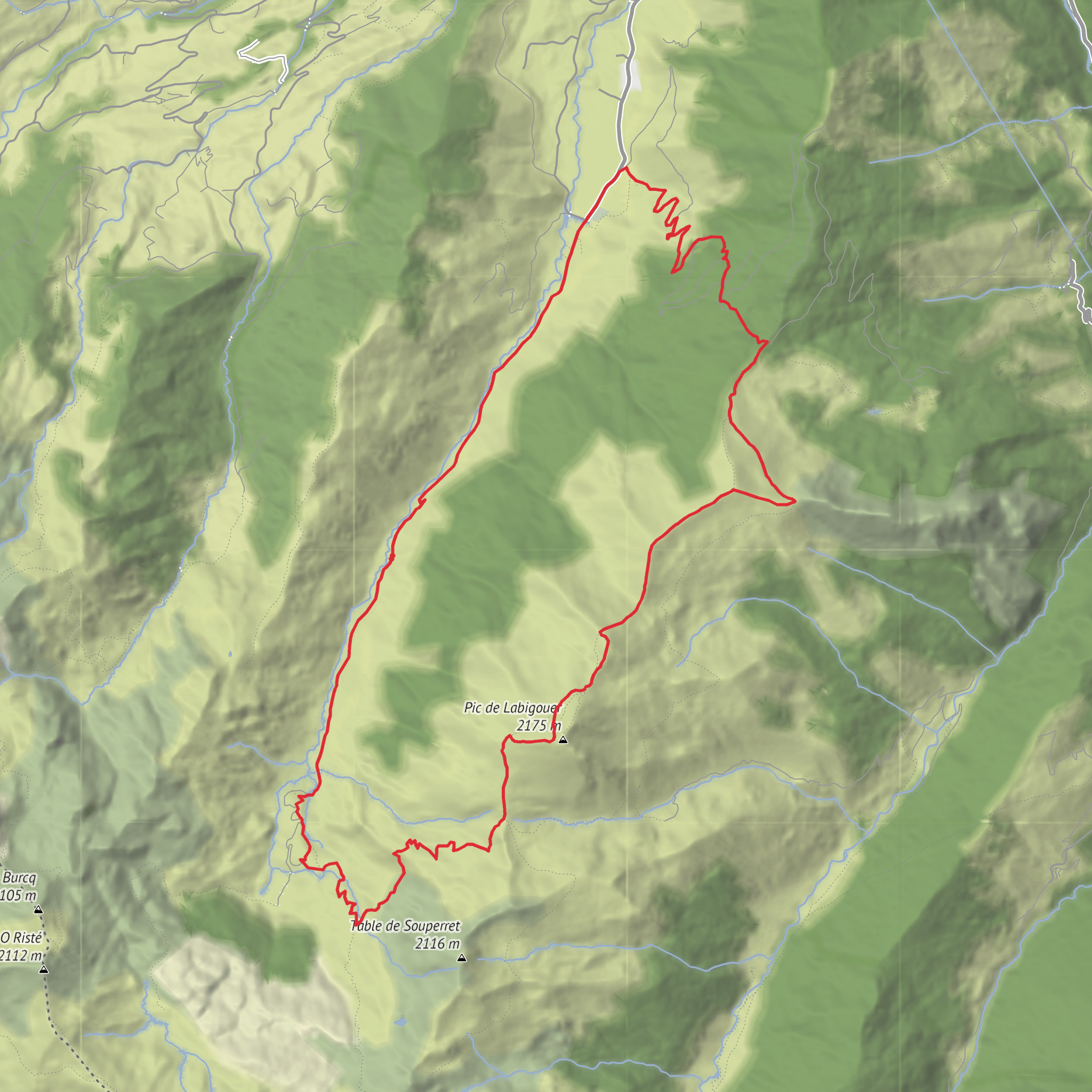
This is a big mountain day on the Plateau de Lhers above Accous in the Aspe Valley, linking pastoral ground, a high hut site, an airy ridge section, and the summit of Pic Labigouer before returning by Col de la Nabe. Expect roughly 17 km / 10.6 miles with about 1,200 m / 3,940 ft of ascent, which puts it firmly in the difficult category. The start is the Parking d’Aumet on Route d’Aumet, Plateau de Lhers, 64490 Accous, France, at around 1,150 m / 3,770 ft, above the hamlet of Lhers. (pirineo-frances.es)
The route usually begins on a broad pastoral track and then transitions to mountain paths through open grazing country. Early on, the gradients are manageable, but the effort builds steadily as the trail climbs toward the higher cabanes and cols. The terrain is varied rather than technical in dry summer conditions: grassy slopes, stony sections, occasional zigzags, and a ridge traverse that feels exposed in poor weather even if it is not a true scrambling route when free of snow. Several route descriptions note the key line from Aumet toward Cabane det Caillau, then toward the Souperret sector, on to Pic Labigouer, and back by Col de la Nabe. (toporandosmontagne.com)
A good working breakdown is: - Aumet to the lower pastoral zone and cabanes: about 4 to 5 km / 2.5 to 3.1 miles, with steady climbing. - Up toward Cabane de Souperret and Col de Souperret: the steepest sustained ascent of the day, bringing you into the high mountain zone. - Col de Souperret to Pic Labigouer: a shorter but more exposed-feeling section with excellent views. - Return by Col de la Nabe: a long descent that still includes undulating ground and requires concentration when tired. (toporandosmontagne.com)
What the route feels like
From the parking area, the first section crosses the estives of Lhers, the traditional summer grazing lands. This opening stretch is often on track or clear path and is a useful warm-up before the mountain steepens. You pass through a landscape shaped as much by pastoral use as by geology: open meadows, grazing areas, and scattered cabanes used historically by shepherds. The commune of Accous specifically identifies Aümet, Pourcibe, and Caillaü as part of the Lhers estive sector, which helps explain the working-mountain character of the route. (accous.fr)
As height is gained, the route becomes more rugged and more expansive. Around the Cabane det Caillau and higher slopes, the path enters classic western Pyrenean terrain: broad grassy shoulders broken by rock bands and steeper traverses. Near the Souperret area, the route descriptions mention passing close to the Cabane de Souperret site before reaching the col of the same name. One recent local account notes that the hut itself is no longer really visible because it was destroyed long ago, so hikers should not rely on it as an obvious shelter landmark. (visorando.com)
The ridge section between Col de Souperret and Col de la Nabe is one of the defining parts of the outing. In dry, snow-free conditions it is generally described as an easy ridge walk rather than a technical climb, but it is still serious mountain terrain. Wind, mist, lingering snow, or wet grass can change the character of this section quickly. The summit of Pic Labigouer, 2,175 m / 7,136 ft, is the high point and delivers wide views over the Aspe Valley, the Cirque de Lescun, and many of the major Béarn Pyrenean peaks. (visorando.com)
Landmarks, scenery, and natural interest
The most notable landmarks on this hike are the Parking d’Aumet, Cabane det Caillau, Cabane de Souperret site, Col de Souperret, Pic Labigouer, and Col de la Nabe. The route sits in a landscape of high pasture and mountain passes, with long sightlines across the western Pyren
AI Planner
Days planned around your pace, with somewhere to stay each night.
Surfaces
Unknown
Gravel
Asphalt
Dirt
Comments and Reviews
User comments, reviews and discussions about the Cabanes de Souperret, Pic Labigouer and Col de la Nabe from Aumet, France.
average rating out of 5
0 rating(s)



