
Download
3D Flyover
Add to list
More
10.3 km
~3 hrs 8 min
652 m
Out and Back
“A demanding climb through sunlit pasture and lonely high ground reveals a hidden Pyrenean tarn.”
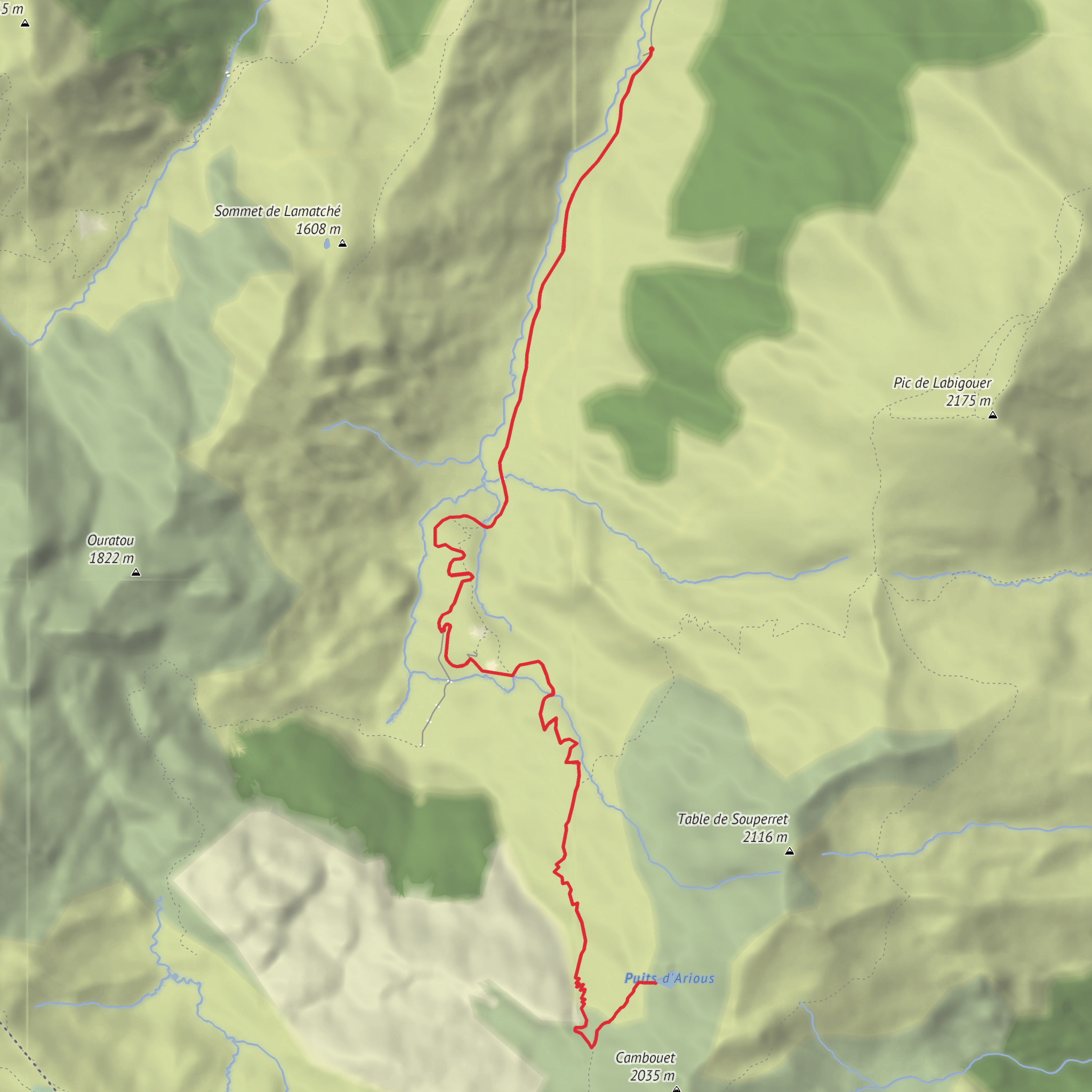
This difficult out-and-back to a secluded Pyrenean lake packs a lot into roughly 10 km / 6.2 miles, with about 700 m / 2,300 ft of ascent. The route starts from Parking d’Aumet on the Plateau de Lhers, above the Aspe Valley near Lescun in the Pyrénées-Atlantiques, France, and climbs by pastoral track and mountain path to Cabane det Caillau before branching toward the little-known Lac du Puits d’Arious, a small tarn sitting at about 1,867 m / 6,125 ft below the rocky bulk of the Table de Souperret. Sources describing this route consistently place the start at Parking d’Aumet and the key waypoints at Cabane det Caillau and the lake. (mes-ballades.com)
The nearest practical landmark for the start is Parking d’Aumet, Plateau de Lhers, 64490 Accous/Lescun area, France, reached by the mountain road above Lhers after turning off toward Lescun from the N134 in the Vallée d’Aspe. One local listing gives a nearby address point as 1300 Route d’Aumet, Plateau de Lhers, 64490 Accous, which is useful for navigation to the plateau area. (tourisme64.com)
The opening section is usually the most straightforward. From the parking area, the route follows a broad pastoral track up the Vallon de Labadie/Labadie valley, passing the Cabane de Pourcibo and continuing in long bends toward Cabane det Caillau. This lower half tends to feel more open than alpine, with grassy slopes, grazing country, and wide views back toward the Lhers plateau and the surrounding ridges. The gradient is steady rather than abrupt at first, making it easy to settle into a rhythm, but the total climb means pacing matters from the beginning. Route descriptions note that some hikers use shortcuts on the way back, though staying on the main line is generally simpler for ascent. (visorando.com)
What the climb feels like
At around Cabane det Caillau, roughly 1,450–1,480 m / 4,760–4,855 ft, the character of the hike changes. The track gives way to a mountain path, and the route becomes more directional, with signposted junctions leading toward Refuge d’Arlet and Col de Saoubathou. From here, the trail climbs more decisively through a higher pastoral basin. Expect a mix of dirt path, stonier sections, and occasional less-distinct tread as you gain height. (visorando.com)
The key navigational point comes before Col de Saoubathou. Several route descriptions mention leaving the main path near a grassy shelf around 1,820 m / 5,970 ft, close to old fence remains or a metal post, then following a fainter side path left toward the lake. This is the part of the outing that deserves the most attention: the lake is not always reached by an obvious built trail, and in poor visibility the turn can be easy to miss. If cloud drops in, this is where careful route-checking on HiiKER becomes especially valuable. (mes-ballades.com)
Once on the side path, the terrain feels quieter and more remote. The line trends across grass and broken ground toward a rocky knoll, usually passed on the right, before the lake appears. Lac du Puits d’Arious is not a large waterbody, but that is part of its appeal: it sits in a tucked-away hollow beneath the limestone and grassy relief around the Table de Souperret, with a more intimate feel than the larger, better-known lakes of the western Pyrenees. (mes-ballades.com)
Landmarks, scenery, and wildlife
The most significant landmarks on this hike are the Cabane de Pourcibo, Cabane det Caillau, the slopes leading toward Col de Saoubathou, and the lake itself beneath the Table de Souperret. The broader setting is the high country between the Plateau de Lhers, the Cirque de Lescun, and the upper Aspe Valley, an area
Surfaces
Unknown
Gravel
Comments and Reviews
User comments, reviews and discussions about the Cabane det Caillau and Lac du Puits d'Arious, France.
average rating out of 5
0 rating(s)
