
Download
3D Flyover
Add to list
More
6.4 km
~2 hrs 14 min
583 m
Out and Back
“A steep woodland push unfolds into a breezy Pyrenean belvedere, compact yet seriously demanding.”
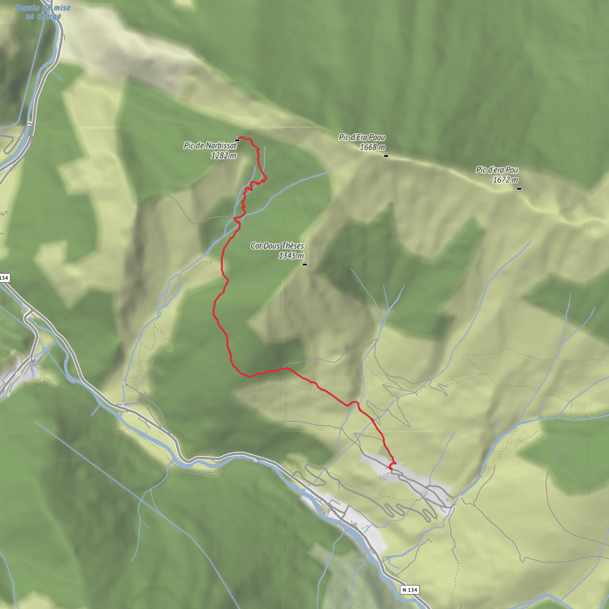
This short but demanding out-and-back above Cette-Eygun packs a lot into roughly 6 to 6.5 km / 3.7 to 4 miles, with about 600 m / 1,970 ft of ascent. The route climbs quickly from the village into steep woodland, reaches the Cabane de Sabas, then continues to the airy viewpoint of Pic de Narbissat at around 1,263 m / 4,144 ft. Official local tourism information lists the walk at about 6.5 km with 600 m of elevation gain and around 4 hours, which fits the character of a compact but strenuous mountain outing. (carrerasdemontana.com)
The start is in the village center of Cette, near Saint-Pierre Church in Cette-Eygun, Pyrénées-Atlantiques, France. Local route information describes the access as heading to the church in Cette and taking the right-hand road toward the geological site, so the nearest clear landmark for the trailhead is Église Saint-Pierre de Cette, 64490 Cette-Eygun, France. (tourisme64.com)
The opening section is usually the hardest on the legs. After a brief passage through the village lanes, the route joins a track and then a proper mountain path heading generally north through forest. The gradient builds early and stays fairly persistent, so although the distance is modest, this feels much more serious than the mileage suggests. Expect a steady climb rather than technical scrambling, but the effort is concentrated and there is not much flat ground to recover on. Route descriptions consistently note the turn toward Cabane de Sabas and then the continuation to the summit ridge/viewpoint. (visorando.com)
What the route feels like
The lower slopes pass through a mix of oak woodland before transitioning into beech forest higher up. One of the pleasures of this hike is that the terrain changes quickly: village edge, rising pastoral slopes, shaded forest, the isolated hut, and finally the more open upper crest. The Cabane de Sabas sits as a natural halfway landmark and a useful mental break before the final push. Local descriptions highlight the high oak woods, the beech forest around the hut, and the final effort needed to reach the narrow crest of Narbissat. (caminaspe.fr)
From the upper viewpoint, the reward is far bigger than the hike’s distance suggests. On a clear day, the panorama opens across major Aspe Valley and western Pyrenean summits, with local tourism material specifically mentioning views toward Pic d’Anie, Billare, and the Table des Trois Rois. This is the kind of summit where weather and visibility make a huge difference: in cloud, it can feel enclosed and abrupt; in clear conditions, it becomes a true belvedere. (tourisme64.com)
Landmarks, terrain, and things to watch for
Cabane de Sabas is the key intermediate landmark. It is useful for orientation and a natural pause point, but hikers should not assume services or guaranteed shelter conditions beyond what is typical of an unmanned mountain hut. From there, the route continues through forest and up to the Narbissat viewpoint/summit area, where the ridge becomes more exposed in feel even if the walking remains straightforward for experienced hikers. (visorando.com)
Because the route gains around 600 m / 1,970 ft in only about 6 to 6.5 km / 3.7 to 4 miles, footing and pacing matter. In wet weather, the woodland path can be slippery with roots, leaf litter, and mud. In autumn and winter, the shaded upper forest can hold moisture, frost, or patches of old snow longer than expected. The final crest also deserves care in wind, especially if visibility is poor. This is best treated as a difficult short mountain hike, not a casual walk. The safest approach is to carry enough water, use trekking poles if you like support on steep descents, and load the route in HiiKER before setting out. The official distance/elevation figures and repeated references to the final crest support that assessment. (carrerasdemontana.com)
Wildlife is one of the quieter attractions here. The forested slopes above Cette-Eygun are part of the rich mountain environment of the Aspe Valley, where hikers may encounter raptors overhead and signs of ungulates in the woods and clearings. Older route notes for this specific area mention
Surfaces
Unknown
Gravel
Grass
Comments and Reviews
User comments, reviews and discussions about the Cabane de Sabas and Pic de Narbissat from Cette, France.
average rating out of 5
0 rating(s)
