
Download
3D Flyover
Add to list
More
205.3 km
8 days
52 m
Multi Day
“A gentle borderland pilgrimage through Alsace’s sunlit plains, where history, rivers, and villages unfold steadily southward.”
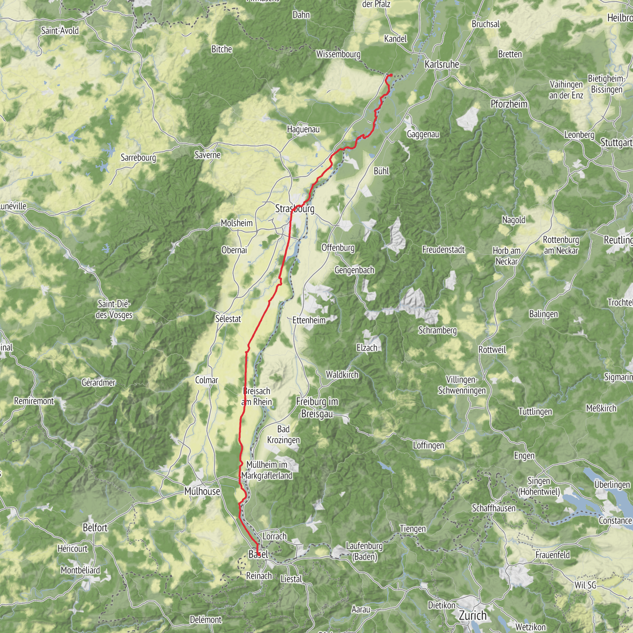
This long, easy-going section of The Columban Way runs for about 205 km / 127 miles, with only around 100 m / 330 ft of total ascent, so the challenge is much more about steady distance than climbing. It links Lauterbourg, near the French-German border on the Rhine, with Basel, the Swiss city at the meeting point of France, Germany, and Switzerland. The route is generally associated with Lauterbourg railway station as the practical starting point, on the southeastern side of town, and it finishes in central Basel, typically approached via the urban area around Basel SBB or the historic center depending on how closely you follow the official line of the route. (thecolumbanway.org)
Because the elevation gain is so low, this is one of the more approachable pilgrimage-style crossings in eastern France. The terrain is largely flat to gently rolling, and the route passes through the Alsace plain, following a corridor shaped by the Rhine, farmland, villages, river landscapes, and historic towns rather than mountain scenery. That makes it suitable for hikers who are comfortable covering repeated daily distances of roughly 20–30 km / 12–19 miles, especially over several consecutive days. The official itinerary describes this stretch as about 209 km in 8 stages, averaging around 25 km / 15.5 miles per day, which fits well with your stated distance of around 205 km. (thecolumbanway.org)
What the route feels like
From Lauterbourg, the walk begins in the far north of Alsace, where the landscape is broad, open, and strongly influenced by the Rhine frontier. Expect a mix of riverside lowlands, agricultural ground, canal or drainage corridors, and settlements with a distinctly borderland character. As the route heads south, it passes through or near major Alsatian centers including Strasbourg, then continues down the plain toward Basel. Rather than a remote wilderness trail, this is a cultural long-distance walk: villages, churches, town centers, and transport links appear regularly, which helps with resupply and flexible stage planning. (thecolumbanway.org)
The easy rating makes sense, but hikers should not mistake “easy” for effortless. On a route this flat, the main factors are repetitive impact, exposure to sun and wind, and the mental rhythm of long straight sections through open country. In wet periods, lowland paths can feel muddy or waterlogged in places, while in hot weather the exposed stretches can feel much harder than the elevation profile suggests. Good footwear for mixed paved and unpaved surfaces is usually more useful here than heavy mountain boots.
Landmarks, towns, and historical setting
A major highlight is Strasbourg, one of the most historically important cities in the region. It has long been a crossroads of Latin and Germanic Europe, and that borderland identity is central to understanding this section of the walk. The wider route follows the legacy of Saint Columbanus, the Irish monk whose travels and foundations helped shape early medieval Christian networks across continental Europe. In eastern France, that heritage overlaps with old monastic routes, Roman corridors, Rhine trade paths, and centuries of shifting political frontiers between France and the German-speaking world. (thecolumbanway.org)
South of Strasbourg, the route continues through the Alsatian plain toward the Upper Rhine. Hikers can expect a sequence of villages, parish churches, agricultural landscapes, and waterways rather than dramatic single landmarks every few kilometers. The appeal lies in the continuity of the landscape: half-timbered settlements in some areas, fertile fields, riverine woods, and the sense of moving through one of Europe’s great historic transit zones. As you approach Basel, the walk gradually shifts from rural lowland into a dense trinational urban region with strong cultural and commercial links across borders. (thecolumbanway.org)
Nature and wildlife
This section crosses a lowland environment shaped by the Rhine floodplain and the agricultural plain of Alsace. Depending on the exact line of the path, hikers may encounter riparian woodland, drainage channels, meadows, cultivated fields, and patches of wetland habitat. Birdlife is often one of the most noticeable features in this kind of terrain: herons, egrets, ducks, swans, and other water-associated species are typical around river and canal zones, while open farmland can support raptors and smaller field birds. In wooded or quieter rural sections, deer and smaller mammals are possible, especially early or late in the day.
Seasonally, insects can be a bigger practical issue than large wildlife. Mosquitoes can be noticeable near wetter ground, especially in warm months, and ticks are worth watching for in grassy edges and brushy sections. Sun exposure is another recurring factor, since long parts of the Alsace plain can be quite open. Carrying enough water matters more here than the elevation profile might suggest.
Planning the walk
With an official breakdown of roughly 8 stages, many hikers will divide the route into week-long
AI Planner
Days planned around your pace, with somewhere to stay each night.
Surfaces
Asphalt
Unknown
Gravel
Ground
Cobblestone
Dirt
Paved
Unpaved
Concrete
Wood
Grass
Comments and Reviews
User comments, reviews and discussions about the The Columban Way in France - Section 4 from Lauterbourg to Basel, France.
average rating out of 5
0 rating(s)

