Table Hill, Sugarloaf Hill, Black Hill and Worcestershire Beacon Loop
Download
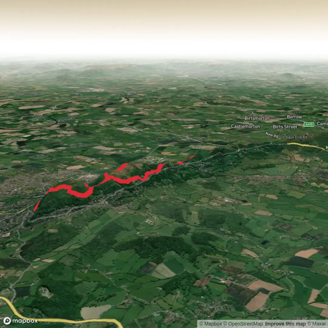
3D Flyover
Add to list
More
17.0 km
~4 hrs 36 min
724 m
Loop
“Climb grassy ridges and rocky peaks, soaking in wildflowers, sweeping views, and ancient echoes.”
Starting from the Malvern Hills area, the loop begins near the Malvern Hills Hotel, a well-known landmark on the A449 between Great Malvern and British Camp. This is a popular access point for the Malvern Hills, with parking available and bus stops nearby for those arriving via public transport from Worcester or Hereford.
Initial Ascent and Table Hill
The route heads north along the spine of the Malvern Hills, quickly gaining elevation as you ascend Table Hill. The first section is a steady climb, with the path rising approximately 200 metres (650 feet) over the first 2 km (1.2 miles). The terrain is a mix of grassy slopes and rocky outcrops, with panoramic views opening up over the Severn Valley and the Cotswolds to the east. Table Hill itself is a broad, grassy summit, often grazed by sheep, and offers a peaceful spot to catch your breath.
Sugarloaf Hill and Black Hill
Continuing north, the trail undulates along the ridge, passing over Sugarloaf Hill at around the 3 km (1.9 mile) mark. This section is known for its wildflowers in spring and summer, with skylarks and meadow pipits frequently seen and heard overhead. The path narrows and becomes rockier as you approach Black Hill, which sits at about 4.5 km (2.8 miles) from the start. Black Hill is less visited than the southern peaks, providing a quieter experience and excellent views west towards the Welsh border.
Worcestershire Beacon and Historical Significance
Turning south, the route climbs steadily towards Worcestershire Beacon, the highest point on the Malvern Hills at 425 metres (1,394 feet). This section involves the steepest ascent of the hike, gaining around 150 metres (490 feet) in just over 1 km (0.6 miles). The summit is marked by a toposcope and offers 360-degree views, including the Shropshire Hills, the Black Mountains, and, on clear days, the distant Brecon Beacons. Worcestershire Beacon has a rich history, with evidence of Bronze Age activity and its use as a beacon point for warning of invasions.
Nature, Wildlife, and Navigation
The Malvern Hills are designated as an Area of Outstanding Natural Beauty, with a mosaic of heathland, acid grassland, and ancient woodland. Look out for red kites, buzzards, and, in the woodlands, nuthatches and woodpeckers. The hills are also home to rare plants such as the spring cinquefoil and the Malvern spotted orchid. The trail is well-marked, but weather can change quickly, and mist can descend, making navigation challenging—using HiiKER for offline maps and route tracking is highly recommended.
Return to the Start
The descent follows the ridge south, passing through the saddle at Upper Wyche and looping back towards the Malvern Hills Hotel. The final section is a gentle descent through mixed woodland and open hillside, with the total loop covering approximately 17 km (10.5 miles) and a cumulative elevation gain of around 700 metres (2,300 feet). The varied terrain, historical landmarks, and sweeping views make this a rewarding hike for those with moderate fitness and a sense of adventure. Public transport users can catch the 44 or 44A bus from Great Malvern railway station to the Malvern Hills Hotel, while drivers will find ample parking at the hotel or nearby lay-bys.

Surfaces
Unknown
Gravel
Dirt
Grass
Ground
Asphalt
Comments and Reviews
User comments, reviews and discussions about the Table Hill, Sugarloaf Hill, Black Hill and Worcestershire Beacon Loop, England.
average rating out of 5
0 rating(s)