
Download
3D Flyover
Add to list
More
8.7 km
~1 hrs 47 min
36 m
Point to Point
“Explore Wolverhampton's rich heritage on a 9 km flat, medium-difficulty hike along the Bradley Arm canal.”
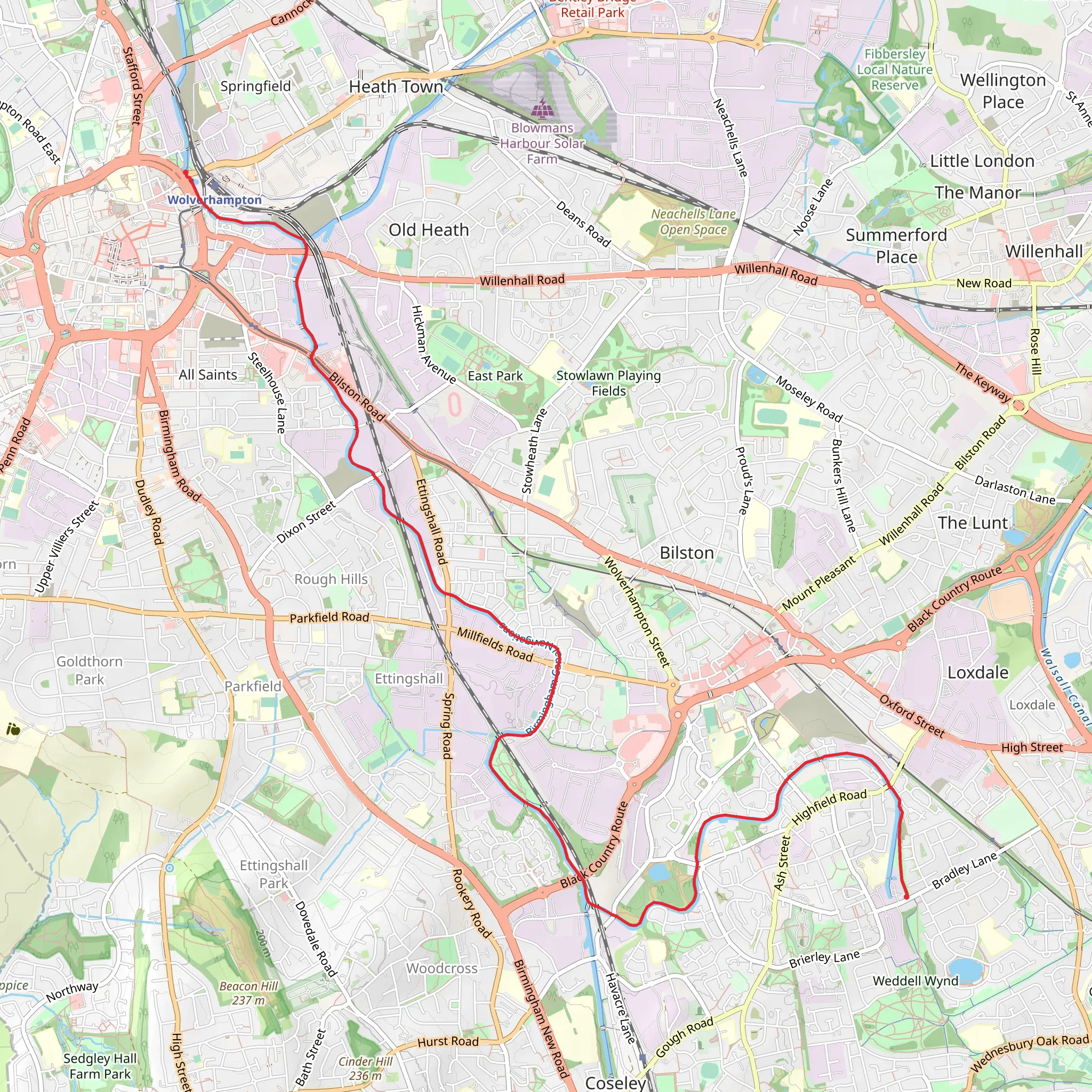
Starting near Wolverhampton, England, the WolverhamptonBradley Arm trail stretches approximately 9 km (around 5.6 miles) and is a point-to-point hike with no significant elevation gain, making it accessible for a wide range of hikers. This trail is estimated to be of medium difficulty, suitable for those with some hiking experience.
Getting There
To reach the trailhead, you can either drive or use public transport. If driving, you can park near Wolverhampton city center, where there are several parking options available. For those using public transport, Wolverhampton Railway Station is well-connected with frequent services from major cities. From the station, it's a short walk or bus ride to the trailhead.
Trail Overview
The trail begins near Wolverhampton and follows the historic Bradley Arm of the Birmingham Canal Navigations. This canal was once a bustling industrial route, and remnants of its industrial past can still be seen along the way. The path is relatively flat, making it an easy walk in terms of elevation but still offering a good workout due to its length.
Points of Interest
- Wolverhampton Locks: Early in the hike, you'll encounter the Wolverhampton Locks, a series of 21 locks that are part of the Birmingham Canal Navigations. These locks are a fascinating piece of engineering history and offer a glimpse into the region's industrial past.
- Bradley Workshops: About halfway through the trail, you'll pass near the Bradley Workshops, which were once a hub for canal maintenance. Though no longer in operation, the site is of historical significance and offers a unique look into the area's industrial heritage.
- Wildlife and Nature: The trail is flanked by lush greenery and is home to a variety of wildlife. Keep an eye out for waterfowl such as ducks and swans, as well as smaller birds like kingfishers. The canal itself is often teeming with fish, making it a popular spot for local anglers.
- Bradley Locks: As you approach the end of the trail, you'll come across the Bradley Locks. Though fewer in number than the Wolverhampton Locks, they are equally impressive and offer another opportunity to appreciate the engineering marvels of the canal system.
Navigation
For navigation, it's highly recommended to use the HiiKER app, which provides detailed maps and real-time updates. This will help you stay on track and ensure you don't miss any of the key landmarks along the way.
Historical Significance
The WolverhamptonBradley Arm trail is steeped in history, primarily due to its connection to the Birmingham Canal Navigations. This canal network was crucial during the Industrial Revolution, facilitating the transport of goods and raw materials. Walking this trail offers a unique opportunity to step back in time and appreciate the engineering feats that helped shape the region.
Practical Tips
- Footwear: Given the flat terrain, sturdy walking shoes should suffice. However, if it's been raining, parts of the trail can become muddy, so waterproof footwear is advisable.
- Water and Snacks: There are limited facilities along the trail, so bring enough water and snacks to keep you energized.
- Weather: The trail is exposed in some sections, so check the weather forecast and dress accordingly. Sunscreen and hats are recommended for sunny days, while waterproofs are essential if rain is expected.
This trail offers a blend of natural beauty and historical intrigue, making it a rewarding hike for those looking to explore the rich heritage of the Wolverhampton area.
What to expect?
Activity types
Comments and Reviews
User comments, reviews and discussions about the WolverhamptonBradley Arm, England.
5.0
average rating out of 5
2 rating(s)

