Download
3D Flyover
Add to list
More
11.1 km
~2 hrs 32 min
199 m
Loop
“Rolling chalk ridges, whispering beeches and secluded Betty Mundy’s Bottom make for a richly varied ramble.”
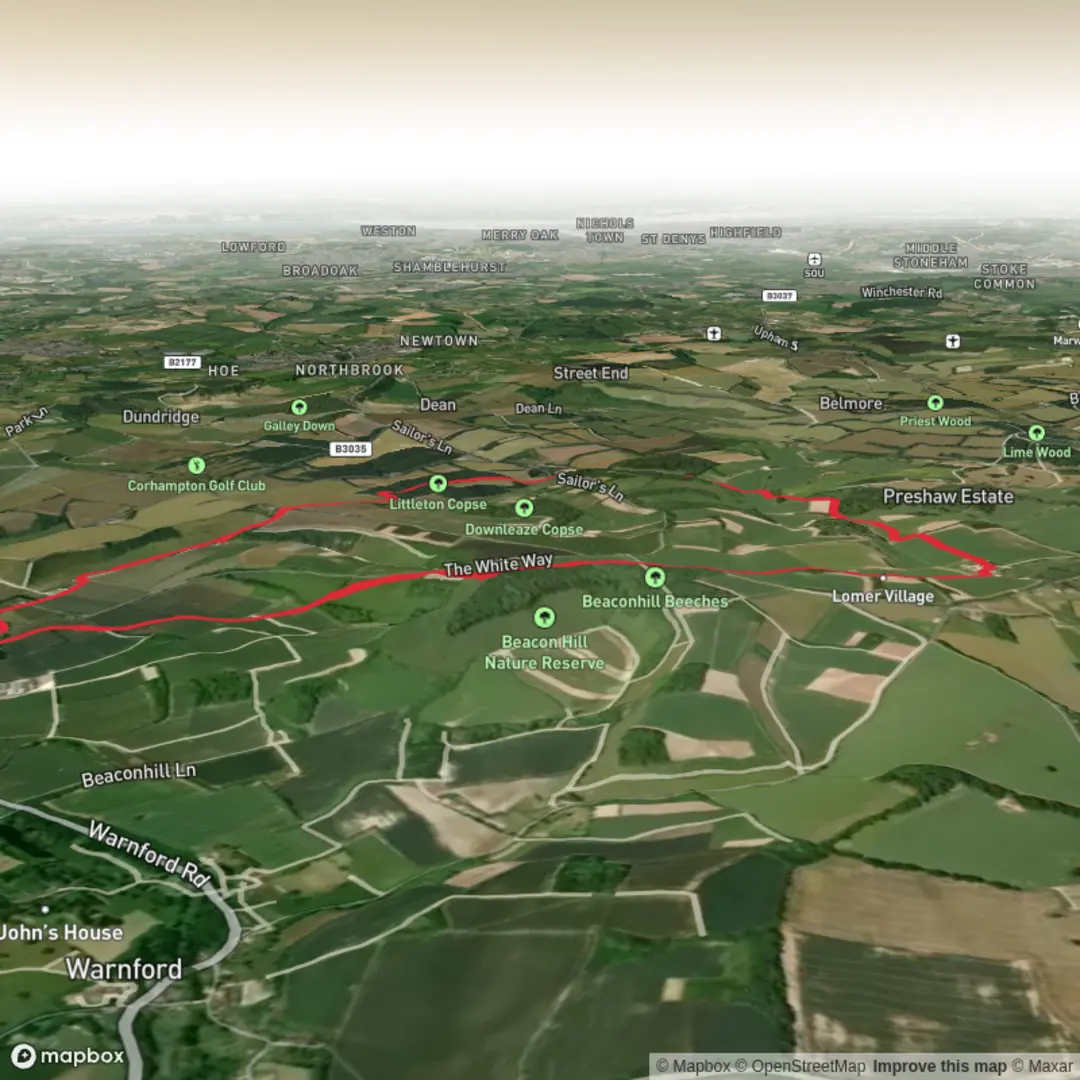
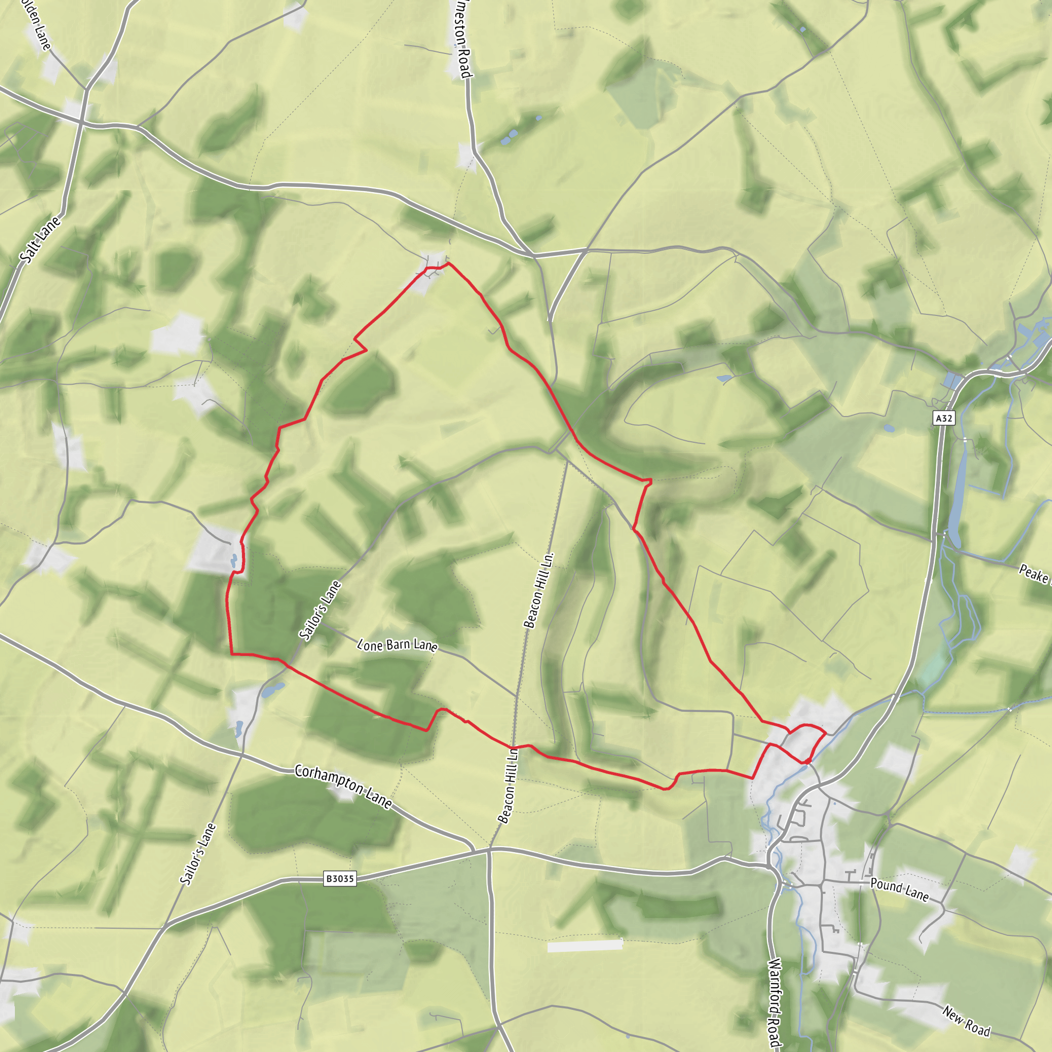
This easy loop of about 11 km / 6.8 miles with roughly 200 metres / 656 feet of ascent explores a classic stretch of the western South Downs above the Meon Valley, linking open chalk downland, beech woodland, estate tracks and the wonderfully named dry valley of Betty Mundy’s Bottom. Expect a route that feels varied rather than strenuous: long, gently rolling sections across high ground are broken up by a few moderate climbs and descents, with the steepest gradients usually coming where the trail drops into or rises out of the valley sides near Beacon Hill and the wooded bottoms. Beacon Hill itself reaches about 201 metres / 659 feet and is part of Beacon Hill National Nature Reserve, a prominent chalk hill at the western end of the South Downs National Park. (gov.uk)
The start is most commonly associated with the small Beacon Hill Beeches car park near Exton and Warnford, with published walk references placing it at roughly grid reference SU 598 227 and giving nearby postcodes including SO32 3LG and SO32 3LJ. The nearest practical landmark is the Beacon Hill Beeches car park off Beacon Hill Lane, above Exton in Hampshire, rather than a street address in the usual urban sense. If arriving by car, approach via the A32 through Warnford or Exton and follow local signs or mapping toward Beacon Hill / Beacon Hill Lane; parking is limited, so early arrival is wise on fine weekends. Public transport is possible but less flexible: Exton is served by the Meon Valley community bus, with stops at The Shoe pub in the village, and the South Downs National Park also recommends journey planning through public transport tools for car-free visits. From Exton, you should allow extra walking time for the uphill approach to the trailhead. (residentmagazine.co.uk)
The character of the walk is shaped by chalk. Underfoot, that usually means firm, fast-going paths in dry weather, but after rain the clayier woodland sections and farm tracks can become slick, while exposed chalk slopes can be surprisingly slippery. Good footwear is still worth having even on an “easy” rating. There may also be gates, stiles and occasional livestock on estate and pasture sections, so this is a route where a little attention goes a long way. Some local route notes also mention cattle in the Preshaw estate area beyond Betty Mundy’s Bottom. (chalk-and-mud-trail-running.co.uk)
What the route feels like
From the Beacon Hill side, the opening kilometres are usually the most expansive. The trail heads out along broad tracks and downland paths with a real sense of height over the Meon Valley. This is South Downs walking at its most recognisable: rounded chalk ridges, big skies, cropped grassland and long views that can stretch across a patchwork of fields, woods and villages. The gradients here are generally manageable, but because the hill shoulders are open, wind and sun exposure can be more significant than the elevation profile suggests. On warm days there is little shelter on the upper ground; in winter, the same openness can make the route feel much colder than the valley forecast.
As the loop bends toward Lomer and Preshaw Wood, the atmosphere changes. Open ridge walking gives way to quieter estate land and woodland margins, where the route becomes more enclosed and intimate. The transition is one of the pleasures of this walk: instead of a single sustained viewpoint trail, it alternates between airy downland and shaded green corridors. Preshaw Wood and the surrounding copses bring birdsong, filtered light and a softer, more sheltered feel under the trees.
Betty Mundy’s Bottom is one of the most memorable sections. In southern English landscape terms, a “bottom” is a dry valley, and this one cuts a shallow, attractive line through the estate landscape north of Exton. The walking here is gentler in mood, with hedged boundaries, woodland edges and a more secluded feel than the exposed crest of Beacon Hill. Local route descriptions place the Wayfarer’s Walk through the middle of Betty Mundy’s Bottom, and several circular walks in the area use this valley as a key linking section. (stbarnabas.org.uk
Surfaces
Dirt
Unpaved
Asphalt
Unknown
Gravel
Concrete
Comments and Reviews
User comments, reviews and discussions about the Beacon Hill, Preshaw Wood and Betty Mundy's Bottom Loop, England.
average rating out of 5
0 rating(s)
