Download
3D Flyover
Add to list
More
19.9 km
~4 hrs 42 min
442 m
Out and Back
“Explore the scenic 20 km King Alfred's Tower to Bruton Walk, blending history, nature, and a moderate challenge.”
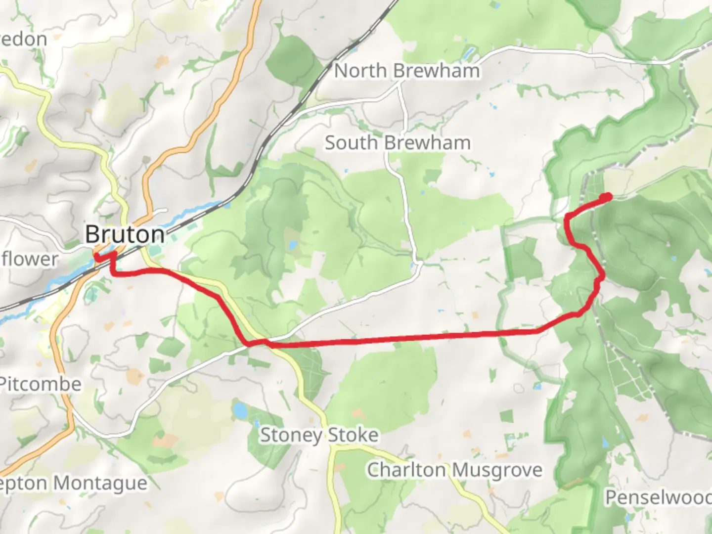
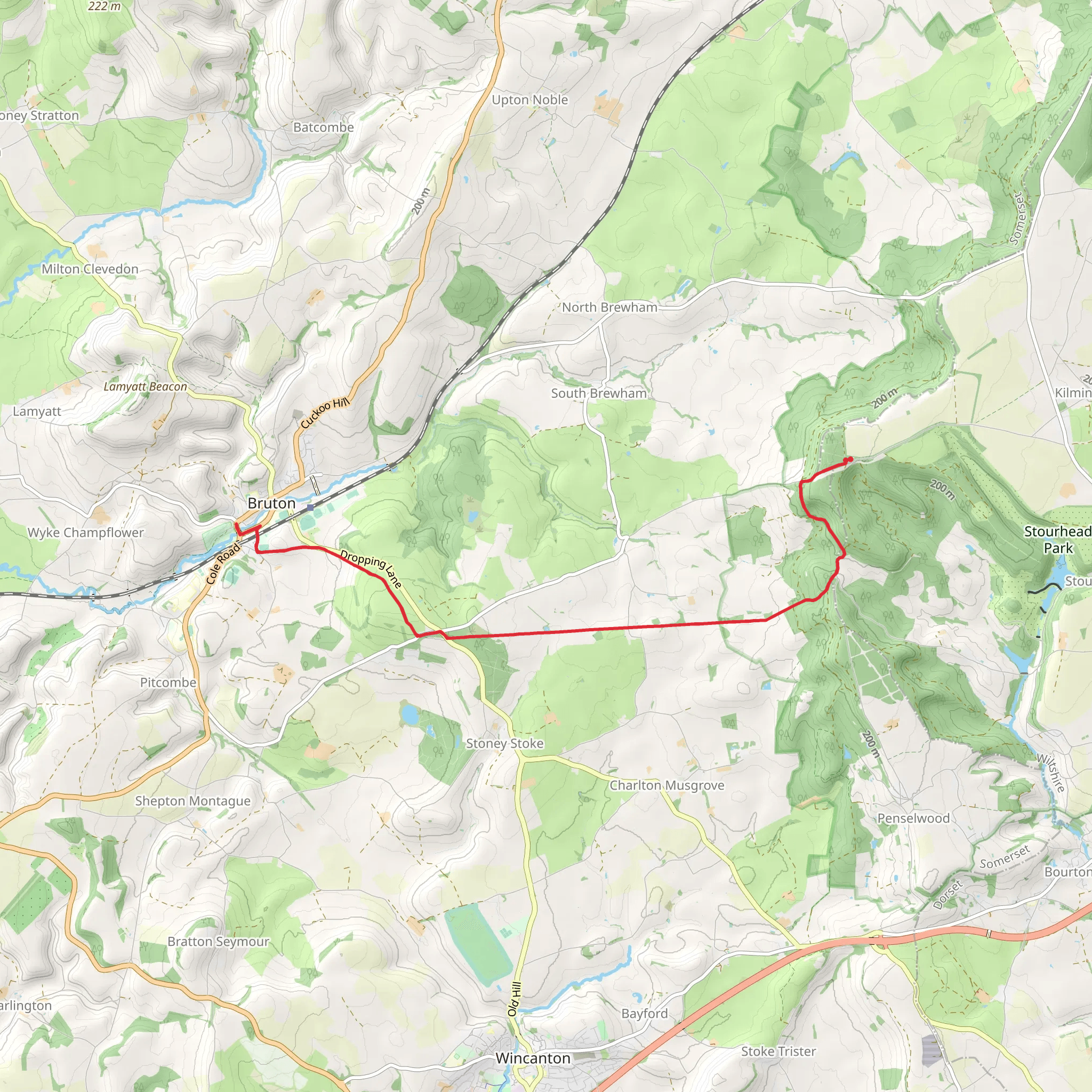
Starting near Wiltshire, England, the King Alfred's Tower to Bruton Walk is an approximately 20 km (12.4 miles) out-and-back trail with an elevation gain of around 400 meters (1,312 feet). This medium-difficulty hike offers a blend of historical intrigue, natural beauty, and a moderate physical challenge.
Getting There
To reach the trailhead, you can drive or use public transport. If driving, set your GPS to King Alfred's Tower, a prominent landmark near Wiltshire. For those using public transport, the nearest train station is Bruton, from where you can take a taxi or local bus to the trailhead.
Trail Overview
The trail begins at King Alfred's Tower, a striking 160-foot (49-meter) folly built in 1772 to commemorate the accession of King Alfred the Great. This Gothic tower offers panoramic views of the surrounding countryside, making it a perfect starting point.
Initial Ascent
From the tower, the trail descends gently through mixed woodland, offering a serene environment filled with the sounds of birds and rustling leaves. After about 2 km (1.2 miles), you'll encounter a moderate ascent, gaining approximately 100 meters (328 feet) in elevation. This section can be a bit strenuous, so take your time and enjoy the lush greenery.
Midway Point: Stourhead Estate
At around the 5 km (3.1 miles) mark, you'll reach the Stourhead Estate, a National Trust property renowned for its landscaped gardens, classical temples, and picturesque lake. This is an excellent spot for a rest, with plenty of benches and scenic views. The estate itself is steeped in history, dating back to the 18th century, and offers a glimpse into England's aristocratic past.
Wildlife and Flora
As you continue, the trail meanders through open fields and dense woodlands. Keep an eye out for local wildlife, including deer, foxes, and a variety of bird species. The flora is equally diverse, with ancient oak trees, vibrant wildflowers, and seasonal bluebells carpeting the forest floor in spring.
Final Stretch to Bruton
The last 5 km (3.1 miles) to Bruton involves a mix of gentle descents and flat sections, making for a relatively easy finish. Bruton itself is a charming town with a rich history dating back to the Saxon era. Notable landmarks include the 14th-century St. Mary's Church and the contemporary art gallery, Hauser & Wirth Somerset.
Navigation and Safety
For navigation, it's advisable to use HiiKER, which provides detailed maps and real-time updates. The trail is well-marked, but having a reliable navigation tool ensures you stay on track. Always carry sufficient water, snacks, and a basic first-aid kit. Weather in this region can be unpredictable, so pack layers and waterproof gear.
Return Journey
The return journey retraces your steps back to King Alfred's Tower, offering a different perspective on the landscapes you passed earlier. The total round trip is approximately 20 km (12.4 miles), making for a fulfilling day hike.
This trail offers a perfect blend of natural beauty, historical landmarks, and moderate physical challenge, making it a rewarding experience for hikers of all levels.
What to expect?
Activity types
Comments and Reviews
User comments, reviews and discussions about the King Alfred's Tower to Bruton Walk, England.
4.25
average rating out of 5
4 rating(s)
