
Download
3D Flyover
Add to list
More
16.5 km
~3 hrs 34 min
163 m
Loop
“A breezy chalkland loop above Avebury threads big skies, ancient earthworks and a haunting sense of deep time.”
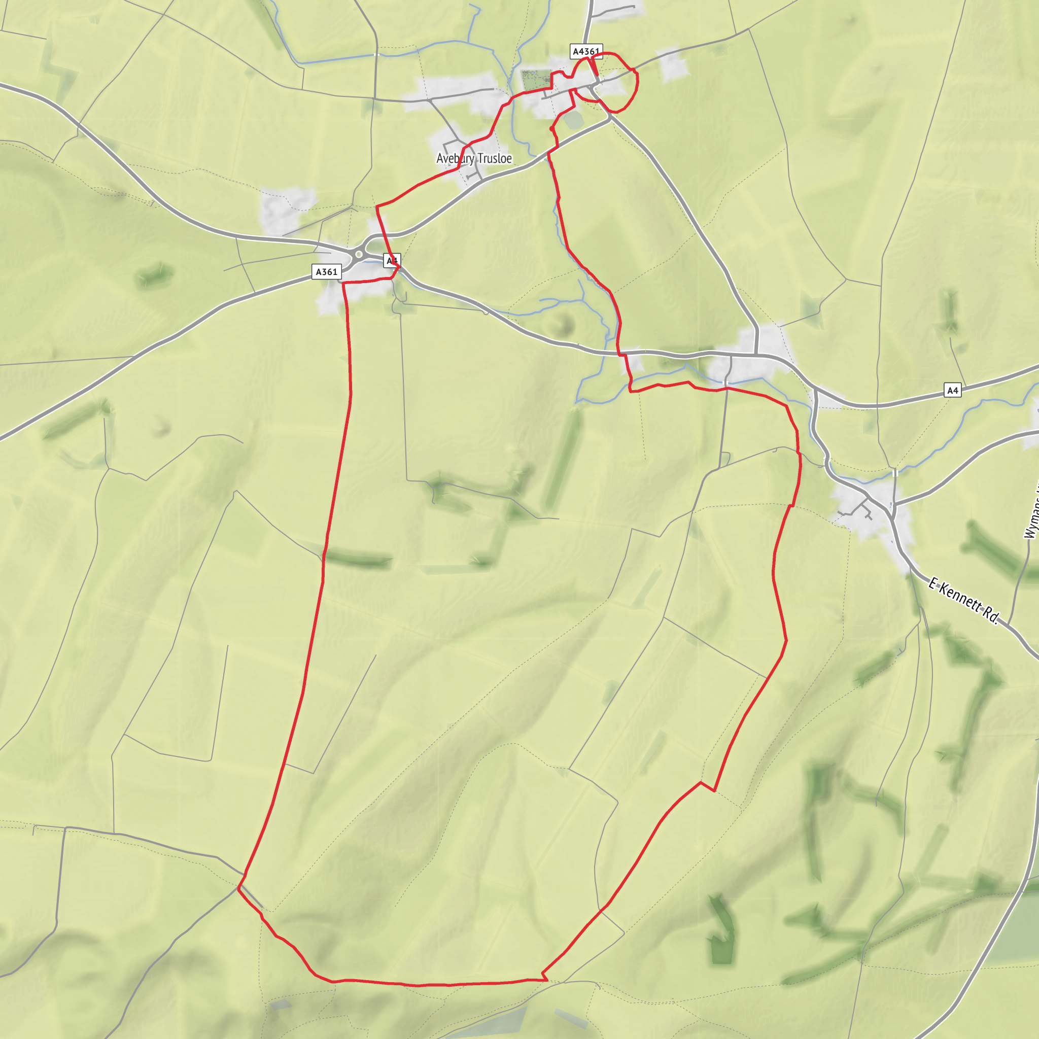
This easy loop of around 16 km / 10 miles with roughly 200 metres / 656 feet of ascent explores the open chalk downs around Avebury, linking broad ridgelines, prehistoric earthworks and some of the most important ancient ceremonial landscapes in Britain. The route is more about space, views and atmosphere than steep climbing, but the exposed ground and long stretches across open downland mean it still deserves proper planning. Expect a mix of grassy tracks, field-edge paths, chalky bridleways and gently rolling slopes, with a few short rises rather than any sustained ascent. The nearest practical start point is Avebury, most commonly from the National Trust main visitor car park off the A4361, Avebury, Marlborough SN8 1RD. English Heritage also lists Avebury village, postcode SN8 1RF, as the main access point for the monument area. (nationaltrust.org.uk)
The opening section is usually the gentlest, easing out from the Avebury side of the landscape before climbing onto higher ground. Within the first few kilometres, the character changes from village-edge paths and pasture to classic Wiltshire chalk downland: wide skies, cropped turf, old field boundaries and long views over the Vale of Pewsey and the surrounding folds of the North Wessex Downs. Because the terrain is open, this is a route where weather has a big influence. After rain, chalk can become slick and greasy underfoot; in dry spells it hardens and can feel fast and easy. Wind exposure is often more noticeable than the elevation profile suggests, especially on Harestone Down and the higher shoulders near Allington Down. (nationaltrust.org.uk)
Terrain, pacing and navigation
Although the difficulty is best described as easy, the distance makes it more of a half-day to full-day outing for many walkers. A comfortable pace with stops for views, archaeology and photos often puts the outing in the 4.5 to 6 hour range. There are no mountain hazards here, but there are a few practical considerations: little shelter on the tops, potentially muddy gateways and rutted farm tracks in wet weather, and livestock in some fields near Avebury. Good walking shoes are usually enough in dry conditions, while waterproof footwear is more comfortable in winter or after prolonged rain. Because paths can split across access land and old trackways, carrying the route on HiiKER is the simplest way to stay on line across the open sections. (visitwiltshire.co.uk)
The climbing is spread out in small increments, so most hikers will notice the distance before they notice the ascent. The highest-feeling parts of the walk are not especially lofty, but they give a strong sense of elevation because the surrounding country is so open. Descents are generally straightforward, though chalk slopes can be slippery when damp. In summer, sun exposure can be significant because there is very little shade once you leave the village and lower hedged lanes behind. Carry more water than the profile alone might suggest.
Landmarks and historical setting
This loop passes through a landscape where the archaeology is the main event. Avebury itself is one of the principal ceremonial sites of Neolithic Britain, built and altered over many centuries from about 2850 BC to about 2200 BC. The henge encloses a huge circular bank and ditch with stone circles inside, and avenues once linked it to other ceremonial sites across the surrounding downs. (production.english-heritage.org.uk)
Waden Hill is especially significant for its relationship to the wider Avebury complex. Historic England records a round barrow cemetery on Waden Hill just south of the henge, reinforcing how densely layered this landscape is with prehistoric burial and ritual monuments. Nearby Silbury Hill, visible or closely associated with this part of the walk depending on the exact line taken, is the largest artificial prehistoric mound in Europe, about 30 metres / 98 feet high and built roughly between 2470 and 2350 BC. (historicengland.org.uk)
Harestone Down and Allington Down continue that prehistoric thread. Allington Down is known for Bronze Age round barrows, and antiquarian records note archaeological finds from the area, including a gold torc fragment reportedly found there in the 19th century. These downs are not dramatic in the way of crags or waterfalls,
AI Planner
Days planned around your pace, with somewhere to stay each night.
Surfaces
Unknown
Dirt
Grass
Asphalt
Gravel
Unpaved
Paved
Concrete
Cobblestone
Comments and Reviews
User comments, reviews and discussions about the Allington Down, Harestone Down and Waden Hill Loop, England.
average rating out of 5
0 rating(s)


