Download
3D Flyover
Add to list
More
15.8 km
~4 hrs 40 min
904 m
Loop
“Embark on a scenic, moderately challenging 16 km hike from Sedbergh, offering stunning views and historical intrigue.”
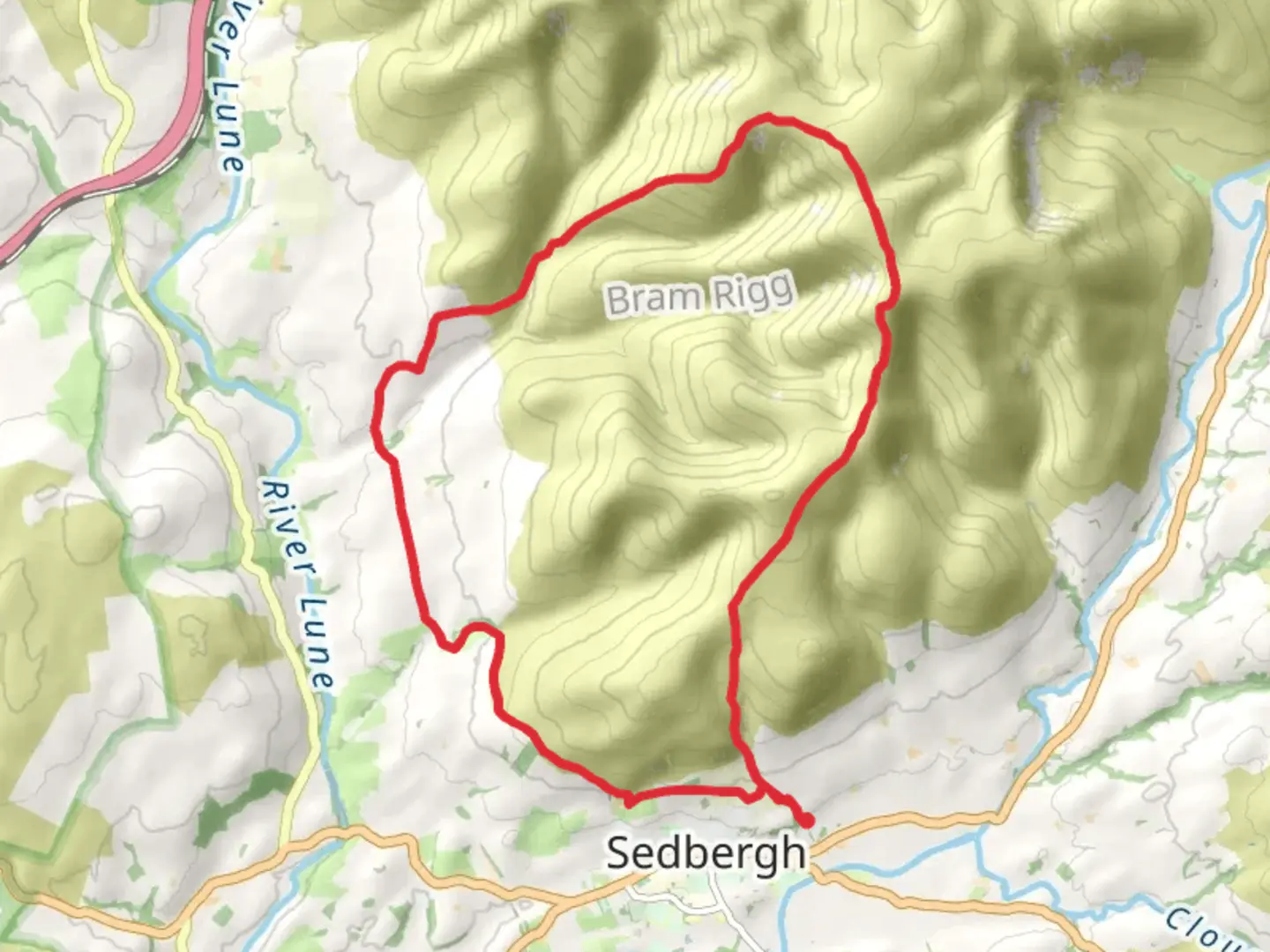
Starting near the picturesque village of Sedbergh in Westmorland and Furness, England, this 16 km (approximately 10 miles) loop trail offers a moderately challenging hike with an elevation gain of around 900 meters (approximately 2,950 feet). The trailhead is conveniently accessible by car, with parking available in Sedbergh. For those using public transport, Sedbergh is well-connected by bus services from Kendal and other nearby towns.
Initial Ascent and Dales Way
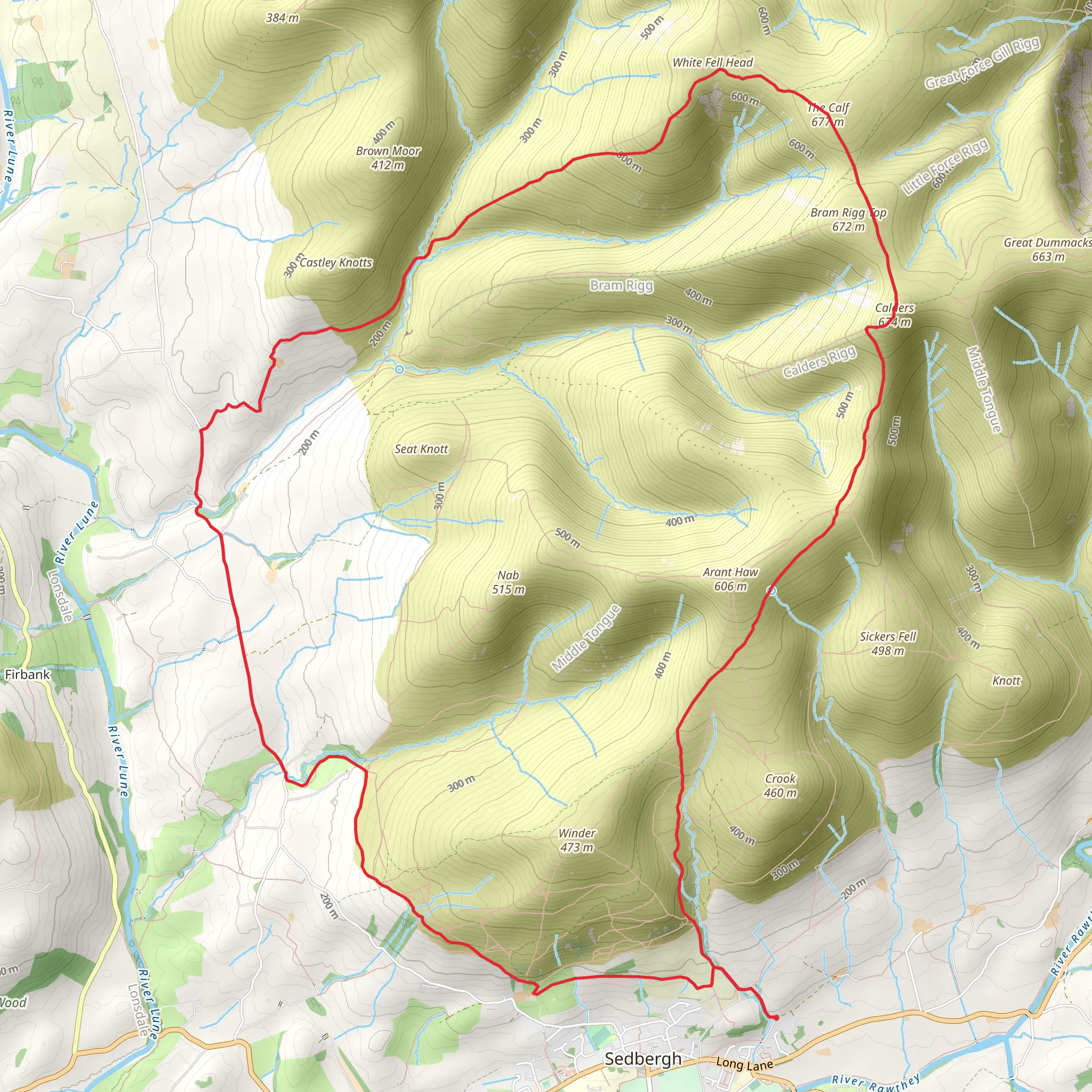
The hike begins with a gentle ascent along the Dales Way, a renowned long-distance footpath that stretches across the Yorkshire Dales. This section of the trail is well-marked and offers a gradual climb through lush meadows and alongside babbling brooks. Keep an eye out for local wildlife, including red squirrels and a variety of bird species. After approximately 3 km (1.9 miles), you'll reach a fork where the trail diverges from the Dales Way and begins a steeper ascent towards The Calf.
Climbing to The Calf
As you continue, the path becomes more rugged and the incline steeper. This section of the trail is characterized by rocky outcrops and heather-covered moorlands. The climb to The Calf, the highest point in the Howgill Fells, is demanding but rewarding. At around the 8 km (5 miles) mark, you'll reach the summit, standing at 676 meters (2,218 feet) above sea level. From here, you'll be treated to panoramic views of the Lake District, the Yorkshire Dales, and even the Pennines on a clear day.
Historical Significance
The Howgill Fells have a rich history, with evidence of ancient settlements and Roman roads scattered throughout the area. The region was historically used for sheep farming, and you may still encounter grazing sheep along the trail. The landscape has remained relatively unchanged for centuries, offering a glimpse into England's pastoral past.
Descent and Return Loop
The descent from The Calf is less strenuous but requires careful footing, especially in wet conditions. The trail loops back towards Sedbergh, passing through verdant valleys and alongside cascading streams. At around the 12 km (7.5 miles) mark, you'll rejoin the Dales Way for the final stretch back to the village. This section is more leisurely, allowing you to enjoy the serene beauty of the countryside.
Navigation and Safety
Given the varied terrain and potential for rapidly changing weather conditions, it's advisable to use a reliable navigation tool like HiiKER to stay on track. Ensure you have appropriate footwear, sufficient water, and layers of clothing to adapt to the weather. The trail is well-marked, but fog and mist can reduce visibility, making navigation tools essential.
Flora and Fauna
Throughout the hike, you'll encounter a diverse range of flora and fauna. The lower elevations are rich with wildflowers in the spring and summer, while the higher moorlands are home to hardy shrubs and grasses. Birdwatchers will delight in spotting species such as curlews, lapwings, and skylarks.
Getting There
For those driving, Sedbergh is accessible via the M6 motorway, with the nearest major town being Kendal. Parking is available in Sedbergh, often at the local car parks near the village center. If using public transport, regular bus services run from Kendal to Sedbergh, making it a convenient option for those without a car.
This trail offers a blend of natural beauty, historical intrigue, and physical challenge, making it a rewarding experience for hikers of moderate ability.
What to expect?
Activity types
Comments and Reviews
User comments, reviews and discussions about the The Calf via Dales Way, England.
4.5
average rating out of 5
2 rating(s)
