
Download
3D Flyover
Add to list
More
12.8 km
~3 hrs 58 min
850 m
Loop
“Embark on the 13 km Striding Edge and Helvellyn Loop for panoramic views and a thrilling adventure.”
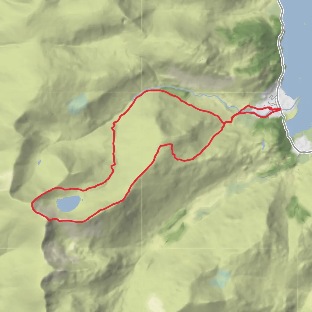
Starting your adventure near Westmorland and Furness, England, the Striding Edge and Helvellyn Loop is a captivating 13 km (8 miles) trail with an elevation gain of approximately 900 meters (2,950 feet). This loop trail is rated as medium difficulty, making it suitable for hikers with a moderate level of experience and fitness.
Getting There
To reach the trailhead, you can drive or use public transport. If driving, head towards Glenridding, a village in the Lake District, which is the nearest significant landmark. There are several car parks available in Glenridding, such as the Glenridding Car Park. For those using public transport, buses run regularly from Penrith, which is accessible by train from major cities like Manchester and London. The bus journey from Penrith to Glenridding takes around 40 minutes.
Trail Overview
The trail begins in Glenridding and quickly ascends towards Birkhouse Moor. The initial section is a steady climb, offering panoramic views of Ullswater Lake and the surrounding fells. After approximately 3 km (1.9 miles) and an elevation gain of 300 meters (985 feet), you will reach the summit of Birkhouse Moor.
Striding Edge
From Birkhouse Moor, the trail continues towards Striding Edge, a narrow ridge that is one of the most iconic features of this hike. The ridge is about 1.5 km (0.9 miles) long and requires careful navigation, especially in wet or windy conditions. The path along Striding Edge is rocky and uneven, with some sections requiring scrambling. It is advisable to use a navigation tool like HiiKER to stay on track and ensure safety.
Helvellyn Summit
After crossing Striding Edge, you will reach the summit of Helvellyn, standing at 950 meters (3,117 feet). This is the third highest peak in England and offers breathtaking 360-degree views of the Lake District. On a clear day, you can see as far as Scotland and the Isle of Man. The summit area is relatively flat, providing a perfect spot for a well-deserved break.
Descent via Swirral Edge
The descent begins via Swirral Edge, another narrow ridge that requires careful footing. This section is shorter but equally challenging as Striding Edge. After descending Swirral Edge, you will reach Red Tarn, a glacial lake nestled between the ridges. This is a great spot to rest and enjoy the serene environment.
Return to Glenridding
From Red Tarn, the trail descends gradually back towards Glenridding. The path follows a well-defined route along the valley, passing through lush meadows and alongside small streams. This final section is about 4 km (2.5 miles) long and relatively easy, allowing you to relax and take in the natural beauty of the area.
Historical Significance
The region around Helvellyn has a rich history. The mountain itself has been a popular destination for hikers and climbers since the 18th century. The poet William Wordsworth and the artist J.M.W. Turner were known to have visited and drawn inspiration from the area. Additionally, the remains of old mining operations can be seen along the trail, offering a glimpse into the industrial past of the Lake District.
Wildlife and Nature
The trail is home to a variety of wildlife, including red deer, foxes, and numerous bird species such as peregrine falcons and ravens. The flora is equally diverse, with heather, bilberry, and various wildflowers adding splashes of color to the landscape. Keep an eye out for the rare alpine plants that thrive in the higher elevations.
Preparation Tips
Given the challenging nature of Striding Edge and Swirral Edge, it is essential to be well-prepared. Wear sturdy hiking boots with good grip, carry a map and compass or use HiiKER for navigation, and pack enough food and water for the journey. Weather in the Lake District can change rapidly, so bring waterproof clothing and check the forecast before setting out.
This trail offers a perfect blend of adventure, natural beauty, and historical intrigue, making it a must-do for any hiking enthusiast.
What to expect?
Activity types
Surfaces
Unknown
Gravel
Asphalt
Dirt
Comments and Reviews
User comments, reviews and discussions about the Striding Edge and Helvellyn Loop, England.
4.86
average rating out of 5
35 rating(s)


