Download
3D Flyover
Add to list
More
11.2 km
~3 hrs 2 min
487 m
Loop
“Experience a captivating 11 km loop through woodlands, scenic heights, and historical landmarks in England's Lake District.”
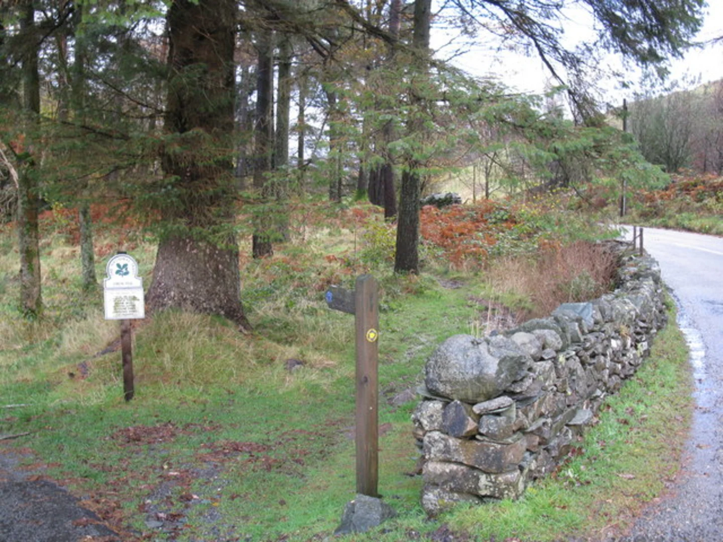
Starting near Westmorland and Furness in England, this 11 km (approximately 6.8 miles) loop trail offers a moderate challenge with an elevation gain of around 400 meters (about 1,312 feet). The trailhead is conveniently accessible by car, with parking available near the village of Skelwith Bridge. For those using public transport, the nearest train station is Windermere, from where you can catch a bus to Skelwith Bridge.
Initial Ascent and Stang End Moss
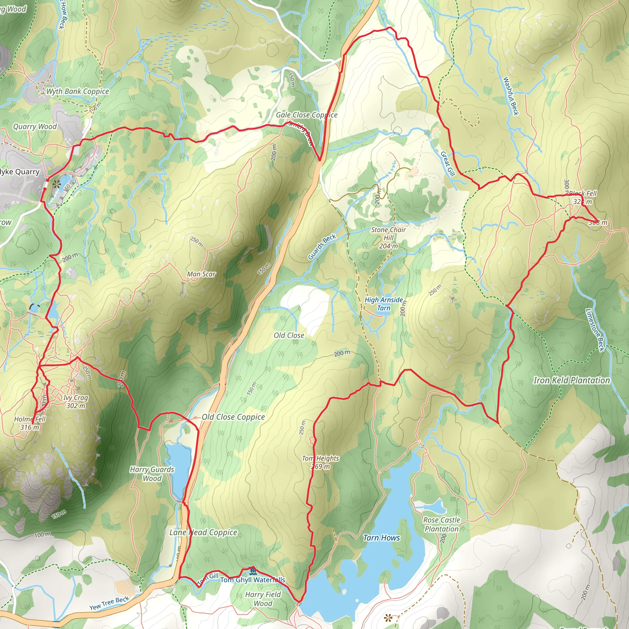
The hike begins with a gentle ascent through lush woodlands, gradually leading you to Stang End Moss. This section is characterized by its serene atmosphere and dense foliage, providing a peaceful start to your journey. As you climb, you'll gain approximately 150 meters (492 feet) in elevation over the first 3 km (1.86 miles). The mossy ground and occasional streams make this part of the trail particularly picturesque.
Tom Heights
Continuing onward, the trail takes you to Tom Heights, a notable high point offering panoramic views of the surrounding landscape. This section involves a steeper climb, adding another 100 meters (328 feet) in elevation over the next 2 km (1.24 miles). The effort is well worth it, as the summit provides stunning vistas of the Lake District, including glimpses of Windermere and the Langdale Pikes. Keep an eye out for local wildlife such as red squirrels and various bird species that inhabit this area.
Black Fell
Descending slightly, you'll reach Black Fell, another highlight of the loop. This area is known for its rugged terrain and dramatic rock formations. The trail here is less steep but more uneven, so sturdy footwear is recommended. Over the next 3 km (1.86 miles), you'll navigate through heather-clad moorlands and rocky outcrops, with an elevation change of about 100 meters (328 feet). Black Fell is also home to several historical sites, including remnants of ancient stone walls and cairns, offering a glimpse into the region's past.
Return to Skelwith Bridge
The final leg of the hike brings you back towards Skelwith Bridge, descending through mixed woodlands and open fields. This section is relatively easy, with a gentle decline of about 50 meters (164 feet) over the last 3 km (1.86 miles). As you approach the end of the loop, you'll pass by Skelwith Force, a small but powerful waterfall that is a popular spot for photos and a brief rest.
Navigation and Safety
For navigation, it's highly recommended to use the HiiKER app, which provides detailed maps and real-time updates. The trail is well-marked, but having a reliable navigation tool ensures you stay on track, especially in areas where the path may be less defined.
Flora and Fauna
Throughout the hike, you'll encounter a diverse range of flora and fauna. The woodlands are rich with oak, birch, and pine trees, while the open moorlands are covered in heather and bracken. Wildlife enthusiasts will appreciate the opportunity to spot red deer, foxes, and a variety of bird species, including kestrels and buzzards.
Historical Significance
The region around Westmorland and Furness is steeped in history. The ancient stone walls and cairns found along the trail are remnants of early human settlements, dating back to the Bronze Age. These historical markers provide a fascinating backdrop to your hike, adding an element of historical intrigue to the natural beauty of the landscape.
This loop trail offers a well-rounded hiking experience, combining moderate physical challenge with rich natural and historical features. Whether you're a seasoned hiker or a nature enthusiast, this trail provides a rewarding adventure in the heart of England's Lake District.
What to expect?
Activity types
Comments and Reviews
User comments, reviews and discussions about the Stang End Moss, Tom Heights and Black Fell Loop, England.
4.33
average rating out of 5
3 rating(s)
