Download
3D Flyover
Add to list
More
8.7 km
~2 hrs 54 min
698 m
Loop
“Explore the scenic 9 km Scales Tarn and Blencathra Loop, blending challenging terrain, natural beauty, and history.”
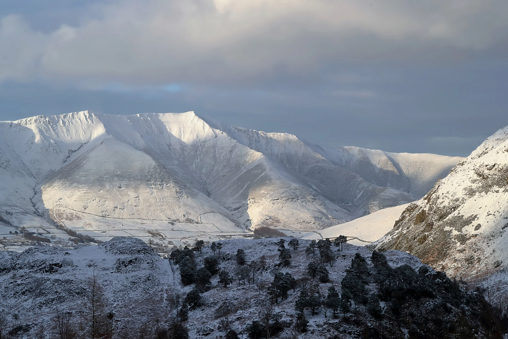
Starting near Westmorland and Furness, England, the Scales Tarn and Blencathra Loop is a captivating 9 km (5.6 miles) loop trail with an elevation gain of approximately 600 meters (1,969 feet). This medium-difficulty hike offers a blend of natural beauty, historical significance, and challenging terrain, making it a rewarding experience for prepared hikers.
Getting There
To reach the trailhead, you can drive or use public transport. If driving, head towards the village of Scales, which is easily accessible from the A66 road. There is limited parking available near the village, so arriving early is advisable. For those using public transport, the nearest significant landmark is Penrith Railway Station. From Penrith, you can take a bus towards Keswick and alight at Scales, which is a short walk from the trailhead.
Trail Overview
The trail begins in the quaint village of Scales, where you will start your ascent towards Scales Tarn. The initial part of the hike is relatively gentle, allowing you to warm up as you traverse through lush meadows and pastures. As you approach the 2 km (1.2 miles) mark, the path becomes steeper, leading you towards the dramatic landscape surrounding Scales Tarn.
Scales Tarn
At approximately 3 km (1.9 miles) into the hike, you will reach Scales Tarn, a serene glacial lake nestled beneath the imposing cliffs of Sharp Edge. This is a perfect spot to take a break, enjoy the tranquil waters, and perhaps spot some local wildlife such as red deer or peregrine falcons. The tarn is also a popular spot for wild swimming, though the water can be quite cold.
Ascent to Blencathra
From Scales Tarn, the trail continues its ascent towards the summit of Blencathra. This section is more challenging, with a steep climb that requires careful footing, especially in wet conditions. The path zigzags up the hillside, offering stunning views of the surrounding fells and valleys. Upon reaching the summit, at around 4.5 km (2.8 miles) into the hike, you will be rewarded with panoramic vistas that stretch as far as the Lake District and beyond.
Historical Significance
Blencathra, also known as Saddleback, has a rich history and is steeped in local folklore. The mountain has been a source of inspiration for poets and writers, including William Wordsworth. The name Blencathra is derived from the Old Norse words "Blenk" (meaning "top") and "Cathra" (meaning "seat"), reflecting its distinctive saddle-like shape.
Descent and Return
The descent from Blencathra follows a different route, creating a loop that takes you back towards Scales. This part of the trail is less steep but still requires caution, especially in wet or windy conditions. As you descend, you will pass through heather-clad moorlands and rocky outcrops, with opportunities to spot more wildlife and enjoy the changing landscape.
Navigation and Safety
Given the varied terrain and potential for rapidly changing weather conditions, it is essential to be well-prepared. Use the HiiKER app for accurate navigation and real-time updates on trail conditions. Ensure you have appropriate footwear, clothing, and sufficient water and snacks. Always check the weather forecast before setting out and be prepared for sudden changes.
This loop trail offers a perfect blend of natural beauty, challenging terrain, and historical intrigue, making it a must-do for any avid hiker exploring the Lake District.

What to expect?
Activity types
Comments and Reviews
User comments, reviews and discussions about the Scales Tarn and Blencathra Loop - Scales, England.
4.5
average rating out of 5
2 rating(s)