Hartsop Dodd, Stony Cove Pike, Thornthwaite Crag and Gray Crag Loop - Hartsop
Download
Preview
Add to list
More
9.7 km
~3 hrs 20 min
839 m
Loop
“Embark on a scenic 10 km loop from Hartsop, exploring fells, valleys, and historical landmarks in the Lake District.”
Starting your adventure near the charming village of Hartsop in Westmorland and Furness, England, this loop trail spans approximately 10 km (6.2 miles) with an elevation gain of around 800 meters (2,625 feet). The trailhead is conveniently located near the Hartsop village, which can be accessed by car or public transport. If driving, you can park at the Hartsop car park. For those using public transport, the nearest significant landmark is the Patterdale Post Office, from where you can take a short taxi ride to the trailhead.
Initial Ascent to Hartsop Dodd
The hike begins with a steady ascent towards Hartsop Dodd. The initial climb is quite steep, gaining elevation quickly. As you ascend, you'll be treated to panoramic views of the surrounding fells and valleys. The terrain here is grassy but can be slippery when wet, so sturdy hiking boots are recommended. Keep an eye out for local wildlife, including red deer and various bird species like the peregrine falcon.
Stony Cove Pike
After reaching the summit of Hartsop Dodd, the trail continues towards Stony Cove Pike. This section is less steep but involves navigating rocky paths. Stony Cove Pike, also known as Caudale Moor, stands at 763 meters (2,503 feet) and offers breathtaking views of the Lake District. The summit is marked by a cairn, and on a clear day, you can see as far as the Pennines to the east.
Thornthwaite Crag
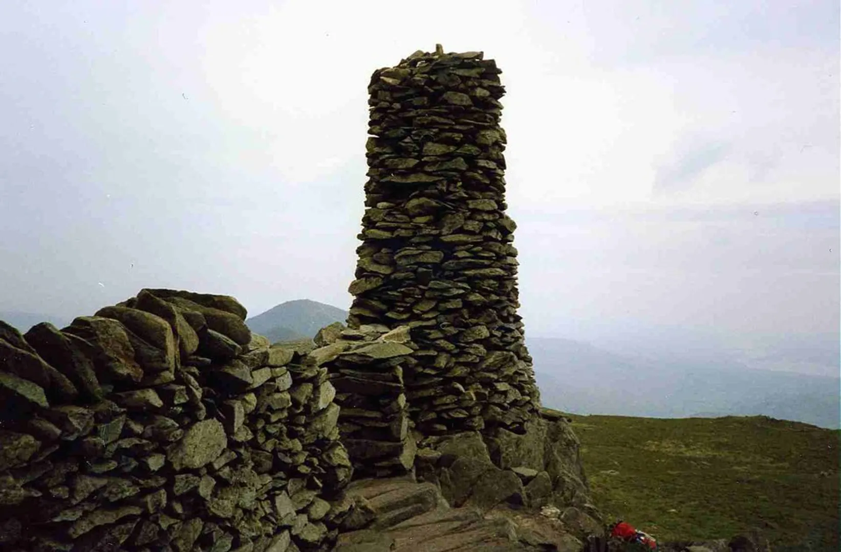
From Stony Cove Pike, the trail leads you to Thornthwaite Crag. This part of the hike is relatively straightforward, with a gradual incline. Thornthwaite Crag is notable for its tall beacon, a stone column that has historical significance as a guidepost for travelers. The beacon stands at 784 meters (2,572 feet) and is a great spot for a rest and some photos. The area is rich in history, with ancient pathways that have been used for centuries by shepherds and traders.
Gray Crag and Descent
The final peak on this loop is Gray Crag. The path to Gray Crag involves a gentle descent followed by a short climb. Standing at 699 meters (2,293 feet), Gray Crag offers a different perspective of the surrounding landscape, including views of Hayeswater Reservoir. The descent from Gray Crag back to Hartsop is gradual but can be boggy in places, so watch your footing.
Flora and Fauna
Throughout the hike, you'll encounter a variety of flora, including heather, bilberry, and various types of moss. The area is also home to a range of wildlife, from small mammals like rabbits and hares to birds of prey. In the spring and summer months, the hillsides are adorned with wildflowers, adding a splash of color to the landscape.
Navigation and Safety
Given the varied terrain and potential for rapidly changing weather conditions, it's advisable to use a reliable navigation tool like HiiKER to stay on track. Ensure you have a map and compass as backup, and always check the weather forecast before setting out. Carry sufficient water, snacks, and a first-aid kit.
This loop trail offers a rewarding experience with its mix of steep climbs, rocky paths, and stunning vistas. Whether you're a seasoned hiker or someone looking to challenge themselves, this trail provides a comprehensive taste of the Lake District's natural beauty and historical richness.

What to expect?
Activity types
Comments and Reviews
User comments, reviews and discussions about the Hartsop Dodd, Stony Cove Pike, Thornthwaite Crag and Gray Crag Loop - Hartsop, England.
4.5
average rating out of 5
2 rating(s)