Download
3D Flyover
Add to list
More
12.7 km
~3 hrs 28 min
557 m
Point-to-Point
“Journey through lush valleys and rugged peaks for stunning views and historical intrigue in England's Lake District.”
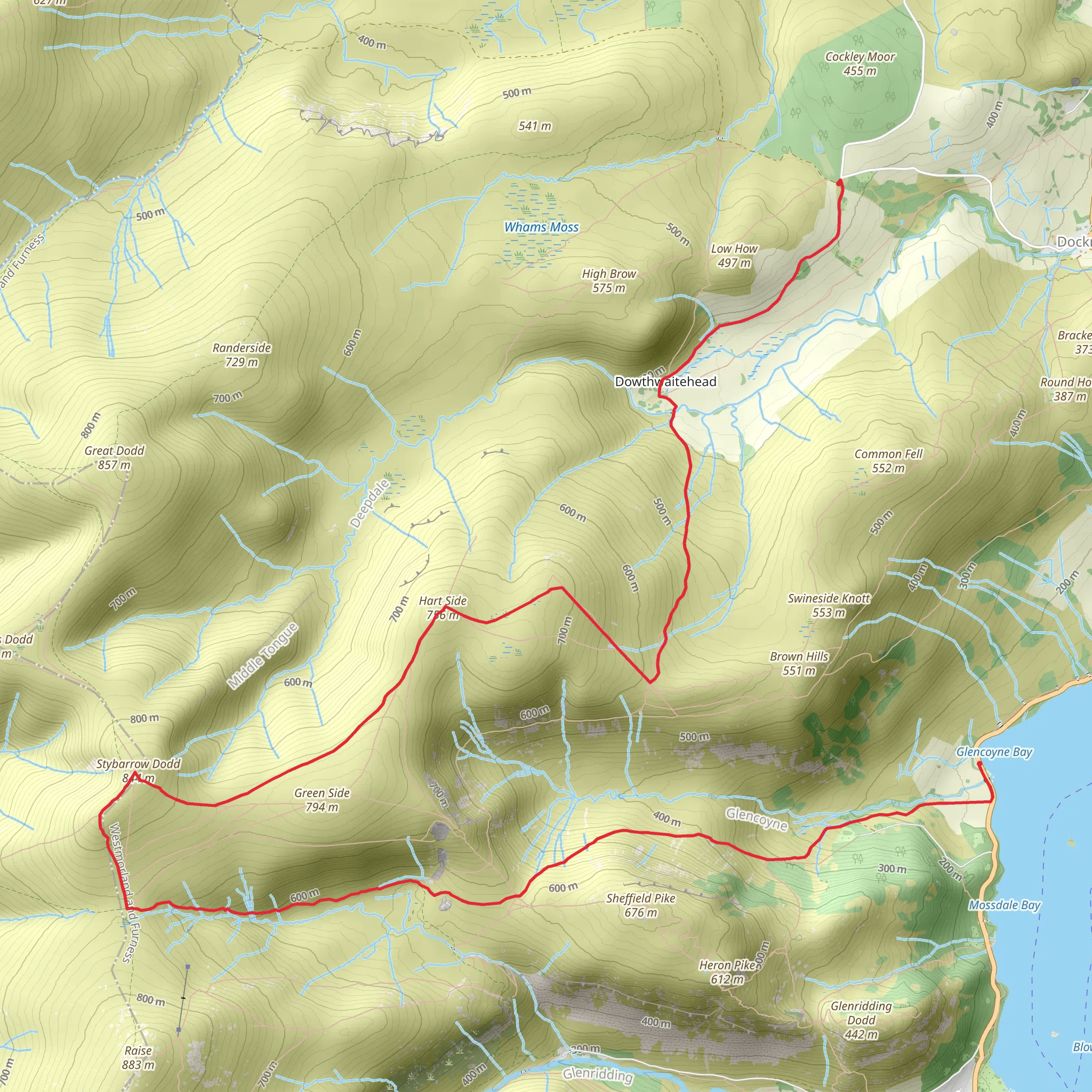
Starting near the picturesque region of Westmorland and Furness in England, this 13 km (approximately 8 miles) point-to-point trail offers a moderately challenging hike with an elevation gain of around 500 meters (1,640 feet). The trailhead is conveniently located near the Sheepfold area, which can be accessed by car or public transport. If you're driving, parking is available near the starting point. For those using public transport, the nearest significant landmark is the town of Penrith, from where you can catch a local bus to the trailhead.
Initial Ascent and Hart Side
The hike begins with a steady ascent towards Hart Side. The initial climb is gradual, allowing you to warm up as you make your way through lush green fields and past ancient stone walls that are characteristic of the English countryside. As you ascend, you'll be treated to panoramic views of the surrounding fells and valleys. Keep an eye out for local wildlife, including red squirrels and various bird species that inhabit the area.
Reaching Hart Side
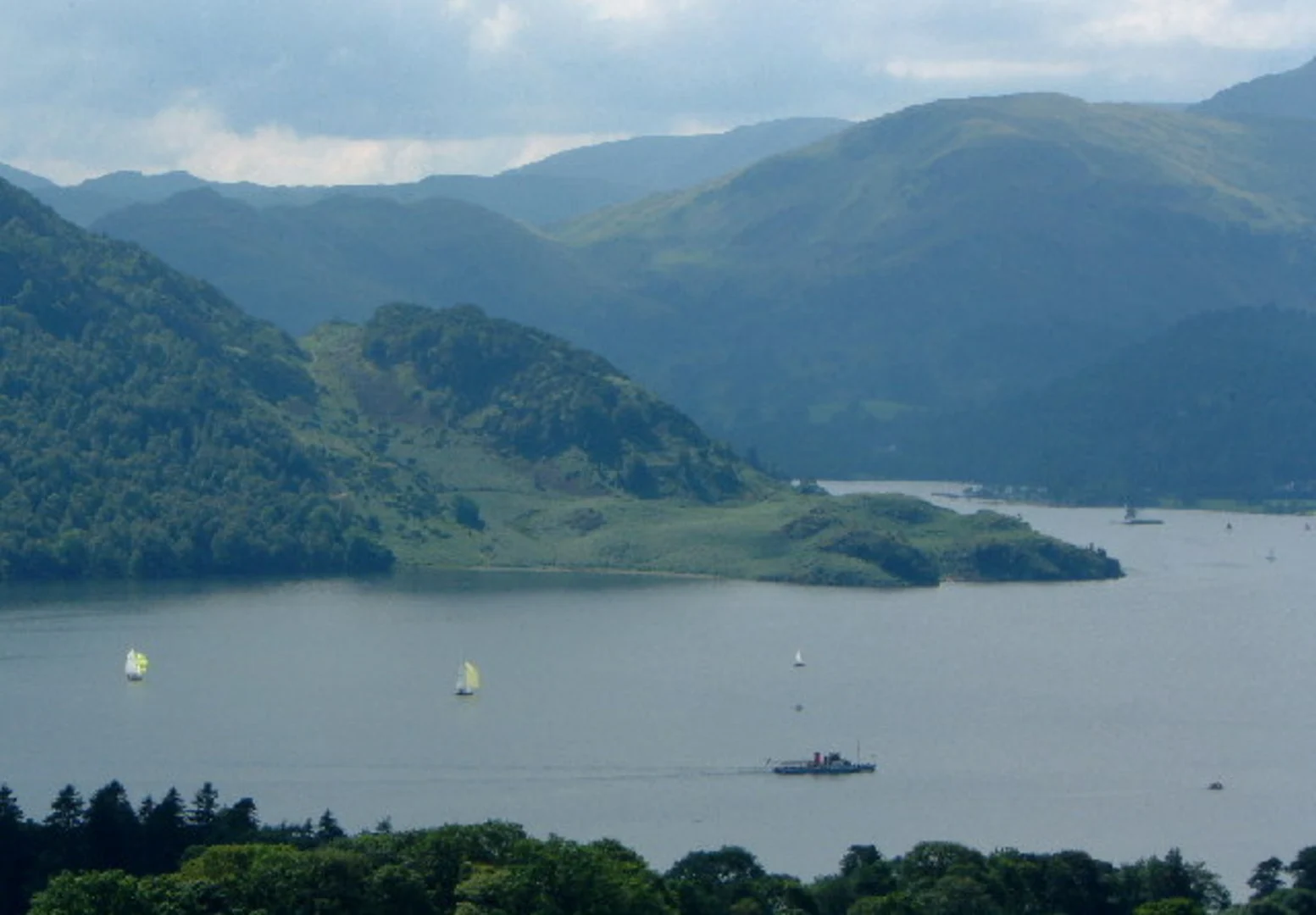
At approximately 4 km (2.5 miles) into the hike, you'll reach Hart Side. Standing at an elevation of 756 meters (2,480 feet), this peak offers stunning views of Ullswater and the surrounding Lake District. The terrain here is a mix of grassy slopes and rocky outcrops, so sturdy hiking boots are recommended. Take a moment to enjoy the scenery and perhaps have a snack before continuing on.
Traversing to Stybarrow Dodd
From Hart Side, the trail continues towards Stybarrow Dodd. This section of the hike is relatively straightforward, with a gentle descent followed by another ascent. The path is well-marked, but it's always a good idea to have a reliable navigation tool like HiiKER to ensure you stay on track. The landscape here is more rugged, with heather-clad moorlands and occasional boggy patches.
Stybarrow Dodd Summit
At around the 8 km (5 miles) mark, you'll reach the summit of Stybarrow Dodd, which stands at 843 meters (2,766 feet). This peak offers even more expansive views, including vistas of Helvellyn and the surrounding fells. The summit is marked by a cairn, and it's a great spot for a well-deserved rest. On clear days, you can see as far as the Pennines to the east.
Descent to Glencoyne Bridge
The final section of the hike involves a descent towards Glencoyne Bridge. This part of the trail is less steep but can be rocky and uneven in places. As you descend, you'll pass through a mix of open moorland and wooded areas. The trail eventually leads you to the Glencoyne Valley, known for its beautiful wildflowers in the spring and summer months.
Historical Significance
The region around this trail is steeped in history. The Lake District has been inhabited since prehistoric times, and you may come across ancient cairns and stone circles along the way. The area was also a significant site during the Roman occupation of Britain, with several Roman roads and forts nearby.
Finishing at Glencoyne Bridge
The hike concludes at Glencoyne Bridge, a charming stone bridge that crosses Glencoyne Beck. This area is perfect for a relaxing end to your hike, with opportunities for a picnic by the water. From here, you can catch a bus back to Penrith or arrange for a pickup if you came by car.
This trail offers a mix of natural beauty, historical intrigue, and moderate physical challenge, making it a rewarding experience for any hiker.
What to expect?
Activity types
Comments and Reviews
User comments, reviews and discussions about the Hart Side and Stybarrow Dodd from Sheepfold to Glencoyne Bridge, England.
4.0
average rating out of 5
1 rating(s)
