Download
3D Flyover
Add to list
More
8.3 km
~2 hrs 4 min
251 m
Loop
“Experience an 8 km trail through serene lakes, lush woodlands, and panoramic fell views in Elterwater.”
Starting near the picturesque village of Elterwater in Westmorland and Furness, England, the Elter Water and Loughrigg Tarn Loop is an 8 km (approximately 5 miles) loop trail with an elevation gain of around 200 meters (656 feet). This medium-difficulty trail offers a delightful mix of serene lakes, lush woodlands, and panoramic views of the surrounding fells.
Getting There
To reach the trailhead, you can drive to Elterwater, where limited parking is available. If you prefer public transport, buses from Ambleside and Windermere serve the area, with the nearest bus stop being in Elterwater village itself. From there, it's a short walk to the start of the trail.
Trail Overview
The trail begins in Elterwater village, a charming spot with traditional stone cottages and a welcoming pub. As you set off, you'll follow a well-marked path that leads you towards Elter Water, a small but stunning lake. The initial section is relatively flat, making it a gentle start to your hike.
Elter Water
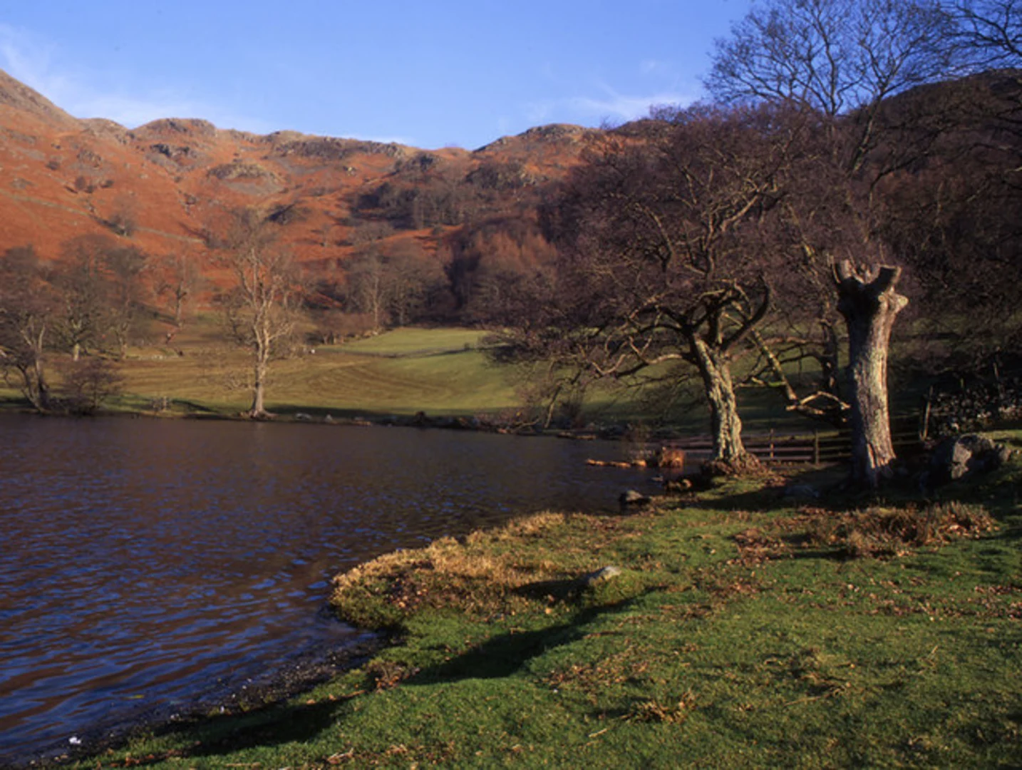
At around 1.5 km (0.9 miles) into the hike, you'll reach the shores of Elter Water. This tranquil lake is a haven for birdwatchers, with species such as herons, ducks, and occasionally ospreys making appearances. The path here is well-maintained and offers several spots to pause and take in the serene waters and the reflections of the surrounding fells.
Woodland and River Brathay
Continuing along the trail, you'll enter a lush woodland area. The path meanders alongside the River Brathay, offering a cool, shaded walk with the soothing sounds of flowing water. This section is particularly beautiful in autumn when the leaves turn vibrant shades of red and gold. The woodland is home to a variety of wildlife, including red squirrels and deer, so keep your eyes peeled.
Loughrigg Tarn
At approximately 4 km (2.5 miles), you'll begin a gentle ascent towards Loughrigg Tarn. The climb is steady but manageable, with an elevation gain of about 100 meters (328 feet) over this section. Loughrigg Tarn is a small, secluded lake surrounded by rolling hills and offers a perfect spot for a picnic. The tarn is steeped in local folklore and is said to have inspired many poets, including William Wordsworth.
Panoramic Views
After leaving Loughrigg Tarn, the trail continues to climb gently, reaching its highest point at around 5.5 km (3.4 miles). From here, you'll be rewarded with panoramic views of the Langdale Pikes and the surrounding valleys. This is an excellent spot for photography, so make sure to bring your camera.
Descent and Return
The descent back towards Elterwater is gradual and takes you through more woodland and open fields. At around 7 km (4.3 miles), you'll pass through the quaint hamlet of Skelwith Bridge, where you can take a short detour to visit Skelwith Force, a small but powerful waterfall.
Historical Significance
The region is rich in history, with evidence of human settlement dating back to the Neolithic period. The nearby village of Ambleside was once a Roman fort, and the area has long been a source of inspiration for artists and writers. The traditional stone walls and farmhouses you see along the trail are a testament to the area's agricultural heritage.
Navigation
For navigation, it's highly recommended to use the HiiKER app, which provides detailed maps and real-time updates to ensure you stay on track.
This loop trail offers a perfect blend of natural beauty, wildlife, and historical intrigue, making it a must-visit for any hiking enthusiast.

What to expect?
Activity types
Comments and Reviews
User comments, reviews and discussions about the Elter Water and Loughrigg Tarn Loop, England.
4.5
average rating out of 5
6 rating(s)