Download
Preview
Add to list
More
13.0 km
~3 hrs 20 min
444 m
Loop
“The Blea Tarn and Sawrey's Wood Loop offers a scenic 13 km hike with diverse landscapes and moderate challenges.”
Starting near Westmorland and Furness, England, the Blea Tarn and Sawrey's Wood Loop is a captivating 13 km (8 miles) loop trail with an elevation gain of approximately 400 meters (1,312 feet). This trail is rated as medium difficulty, making it suitable for moderately experienced hikers.
Getting There
To reach the trailhead, you can drive or use public transport. If driving, set your GPS to the vicinity of the Blea Tarn Car Park, which is the nearest known landmark. For those using public transport, the nearest major town is Ambleside. From Ambleside, you can take a local bus service towards the Langdale Valley and alight at the closest stop to Blea Tarn.
Trail Overview
The trail begins with a gentle ascent through Sawrey's Wood, a serene woodland area rich with native flora and fauna. As you navigate through the woods, keep an eye out for red squirrels and various bird species that inhabit this area. The initial 2 km (1.2 miles) of the trail will see you gaining about 100 meters (328 feet) in elevation, providing a good warm-up for the more challenging sections ahead.
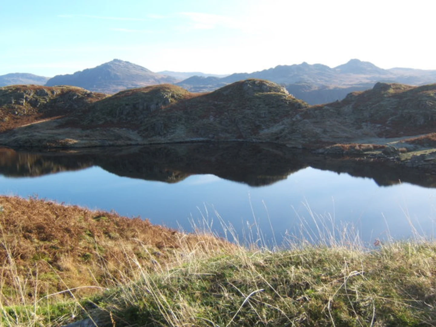
Blea Tarn
Around the 3 km (1.9 miles) mark, you will reach Blea Tarn, a picturesque tarn nestled between the fells. This is an excellent spot for a short break, offering stunning views of the surrounding peaks. The tarn itself is a glacial lake, and its clear waters reflect the rugged landscape, making it a popular spot for photographers.
Historical Significance
The area around Blea Tarn has historical significance dating back to the medieval period. The tarn and its surroundings were once part of a larger estate owned by local nobility. Evidence of ancient settlements and agricultural practices can still be found in the form of old stone walls and farm ruins.
Ascending the Fells
After leaving Blea Tarn, the trail begins a more strenuous ascent. Over the next 4 km (2.5 miles), you will gain approximately 200 meters (656 feet) in elevation. This section offers panoramic views of the Langdale Pikes and the surrounding valleys. The path here can be rocky and uneven, so sturdy hiking boots are recommended.
Sawrey's Wood Descent
The descent through Sawrey's Wood is a welcome relief after the challenging climb. This section of the trail is about 4 km (2.5 miles) long and gradually loses elevation, making it easier on the knees. The woodland is dense with oak, birch, and pine trees, creating a tranquil atmosphere. During autumn, the forest floor is carpeted with fallen leaves, adding a splash of color to your hike.
Wildlife and Flora
Throughout the trail, you will encounter a variety of wildlife and plant species. Deer are commonly spotted in the early mornings and late afternoons. The flora includes a mix of wildflowers, ferns, and mosses, particularly in the more shaded areas of the woods.
Navigation
For navigation, it is highly recommended to use the HiiKER app, which provides detailed maps and real-time updates on trail conditions. This will ensure you stay on the correct path and can enjoy your hike without any navigational worries.
Final Stretch
The final stretch of the trail loops back towards the starting point, covering the last 2 km (1.2 miles) with a gentle descent. This section offers a mix of open fields and woodland, providing a diverse end to your hike. As you approach the trailhead, take a moment to enjoy the views of the surrounding countryside, a fitting conclusion to a rewarding hike.

What to expect?
Activity types
Comments and Reviews
User comments, reviews and discussions about the Blea Tarn and Sawrey's Wood Loop, England.
4.4
average rating out of 5
5 rating(s)