Download
3D Flyover
Add to list
More
20.0 km
~4 hrs 37 min
370 m
Multi-Day
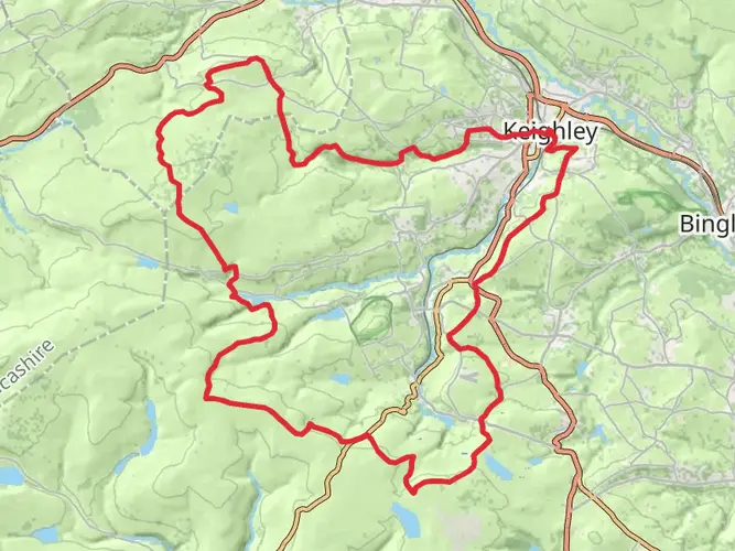
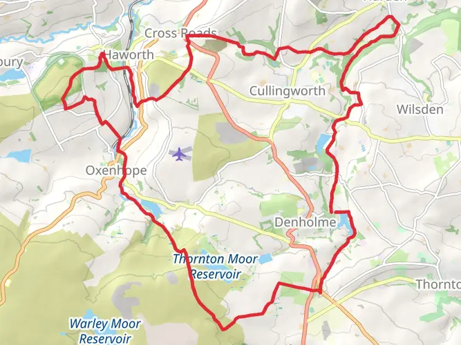
The Oxenhope to Hebden Bridge is a 20.0 km trail that starts in Bradford, West Yorkshire, England. Based on our data, the hike is graded as Easy. For information on how we grade trails, please read measuring the difficulty of a hiking trail on hiiker. Also, check our latest community posts for trail updates. This hike can be completed in approx 4 hrs 37 mins. Caution is advised on trail times as this depends on multiple variables. For more info read about how we calculate hike time.

What to expect?
Activity types
Frequently asked questions
How long does the Oxenhope to Hebden Bridge hike take to complete?
The Oxenhope to Hebden Bridge hike is 20.03 km long with 370 m of elevation gain, and the usual moving time is about 4 hours 37 minutes. Because it is graded Easy, many walkers complete it in a single day, even though it is listed as a multi-day route.
Is the Oxenhope to Hebden Bridge hike difficult?
The Oxenhope to Hebden Bridge hike is graded Easy, which makes it one of the more approachable point-to-point walks in this part of West Yorkshire. The main figures to expect are 20.03 km of distance and 370 m of climbing, so it is more about steady mileage than steep mountain terrain.
Can the Oxenhope to Hebden Bridge hike be done as a day hike?
Yes. Although the route is categorized as multi-day, the full Oxenhope to Hebden Bridge hike is 20.03 km and has an estimated hiking time of about 4 hours 37 minutes, so it fits comfortably into a day for most regular walkers. The point-to-point format means transport planning matters more than overnight logistics.
Where can you park for the Oxenhope to Hebden Bridge hike?
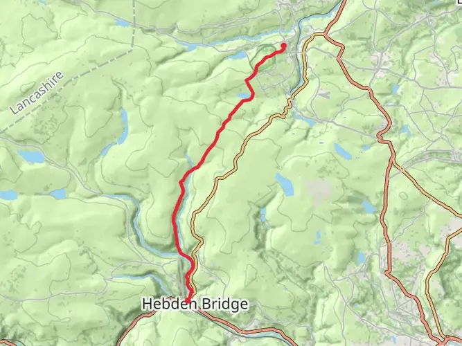
A practical place to start the Oxenhope to Hebden Bridge hike is Oxenhope Station, where the Keighley and Worth Valley Railway states there is ample free parking and the station is about a minute’s walk from the village center. At the Hebden Bridge end, Hebden Bridge railway station has 78 parking spaces, which can help with a car shuttle.
Can you get public transport for the Oxenhope to Hebden Bridge hike?
Yes, public transport works well for the Oxenhope to Hebden Bridge hike because Hebden Bridge has a National Rail station on Station Road, HX7 6JE, and Oxenhope has the Keighley and Worth Valley Railway terminus in the village. That makes the route a practical one-way walk without needing to retrace the full 20.03 km.
Is the Oxenhope to Hebden Bridge hike dog friendly?
Dogs can usually be taken on walks in this area, but parts of the Oxenhope to Hebden Bridge hike may cross open access moorland where England’s access rules require dogs to be on a lead no longer than 2 meters, and local seasonal restrictions can apply. Near Hebden Bridge, Hardcastle Crags is also managed as a dog-friendly walking area, though riverside and stepping-stone sections can be slippery.
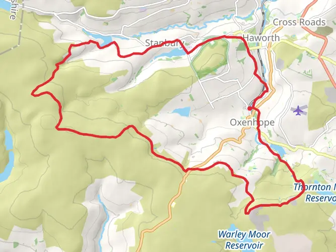
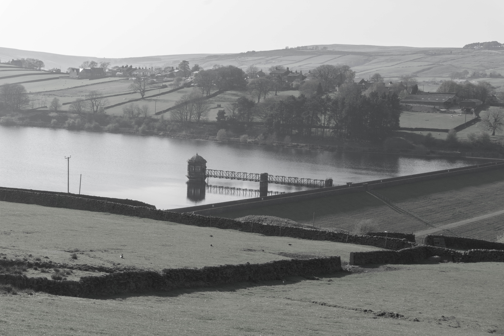
What kind of scenery is on the Oxenhope to Hebden Bridge hike?
The Oxenhope to Hebden Bridge hike links two well-known West Yorkshire walking areas and combines open moorland country with the wooded valley scenery around Hebden Bridge. Near the Hebden Bridge end, Hardcastle Crags is known for streams, stepping stones, weirs, woodland paths, and Gibson Mill, giving the route a more sheltered finish after the higher ground.
Comments and Reviews
User comments, reviews and discussions about the Oxenhope to Hebden Bridge, England.
4.0
average rating out of 5
1 rating(s)