Download
3D Flyover
Add to list
More
10.7 km
~2 hrs 54 min
460 m
Loop
“Steep woods, canal calm, and wide Calder views make this loop a rewarding Pennine challenge.”
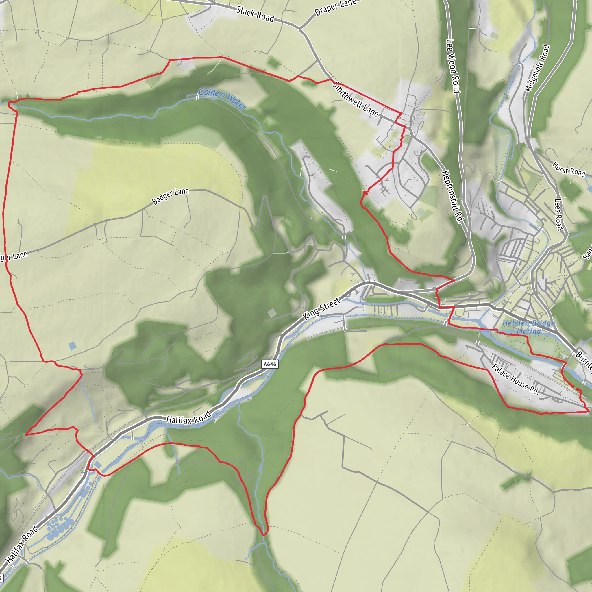
This Calder Valley loop packs a lot into roughly 11 km / 6.8 miles, with about 500 m / 1,640 ft of ascent, so it feels more substantial than the distance suggests. The route links the canal and valley floor around Hebble End with steep wooded climbing through Callis Wood, then rises onto higher ground around Pry Hill and Bob Wood before looping back toward Mytholm and Hebden Bridge. With a medium difficulty rating, the main challenge is not mileage but the repeated gradients, uneven hillside paths, and often slick surfaces on stone, roots, and mud—especially after rain, which is common in the South Pennines. The start is best understood as being near Hebden Bridge railway station on Station Road, Hebden Bridge, West Yorkshire HX7 6JE, close to the Rochdale Canal and the Hebble End area. (nationalrail.co.uk)
The opening section is typically gentler underfoot, following the valley-bottom corridor where canal, river, railway, and old industrial sites sit tightly compressed by the landscape. Around Hebble End, walkers are moving through one of those classic Upper Calder Valley transition zones where former mill activity gives way quickly to steep pasture and woodland. The canal-side stretch is useful for warming up before the climb begins, but it can also lull people into underestimating the route. Once you leave the towpath and start uphill, the character changes fast: lanes steepen, views widen, and the route begins to feel distinctly upland. The Rochdale Canal itself is a major historic feature of the area, built to move goods through the Pennine valleys and still shaping the geography of local walking routes today. (ukhillwalking.com)
Climbing through Callis Wood
The ascent above Hebble End and toward Callis Wood is likely to be the most sustained effort of the day. Expect a sharp pull on lanes and footpaths, gaining a large share of the route’s elevation in a relatively short distance. On a walk of this length and total ascent, it is reasonable to expect the first 3 to 4 km / 1.9 to 2.5 miles to do much of the hard work. In wet weather, this section can be slippery on cobbles, compacted earth, exposed roots, and leaf litter. Good grip matters more here than outright speed.
Callis Wood brings a more enclosed feel, with the route skirting or passing through mixed woodland on the valley side. This is the kind of terrain where the path can narrow, contour above steep drops, and cross small streams or drainage lines. Bluebells can be a highlight in spring, while summer brings dense greenery and filtered views; in autumn, wet leaves can make the trail deceptively slick. Woodland birds are common, and walkers should keep an eye out for species such as nuthatches, robins, wrens, and woodpeckers, with buzzards often seen overhead once the route breaks back into open country. Because the valley sides are steep, short sections can feel more exposed than the map suggests, so careful foot placement is important. For navigation, HiiKER is the best tool to keep track of junctions where woodland paths, farm tracks, and Pennine access routes intersect. (ukhillwalking.com)
Higher ground, views, and route character
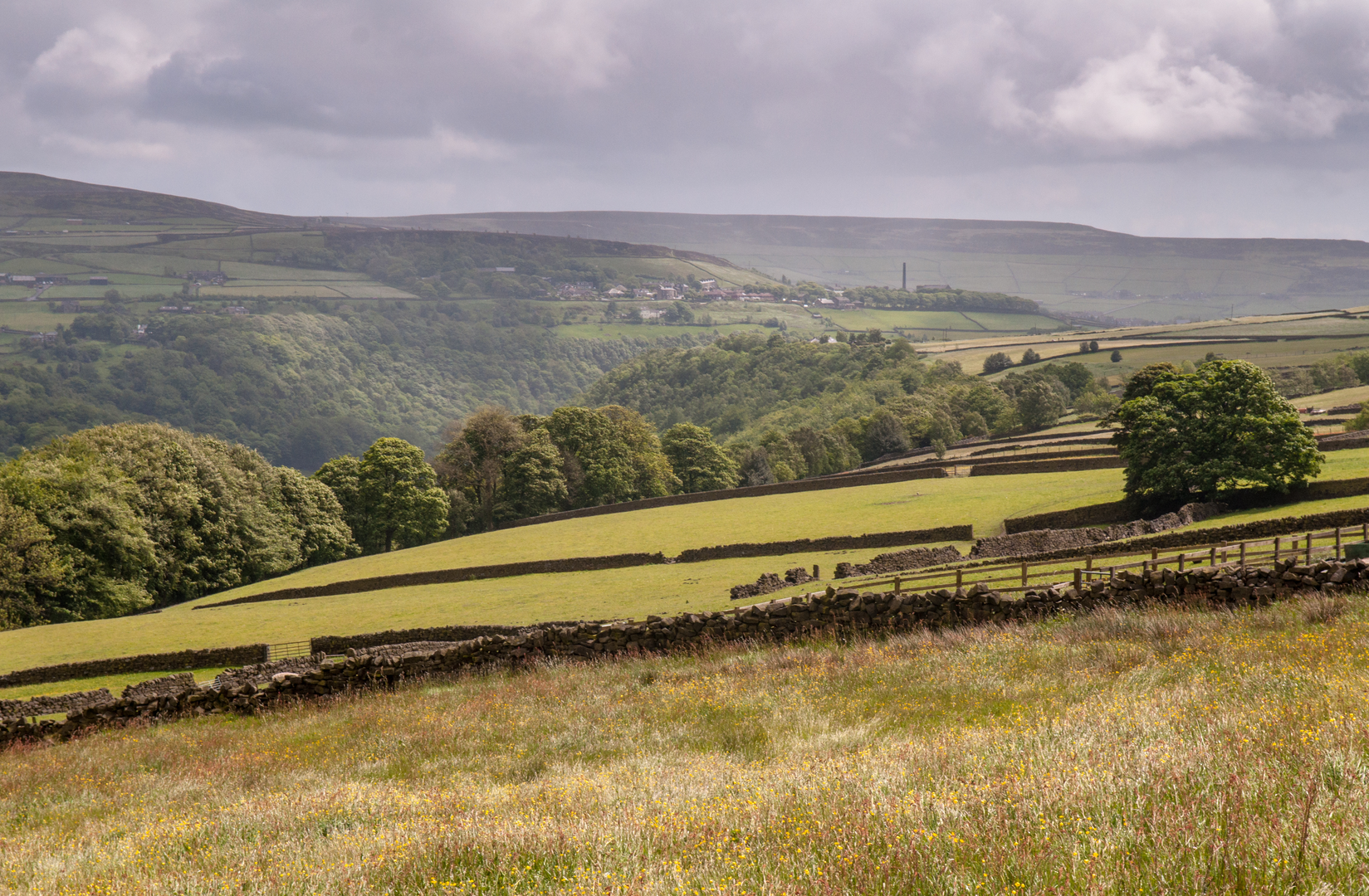
Beyond the woods, the route around Pry Hill and Bob Wood should feel more open and airy, with a mix of hillside pasture, rougher tracks, and broad Calder Valley views. This is where the walk earns its scenic reputation. The South Pennine landscape is defined by gritstone, drystone walls, scattered farmsteads, and a patchwork of enclosed fields giving way to moorland edges. If visibility is good, expect long views across the valley sides and down toward Mytholmroyd and Hebden Bridge. The terrain here can be deceptively tiring: even when the steepest climbing is done, rolling ups and downs on rough ground continue to sap energy.
This part of Calderdale is rich in cultural landscape as well as scenery. The valley settlements below grew through textile production and transport links, while the surrounding hills preserve much older routeways and field patterns. The wider area around Mytholmroyd and Hebden Bridge is also associated with
Surfaces
Unknown
Gravel
Asphalt
Cobblestone
Dirt
Ground
Paved
Unpaved
Comments and Reviews
User comments, reviews and discussions about the Hebble End, Callis Wood, Pry Hill, Bob Wood and Mytholm Loop, England.
average rating out of 5
0 rating(s)
