Download
3D Flyover
Add to list
More
36.4 km
~2 days
1039 m
Multi-Day
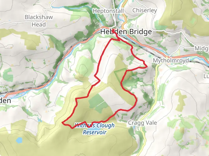
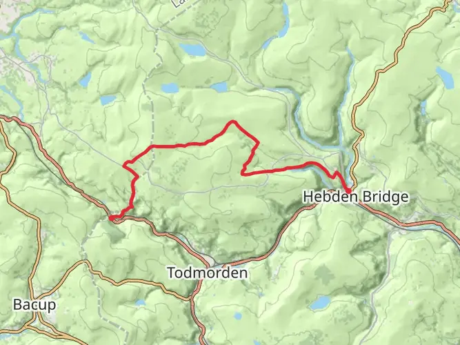
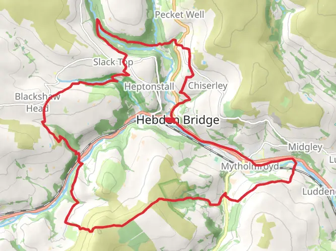
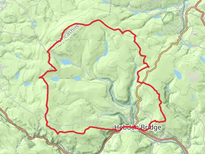
The Bronte Loop from Hebden Bridge is a 36.4 km trail that starts in Calderdale, West Yorkshire, England. Based on our data, the hike is graded as Medium. For information on how we grade trails, please read measuring the difficulty of a hiking trail on hiiker. Also, check our latest community posts for trail updates. This hike can be completed in approx 2 days. Caution is advised on trail times as this depends on multiple variables. For more info read about how we calculate hike time.

What to expect?
Activity types
Frequently asked questions
How long is the Bronte Loop from Hebden Bridge and how difficult is it?
The Bronte Loop from Hebden Bridge is 36.39 km long with 1,039 m of elevation gain, so it is a substantial outing rather than a short moorland walk. It is graded medium, but the combination of distance, repeated climbing, and exposed Pennine terrain makes it feel like a full-day or overnight route for many hikers.
Can the Bronte Loop from Hebden Bridge be done in one day?
The Bronte Loop from Hebden Bridge can be completed in a long day by strong hikers, but its 36.39 km distance and 1,039 m of ascent put it firmly at the upper end of a day hike. Because it is listed as a multi-day route, many walkers will find it more comfortable to split the loop or allow extra time for moorland conditions and stops along the way.
What landmarks are likely to feature on the Bronte Loop from Hebden Bridge?
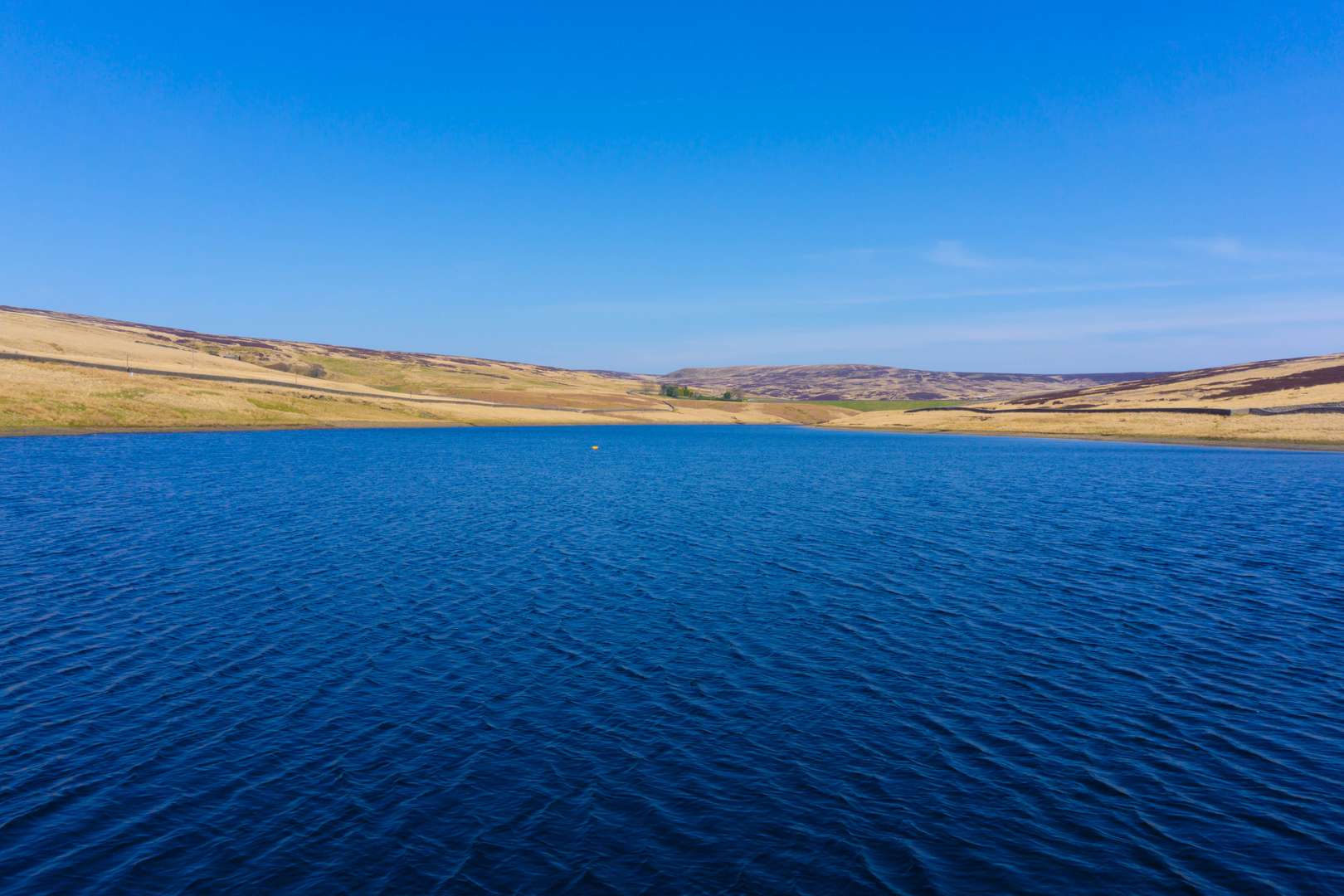
Routes linking Hebden Bridge with Bronte Country commonly cross high moorland toward Haworth-side landmarks such as Top Withens and the Bronte Waterfall area, both closely associated with the Pennine moors. Hebden Bridge also connects into well-known upland routes around the Pennine Way and nearby reservoir country above the Calder Valley, giving this loop a classic South Pennine feel.
Is the Bronte Loop from Hebden Bridge easy to reach by public transport?
Yes. Hebden Bridge has a railway station in town, making the Bronte Loop from Hebden Bridge one of the easier long walks in West Yorkshire to reach without a car. That station gives direct access to the start and finish in Hebden Bridge, which is useful on a 36.39 km loop where returning to the same point matters.
Where do hikers usually park for the Bronte Loop from Hebden Bridge?
For the Bronte Loop from Hebden Bridge, the most logical parking is in or near Hebden Bridge because the route starts and finishes there. If the loop includes the Haworth moors section, parking areas used on the Bronte side of the landscape include Penistone Hill Country Park and parking near Haworth, both common access points for Top Withens and Bronte Waterfall approaches.
What is the terrain like on the Bronte Loop from Hebden Bridge?
The Bronte Loop from Hebden Bridge is likely to mix valley paths near Hebden Bridge with rougher upland tracks across open moorland. On the Bronte side of the route, paths to places like Top Withens and Bronte Waterfall are known for gravel tracks, stone pitching, flagstones, and wetter peaty ground in places, so sturdy footwear is a sensible choice.
What is the best time of year to hike the Bronte Loop from Hebden Bridge?
Spring through early fall usually offers the best balance of daylight and trail conditions for the Bronte Loop from Hebden Bridge. The route crosses exposed West Yorkshire moorland, so wind, rain, low cloud, and boggy ground can make the 36.39 km distance feel much harder in winter, especially on higher sections around the Bronte moors.
Comments and Reviews
User comments, reviews and discussions about the Bronte Loop from Hebden Bridge, England.
4.5
average rating out of 5
2 rating(s)