
Download
3D Flyover
Add to list
More
13.9 km
~3 hrs 1 min
149 m
Loop
“A mellow Oxfordshire loop blends Roman echoes, riverside calm, wooded edges, and softly unfolding farmland.”
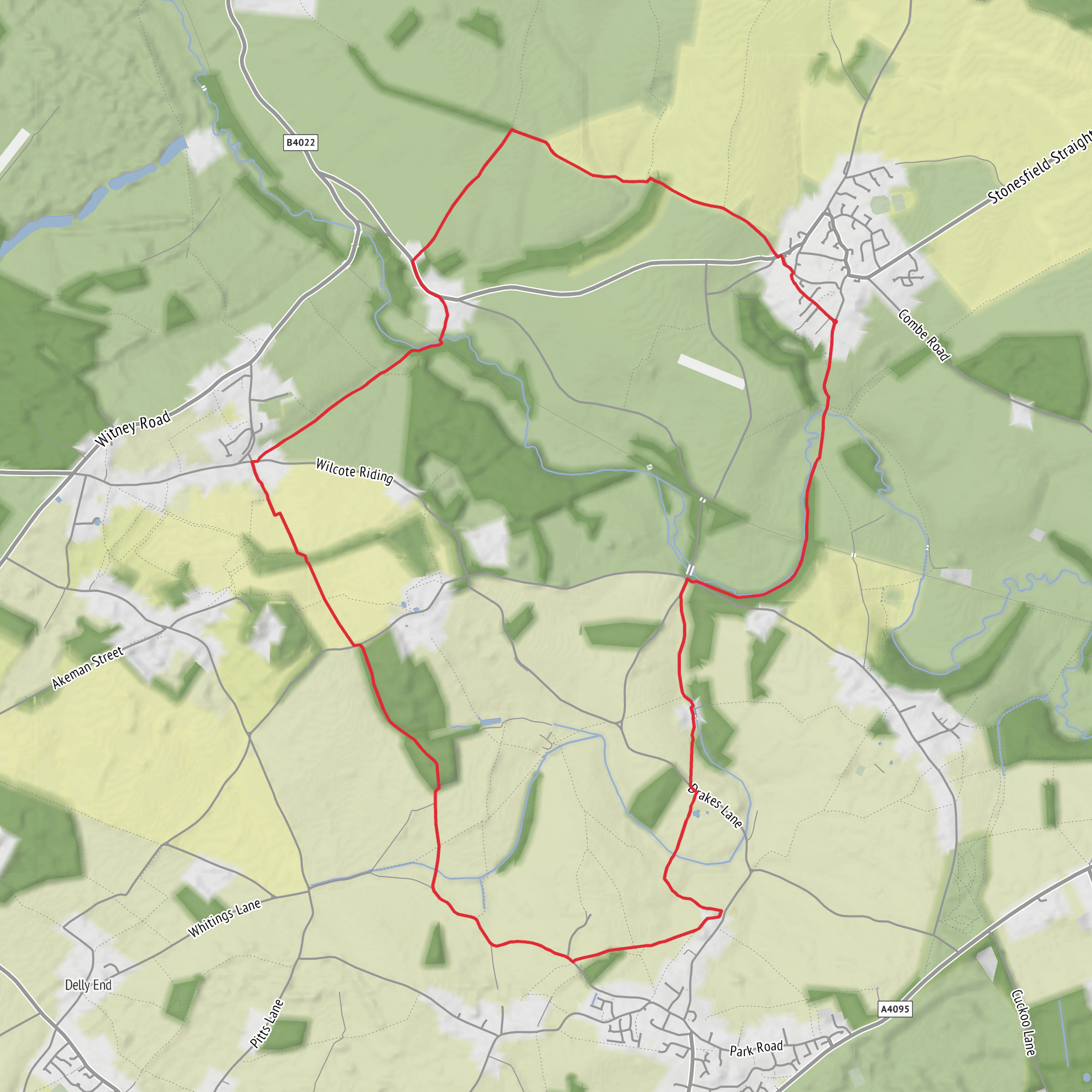
This easy loop of about 14 km / 8.7 miles with roughly 200 metres / 656 feet of ascent explores a gentle stretch of Oxfordshire countryside around North Leigh, linking riverside paths, woodland edges, open farmland, a historic bridge, and one of the most important Roman villa sites in the county. The terrain is generally forgiving, but it is varied enough to keep the walk interesting: field paths, farm tracks, short road sections, grassy margins, and potentially muddy riverside ground all feature along the way. The route is best thought of as a relaxed countryside circuit rather than a rugged hill walk, with the climbing spread out in mild rises rather than one major ascent. The nearest clear starting landmark is North Leigh Roman Villa, North Leigh, Witney, Oxfordshire OX29 6PZ, where there is roadside parking in a lay-by opposite the track to the villa. (english-heritage.org.uk)
If arriving by car, the simplest approach is to head for North Leigh Roman Villa, which lies off the A4095 about 10 miles west of Oxford and roughly 2 miles north of North Leigh village. Sat nav users can use OX29 6PZ. Parking is limited rather than expansive, so early arrival is sensible on fine weekends. If using public transport, Hanborough Station is the nearest rail stop at about 3.5 miles / 5.6 km away, and bus links in the area include the Stagecoach S7, which serves North Leigh and Hanborough Station. From there, a short taxi ride or a longer walk is usually needed to reach the start comfortably. For route-finding on the day, use HiiKER. (english-heritage.org.uk)
The opening section is usually the most historically striking. Very early in the walk, the route passes North Leigh Roman Villa, an English Heritage site in the Evenlode valley. This was a substantial courtyard villa and, at its height in the early 4th century, included bath suites, numerous mosaic floors, and underfloor heating in multiple rooms. The villa stands close to Akeman Street, a major Roman road that linked Verulamium and Corinium, placing this rural estate within an important transport and agricultural network of Roman Britain. Even if the mosaic house is not open on the day, the setting alone gives the route a strong sense of depth and continuity. (english-heritage.org.uk)
Route character and what to expect
From the villa area, the loop moves through a classic patchwork of lowland English countryside. Expect broad views over arable fields, hedgerows, and pasture, with the landscape folding gently rather than dramatically. The route around Whitehill Bridge, the River Evenlode corridor, Ashford Bridge, and the tracks near Holly Court Farm is especially scenic, combining water, tree cover, and open farmland in quick succession. One established local route description notes the sequence of crossing Whitehill Bridge, heading toward the Roman villa, then following the river and railway before continuing through Whitehill Wood to Ashford Bridge, and from there taking the bridleway toward Holly Court Farm and climbing across fields toward East End. (cotswolds-nl.org.uk)
Although the overall difficulty is easy, there are a few practical things to plan for. After rain, the riverside stretches and field-edge paths can become muddy, and gates or livestock fields may slow progress. The climb away from the lower ground near Ashford Bridge and Holly Court is not severe, but it is likely the most noticeable ascent of the day and accounts for much of the route’s elevation gain. In dry weather, lightweight walking shoes may be enough for many hikers, but waterproof footwear is the safer choice in cooler months or after prolonged rain. Because this is a mixed-use rural landscape, it is also worth expecting uneven ground, tractor ruts, and occasional short sections where waymarking is less obvious than the main line of the path.
Landmarks, nature, and wildlife
Ashford Bridge is one of the route’s most memorable waypoints, sitting near the River Evenlode and marking a transition between wooded riverside walking and the more open agricultural ground beyond. The river itself shapes much of the local landscape. The Evenlode meanders along the parish boundary, while a smaller tributary rises near the Roman villa and flows northeast toward the Evenlode near Ashford Mill Farm. That combination of river, tributary, wet ground, and floodplain helps explain the lush vegetation and the likelihood of muddy patches in wetter periods. (westoxon.gov.uk)
Wildlife is typical of the Oxfordshire farmed lowlands and river margins. Along hedgerows and woodland edges, hikers should watch for common songbirds, pigeons, corvids, and seasonal butterflies
Surfaces
Ground
Unknown
Unpaved
Asphalt
Grass
Dirt
Gravel
Paved
Concrete
Wood
Comments and Reviews
User comments, reviews and discussions about the Roman Villa, Holly Grove and Ashford Bridge Loop, England.
average rating out of 5
0 rating(s)
