Download
3D Flyover
Add to list
More
13.8 km
~2 hrs 58 min
128 m
Loop
“Explore the Shustoke to Foul End Loop, a picturesque 14 km hike blending natural beauty and historical intrigue.”
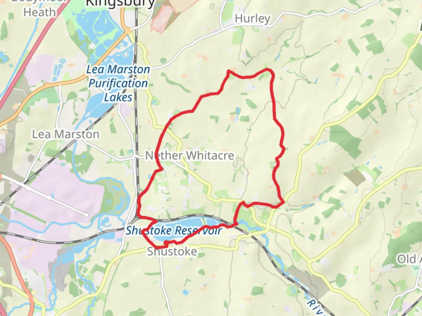
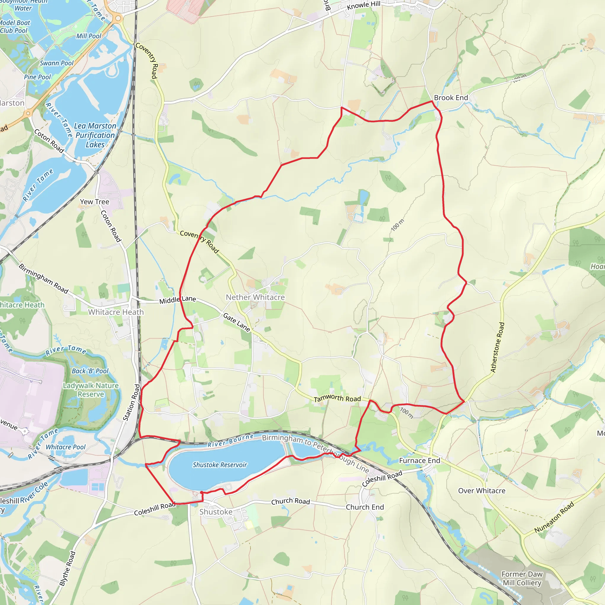
Starting your hike near Warwickshire, England, the Shustoke to Foul End Loop is a delightful 14 km (approximately 8.7 miles) journey with an elevation gain of around 100 meters (328 feet). This loop trail is rated as medium difficulty, making it suitable for moderately experienced hikers.
Getting There
To reach the trailhead, you can drive or use public transport. If driving, set your GPS to Shustoke Reservoir, which is a well-known landmark in the area. For those using public transport, the nearest train station is Coleshill Parkway. From there, you can take a local bus or taxi to Shustoke Reservoir.
Trail Overview
The trail begins at Shustoke Reservoir, a serene spot perfect for a moment of calm before you start your hike. The reservoir is also a great place for birdwatching, so keep your binoculars handy. As you set off, you'll be walking through a mix of open fields and wooded areas, offering a variety of landscapes.
Key Landmarks and Sections
Shustoke Reservoir to Whitacre Heath
The first section of the trail takes you from Shustoke Reservoir towards Whitacre Heath. This part of the trail is relatively flat and easy, making it a good warm-up. You'll pass through lush meadows and small patches of woodland. Keep an eye out for local wildlife such as deer and various bird species.
Whitacre Heath to Foul End
As you approach Whitacre Heath, the trail starts to gain a bit of elevation. This is where you'll encounter the most significant climb of the hike, though it is still manageable for most hikers. The path here is well-marked but can be muddy after rain, so good hiking boots are recommended. The village of Whitacre Heath itself is charming, with traditional English cottages and a few local pubs where you can take a short break.
Foul End and Historical Significance
Continuing from Whitacre Heath, you'll head towards Foul End. This area is steeped in history, with several old farmhouses and remnants of medieval structures. The name "Foul End" is believed to have historical roots dating back to the medieval period, possibly referring to the marshy conditions that once prevailed here. The trail here is relatively flat, making it a pleasant walk through the countryside.
Return to Shustoke Reservoir
The final leg of the loop brings you back towards Shustoke Reservoir. This section is mostly downhill or flat, allowing for a leisurely end to your hike. As you approach the reservoir, you'll pass through more open fields and small woodlands, offering a final chance to spot local wildlife.
Navigation and Safety
For navigation, it's highly recommended to use the HiiKER app, which provides detailed maps and real-time updates. The trail is generally well-marked, but having a reliable navigation tool can be invaluable, especially in the more wooded sections.
Flora and Fauna
Throughout the hike, you'll encounter a variety of flora and fauna. The woodlands are home to oak, ash, and beech trees, while the open fields are often filled with wildflowers in the spring and summer. Wildlife enthusiasts can look forward to spotting deer, foxes, and a variety of bird species, including herons and kingfishers near the reservoir.
Final Tips
Given the moderate difficulty of the trail, it's advisable to bring plenty of water, snacks, and a basic first-aid kit. Weather in Warwickshire can be unpredictable, so dressing in layers and bringing a waterproof jacket is a good idea. The trail can be muddy in places, especially after rain, so sturdy hiking boots are recommended.
Enjoy your hike on the Shustoke to Foul End Loop, a trail that offers a perfect blend of natural beauty and historical intrigue.
What to expect?
Activity types
Comments and Reviews
User comments, reviews and discussions about the Shustoke to Foul End Loop, England.
4.55
average rating out of 5
11 rating(s)
