
Download
3D Flyover
Add to list
More
2.5 km
~29 min
0 m
Loop
“A peaceful brookside wander through Richmond Park’s leafy edge, with willows, woodland, and open green calm.”
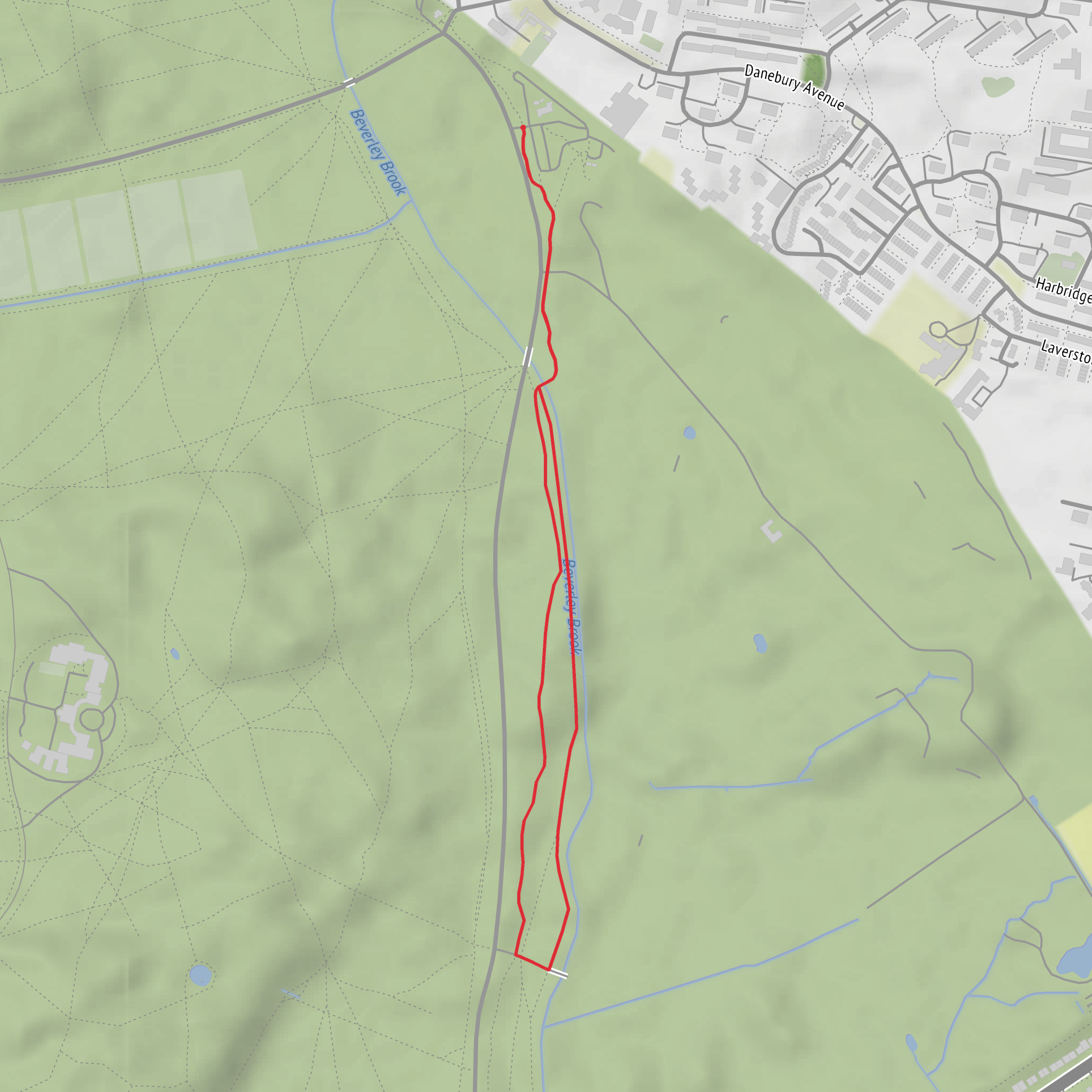
This easy out-and-back or short linear stroll follows a gentle section of the Beverley Brook Walk beside Killcat Wood in southwest London, covering about 2 km / 1.2 miles with virtually no climbing—around 0 m / 0 ft of elevation gain. The terrain is generally flat and forgiving, making it well suited to families, casual walkers, and anyone looking for a short nature walk rather than a strenuous hike. The route sits near Killcat Corner in Richmond Park, close to Priory Lane and Roehampton Gate, which is the clearest nearby landmark for planning and navigation. The brook here runs along the edge of woodland and open parkland, and this stretch is known for its calm, green character. (commons.wikimedia.org)
Expect a broad, mostly level path with a mix of compacted earth, gravel, and potentially muddy patches after rain, especially close to the watercourse. Because the route follows the brook rather than climbing into higher ground, the walking feels relaxed throughout, but wet weather can make sections slick underfoot. Waterproof shoes are a sensible choice in winter or after prolonged rain. For navigation, using HiiKER is the simplest way to keep track of the short route and any nearby connecting paths.
What the walk is like
From the Killcat Corner area, the path traces Beverley Brook as it emerges from woodland and passes open edges of Richmond Park. One of the defining features here is the contrast between shaded tree cover and more open meadow-like margins beside the stream. On a walk of only about 2 km / 1.2 miles, the scenery changes subtly rather than dramatically: expect willow-lined water, low banks, patches of rough grass, and glimpses into the surrounding park landscape. A historic photo record of this exact area describes the brook emerging from woodland at Killcat Corner with pollarded willows nearby and the Beverley Brook Walk running alongside. (commons.wikimedia.org)
The route is not demanding, but it is worth watching for roots, puddles, and soft ground near the brook edge. In warmer months, vegetation can narrow the feel of the path in places, while in colder months the route opens up visually and gives clearer views through the trees. Because the elevation change is negligible, the main things to prepare for are surface conditions and the weather rather than fitness demands.
Landmarks, wildlife, and atmosphere
Beverley Brook is the central landmark throughout. This stream rises in Worcester Park and flows north to the Thames at Putney, and along this section it forms part of the boundary landscape of Richmond Park. The nearby presence of Richmond Park Golf Course and the park’s wider trail network adds to the sense that this is a green corridor threading through a much larger historic landscape. (commons.wikimedia.org)
Wildlife is one of the main reasons to choose this short walk. The brook and woodland edge can attract common water- and woodland-associated birds, while the grassland and scrub margins support insects and small mammals. Richmond Park is especially well known for its larger wildlife populations, and although this short route stays on the brookside edge rather than deep in the park interior, walkers should still stay alert and give all animals space. The setting is more about quiet observation than dramatic viewpoints.
Historical significance of the area
This walk gains much of its interest from its setting within and beside Richmond Park, one of London’s great historic royal parks. Richmond Park was created in the 17th century as a deer park by Charles I, and its landscape still reflects that long history of managed woodland, open pasture, and royal hunting ground. The Beverley Brook corridor adds another older layer to the landscape, as streams like this historically shaped boundaries, drainage, grazing land, and later recreational walking routes through southwest London. The modern Beverley Brook Walk is part of that continuing relationship between watercourse, parkland, and public access. (en.wikipedia.org)
Getting to the start
For drivers, the most practical target is Roehampton Gate, Richmond Park, London, or the Priory Lane / Killcat Corner area nearby, depending on exactly which access point you plan to use. That gives a recognizable landmark close to the brookside section of the walk. Parking availability can vary, so it is worth checking access arrangements before setting out. (frp.org.uk)
By public transport, the Beverley Brook Walk has connections at multiple points along its length, and this Richmond Park section is typically reached by combining rail or Underground travel with a local bus or a short walk from the park edge. The official Beverley Brook Walk guide notes that public transport facilities are marked along the route, and the walk as a whole is designed with access points throughout. (merton.gov.uk)
Because this is a short, easy route, many walkers pair it with a longer outing in Richmond Park. If doing that, allow extra time for detours and use HiiKER to confirm junctions and nearby entrances. For a standalone 2 km / 1.2 mile walk, most people will only need light supplies, weather-appropriate layers
What to expect?
Surfaces
Unknown
Ground
Wood
Grass
Comments and Reviews
User comments, reviews and discussions about the Killcat Wood via Beverley Brook Walk, England.
average rating out of 5
0 rating(s)

