
Hartland Point and North Devon Loop via St Catherine's Tor, Warren Cliff and Blegberry Beach
Download
3D Flyover
Add to list
More
12.8 km
~3 hrs 26 min
527 m
Loop
“A wild Atlantic rollercoaster of cliff tops, hidden coves, and hard-earned calm through quiet farmland.”
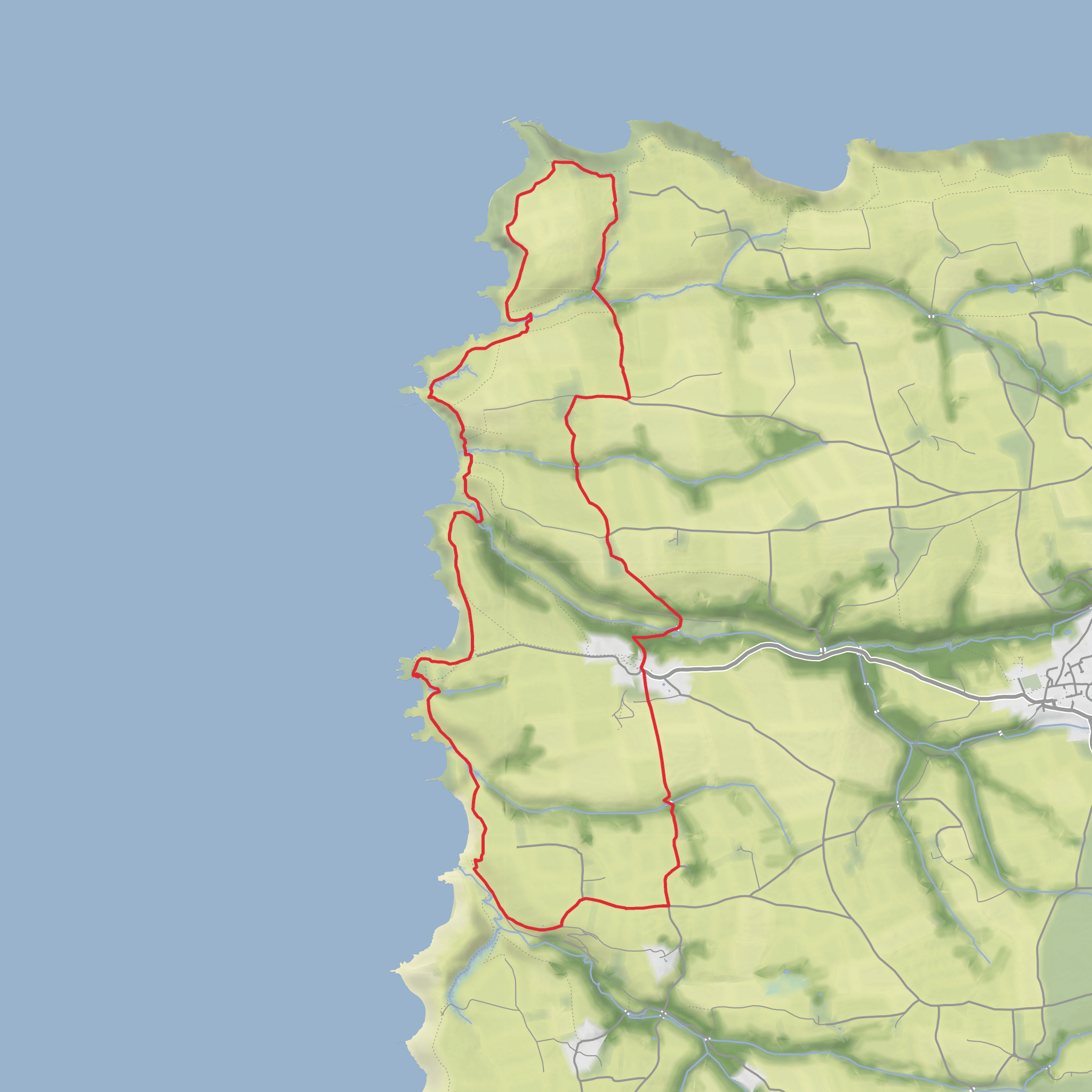
This medium-grade loop explores one of the wildest corners of the North Devon coast, combining exposed cliff-top walking, steep combes, a remote shingle beach, and a quieter inland return through lanes and farmland. Expect roughly 13 km / 8 miles with about 500 m / 1,640 ft of ascent, though the effort can feel greater than the numbers suggest because the coastal section rises and falls repeatedly. The route is best thought of as a “rollercoaster” outing: short, sharp descents into stream-cut valleys followed by equally sharp climbs back to the cliff tops. (southwestcoastpath.org.uk)
The walk is generally associated with Hartland Point on the Hartland Peninsula in North Devon, and the practical start is the Hartland Point car park near Hartland Point Lighthouse, Hartland, Bideford EX39 6DU. Some versions of the wider loop begin from Hartland Quay instead, but the Hartland Point and Blegberry circuit described in local route notes starts from the car park by the point itself. (hartlandpeninsula.co.uk)
From the start, the landscape feels immediately maritime and exposed. Hartland Point is Devon’s north-western extremity, where Atlantic weather and Bristol Channel currents meet, and the views can be immense on a clear day, often stretching out toward Lundy. The first part of the route follows the South West Coast Path over open headland and along the cliff edge, with a constant sense of height above the sea. (exploredevon.info)
Terrain and what the walking feels like
Although the distance is moderate, this is not a gentle stroll. The coast path here is often narrow, uneven, and grassy or earthen underfoot, with sections of rock, mud, and exposed roots depending on recent weather. There are several stiles and some notably steep climbs and descents, especially around the valleys and cliff sections near Warren Cliff and the approaches to Blegberry. In wet or windy conditions, the route becomes more serious: the slopes can be slippery, the cliff-edge sections demand care, and strong crosswinds are common on the headland. (southwestcoastpath.org.uk)
St Catherine’s Tor adds to the drama of the route. This part of the coast is shaped by active erosion, and the path briefly pulls inland where the cliff geometry becomes more severe. Around Warren Cliff and the combes south of Hartland Point, the route repeatedly drops to stream crossings and climbs back out, so pacing matters. Hikers should allow extra time for the ascents rather than judging the day purely by mileage. (uksouthwest.net)
If you are planning with HiiKER, it is worth checking the elevation profile closely before setting out, because the steepest ramps are concentrated into short sections rather than spread evenly across the day.
Landmarks, coast scenery, and notable features
One of the standout landmarks is Hartland Point Lighthouse, built by Trinity House in 1874 to guide vessels approaching the Bristol Channel. It is one of the defining features of the headland and a reminder of how hazardous this coast has long been for shipping. (trinityhouse.co.uk)
The coastline itself is a major attraction. Around Warren Cliff and the Hartland Quay side of the peninsula, the cliffs show striking folded and eroded rock formations, with steep “hogs back” profiles and truncated valleys created by long-term coastal retreat. Even hikers with only a casual interest in geology usually notice how rugged and sculpted this stretch feels compared with softer, greener coastal walks elsewhere in Devon. (northdevoncoast-nl.org.uk)
Blegberry Beach is the route’s most secluded-feeling feature. It is a long, usually quiet pebble beach with rocky areas exposed at low tide, reached only on foot. A waterfall from Blegberry Water drops toward the shore, adding a dramatic focal point when viewed from above or on the descent. Access down to the beach is a worthwhile detour if conditions are dry and you are comfortable with the extra climb back out. (devonbeachguide.co.uk)
Smoothlands and the valleys around the point bring a change of mood from the open headland. Here the route briefly feels more sheltered, with stream crossings, thicker vegetation, and a stronger sense of the old working landscape behind the cliffs. Inland, the return leg uses green lanes and field-edge paths that contrast nicely with the exposed coast.
Surfaces
Unknown
Asphalt
Dirt
Ground
Grass
Gravel
Concrete
Wood
Comments and Reviews
User comments, reviews and discussions about the Hartland Point and North Devon Loop via St Catherine's Tor, Warren Cliff and Blegberry Beach, England.
average rating out of 5
0 rating(s)



