Download
Preview
Add to list
More
3.9 km
~52 min
64 m
Loop
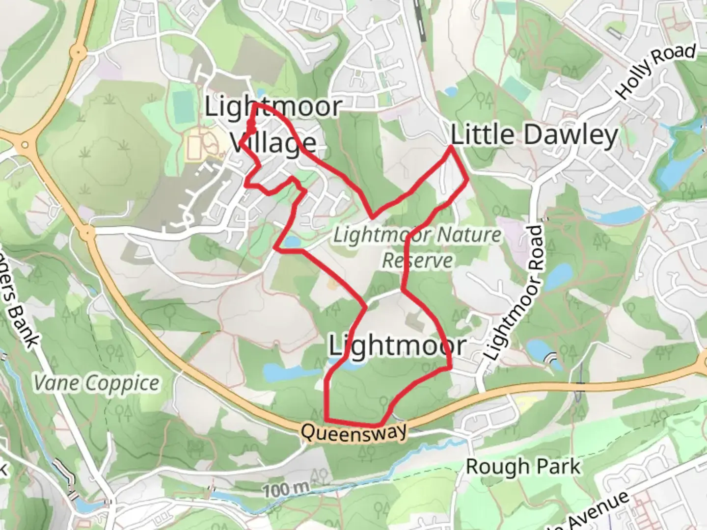
Car Park at Lightmoor Village Centre, TF4 3TB. Note: parking is restricted to 2 hours here, ample time to complete the route. An additional permanent overflow car park is planned at a nearby location, yet to be confirmed. Note: The start is accessible by a regular bus service from Telford Bus Station. Exit the car park using the steps to the right of the Londis Customer Parking, then turn right then immediately left to pass under the arches by some shops. Turn left at the Bournville Village Trust office on the corner into Little Meadow Mews (Lightmoor Way) and continue downhill to the T junction. Turn right into Little Flint (Lightmoor Way). Take the first left into Rays Meadow. After 30 metres, turn right onto a short paved footpath, noting the extensive views across to Woodside. Turn left at the end into Craven Close and keep to the right of the shared highway alongside the top of parkland. Join the path on the right which descends through Stocking Park Play Area towards the line of trees. Take the left fork near the bottom of the hill to emerge onto a path adjacent to houses and turn right. Continue straight to a narrower path, ignoring a turning to the left. At the end of this short way, follow the rough track ahead with a further recreational space, Croppings Park, above on the right and Holywell Meadow on the left. (You may like to explore this poolside area). Take the next left. Having left the new housing area behind, the walk now becomes notably more rural and uses rough tracks which can be muddy and wet. At the next junction, fork right. Continue ahead to a T junction and turn right. Ignoring any side tracks, follow this lane for 900 metres as it winds through woodland, first passing pools where kingfishers may be seen and then the spoil heaps, mine shafts and works of Lightmoor’s industrial history. The A4169 runs parallel to a short section of this quiet backwater. At the T junction, close to a more modern industrial unit, bear left and continue ahead on the tarmac surface which reverts to an ascending rough track. Towards the top of the short rise, just before it bends to the left, go right over a stile. (It is possible to avoid this by taking a shortcut a few paces before this.) Follow the narrow path downhill for approximately 100 metres through a coppice towards a marshy area, noting the pools below on the right. Now in more open terrain, continue across a boardwalk and uphill, taking the more definite right hand route on the ascent and ignoring a path to the right to emerge through a wooden barrier opposite a converted chapel. Turn Left onto the rough track which becomes a tarmaced lane through a small settlement. As this bends to the left, note the embankment of the former railway on the right. Continue to the junction and turn Left into Holywell Lane, descending past Boatwell Meadow on the left. Previously the site of a squatters’ settlement, the lane begins to climb. Opposite a modern property, Spring meadow, observe an old well on the right. After 20 metres, turn Right onto Woodlands Lane. Follow this well defined track, ignoring any side paths, as it ascends back towards Lightmoor’s new development. Stop to look at the restored Squatter’s Cottage, now used as an educational resource, on the right. Continue on Woodlands Lane, crossing the first road, Little Green Avenue, on a cobbled walkway, to reach the next road, Green Moors. Here leave Woodlands Lane by turning Left to return to the car park, clearly visible ahead.

Comments and Reviews
User comments, reviews and discussions about the Lightmoor, England.
average rating out of 5
0 rating(s)