
Download
3D Flyover
Add to list
More
10.9 km
~2 hrs 18 min
73 m
Loop
“Big estuary skies, whispering creeks and orchard-framed lanes make this a gently varied marshland ramble.”
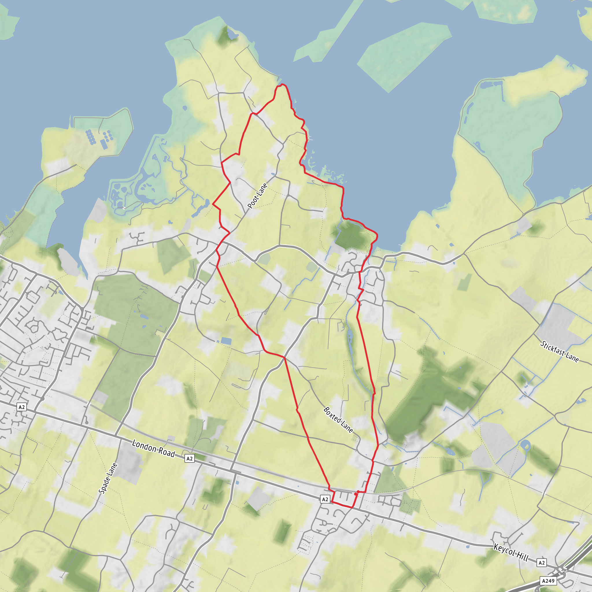
This easy loop of around 11 km (about 6.8 miles) with roughly 100 m (about 330 ft) of ascent explores the low-lying edge of the Medway estuary around Lower Halstow and Upchurch, linking open farmland, marsh-edge paths, creeks, old wharfage and a few gentle rises rather than any sustained climbing. The terrain is generally forgiving, but it is varied enough to keep the walk interesting: field-edge paths, grassy embankments, unmade tracks, country lanes and short village sections all feature on the route. In wet weather, the marsh-side stretches and field entrances can become muddy and slippery, so waterproof footwear is a sensible choice even on an otherwise straightforward day. The area is exposed in places, especially along the estuary edge, so windproof layers are worth carrying. (explorekent.org)
The route sits in the Lower Halstow and Upchurch area of north Kent, where the landscape shifts between rolling orchard country and the broad tidal margins of the Medway. Expect a walk that feels bigger than its modest elevation suggests: the open skies, saltmarsh creeks and long estuary views create a strong sense of space, while the inland sections over Broom Downs and around Mill Hill add a softer agricultural character with hedgerows, paddocks and cultivated fields. Explore Kent describes this wider circuit area as a mix of scenic fields, salt marsh, estuary birdlife, wharfs, barges, woodland glades, ancient churches and village life, which is a good reflection of what hikers should prepare for here. (explorekent.org)
Getting to the start
For public transport, the most practical rail access is Newington station, Station Road, Newington, Kent ME9 7LQ. National Rail lists Newington as the nearest station for this walking area, and onward travel information shows bus route 327 serving Lower Halstow (The Green) from the station area. That makes Newington the simplest arrival point if you are combining train and bus, or if you are happy to add a short taxi ride. (nationalrail.co.uk)
If arriving by car, the most useful landmark for the Lower Halstow side of the loop is The Green, Lower Halstow, Sittingbourne, Kent, or the historic creekside area near St Margaret of Antioch Church, School Lane, Lower Halstow, Sittingbourne, Kent. Lower Halstow is a small village with limited roadside space, so park considerately and check for local restrictions. If your mapping data only gives a rough trailhead, this village core is the nearest obvious landmark for accessing the loop. For route-finding on the day, HiiKER is the best tool to confirm the exact line of public rights of way and field crossings. (services.swale.gov.uk)
What the walk feels like
The opening part is usually the gentlest, easing you out through quiet village edges and into open country. Around Broom Downs and the surrounding farmland, the gradients are mild and the walking rhythm is easy, with broad views over the estuary-side landscape. This is where much of the route’s modest ascent is gained: not in one steep pull, but in a series of shallow undulations and embankment climbs that most walkers will barely notice until the total adds up. On a clear day, the elevated sections give a good sense of the relationship between the inland farms and the tidal creeks beyond. (christophersomerville.co.uk)
As the loop reaches the waterside, the character changes. The paths near Halstow Creek and Twinney Wharf are flatter and more open, often following flood banks or marsh-edge tracks. These sections can feel wonderfully remote despite being close to villages, with mudflats, reeds, moored boats and broad estuary light dominating the scene. One older route description of the Saxon Shore Way through this area notes the flood banks, old wharfage, boats at Twinney Wharf and the transition inland via Shoregate Lane and orchard country, all of which match the landscape hikers should expect here. (britishwalks.org)
The Mill Hill portion adds another subtle change in mood, bringing you back toward slightly higher
Surfaces
Unknown
Asphalt
Dirt
Grass
Comments and Reviews
User comments, reviews and discussions about the Broom Downs, Twinney Wharf and Mill Hill Loop, England.
average rating out of 5
0 rating(s)
