
Download
3D Flyover
Add to list
More
4.9 km
~1 hrs 9 min
110 m
Loop
“Experience Surrey's natural beauty and historical intrigue on this 5 km loop through woodland and heathland.”
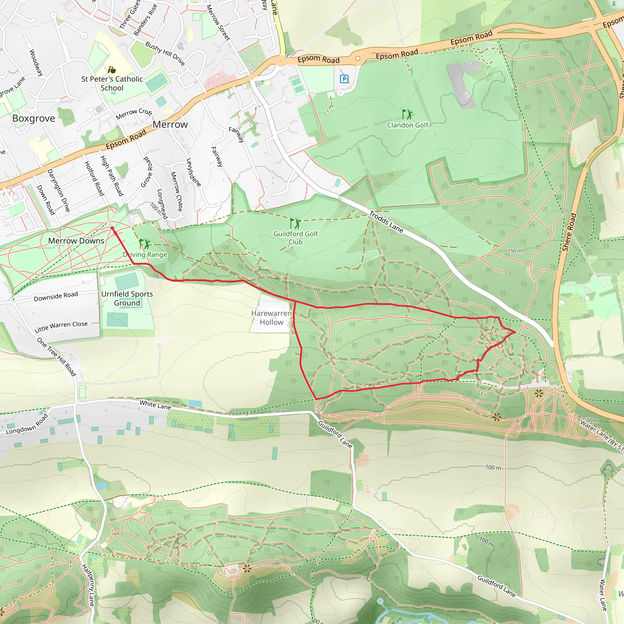
Starting near Surrey, England, this 5 km (approximately 3.1 miles) loop trail offers a delightful mix of natural beauty and historical intrigue. The trailhead is conveniently accessible by both public transport and car. If you're taking public transport, the nearest significant landmark is the Guildford Railway Station. From there, you can catch a local bus or taxi to the trailhead. For those driving, parking is available near the Newlands Corner Visitor Centre, which is a short distance from the trail's starting point.
Trail Overview
The trail begins with a gentle ascent, gaining around 100 meters (328 feet) in elevation. This initial climb takes you through a lush woodland area, where you'll be surrounded by towering walnut trees and a variety of other native flora. The path is well-marked, but it's always a good idea to have a navigation tool like HiiKER to ensure you stay on track.
Significant Landmarks and Nature
As you progress, you'll come across Walnut Tree Bottom, a serene valley that offers a perfect spot for a short break. Here, you can enjoy the tranquil surroundings and perhaps spot some local wildlife, such as deer or various bird species. The valley is particularly beautiful in the spring when wildflowers are in full bloom.
Continuing on, the trail leads you to The Roughs, an open heathland area that provides stunning panoramic views of the Surrey Hills. This section is relatively flat, making it a great place to catch your breath and take in the scenery. The Roughs are also home to several species of butterflies and other insects, making it a fascinating spot for nature enthusiasts.
Historical Significance
The region around Surrey is steeped in history, and this trail is no exception. As you hike, you'll pass by remnants of ancient settlements and possibly even some old boundary markers. These historical elements add an extra layer of interest to your hike, offering a glimpse into the area's rich past.
Final Stretch
The final stretch of the trail loops back towards the starting point, taking you through another section of woodland. This part of the hike is relatively easy, with a gentle descent that allows you to relax and enjoy the surroundings. Keep an eye out for more wildlife and interesting plant species as you make your way back.
Overall, this medium-difficulty trail offers a well-rounded hiking experience, combining natural beauty, wildlife, and historical intrigue. Whether you're a seasoned hiker or a casual walker, this trail has something to offer everyone.
What to expect?
Activity types
Comments and Reviews
User comments, reviews and discussions about the Walnut Tree Bottom and The Roughs, England.
5.0
average rating out of 5
1 rating(s)

