
Download
3D Flyover
Add to list
More
12.4 km
~2 hrs 40 min
112 m
Loop
“A mellow Suffolk ramble of fields, big skies, and old stones, crowned by Clare’s historic park.”
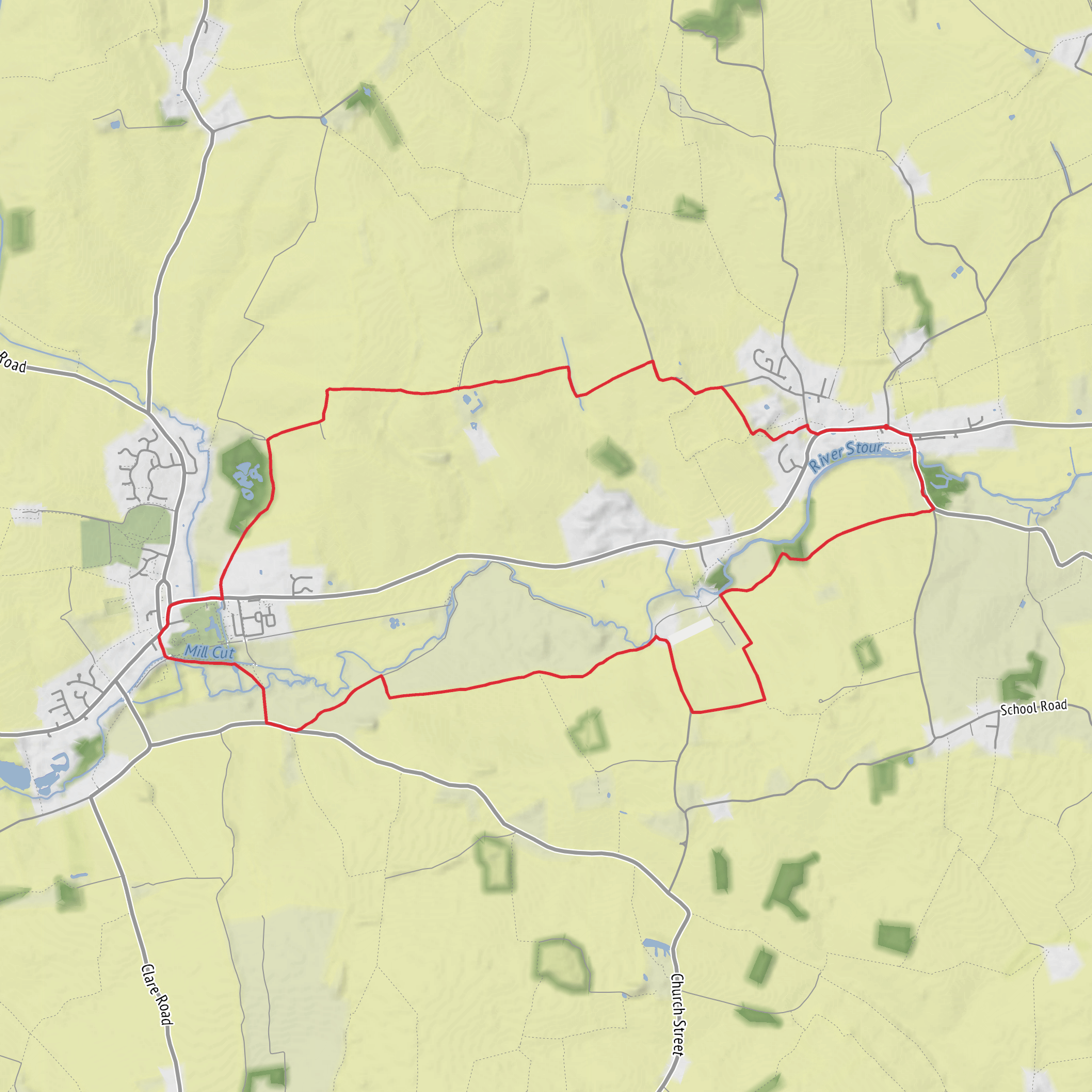
This easy loop of about 12 km / 7.5 miles with roughly 100 m / 330 ft of ascent is a gentle countryside walk that mixes open farmland, quiet lanes, a modest hill, and one of the most historically interesting small-town parks in East Anglia. The route is best thought of as a relaxed half-day outing rather than a strenuous hike: gradients are generally mild, the terrain is mostly lowland, and the climbing tends to come in short rises rather than long sustained pulls. (clarecastlecountrypark.co.uk)
The walk is most naturally started at Clare Castle Country Park, Malting Lane, Clare, Suffolk CO10 8NW, which is the main visitor parking area and a well-established base for local circular walks. The park sits just south of Clare town centre, close to the River Stour, and has parking, toilets, a café, historic railway buildings, and access to waymarked walking routes. Entry to the park is free, while the Malting Lane car park is pay-and-display. (visit-clare.co.uk)
For hikers arriving by car, Clare is on the A1092, about 7 miles / 11 km from Haverhill and 9 miles / 14.5 km from Sudbury. If using public transport, Clare is served by buses from Sudbury and Haverhill on weekdays and Saturdays, with the nearest rail connection at Sudbury railway station, which links onward via Marks Tey. Bus services do change over time, but current local information shows Clare served from Sudbury and Haverhill, with no Sunday service. (visit-clare.co.uk)
The route itself is likely to feel varied despite the modest distance. Leaving Clare, the first section is usually the easiest underfoot, with level or gently rolling ground as the walk moves out from the park and town edge into the surrounding agricultural landscape. Expect a mix of field-edge paths, farm tracks, and short road sections. In dry weather these are usually straightforward; after rain, some stretches can become muddy, especially where paths cross cultivated land or dip toward wetter ground near the Stour valley. Because waymarking in rural East Anglia can be inconsistent, it is worth checking the route carefully in HiiKER before setting out and at field junctions where paths can be less obvious. (clarecastlecountrypark.co.uk)
Terrain and what to expect
Although the total ascent is only around 100 m / 330 ft, the “hill” element of this loop still gives the walk some shape. The climb toward the Pentlow side of the route is not mountainous by any measure, but it does lift the walk onto higher ground where the views begin to open. On a clear day, these higher sections can give broad rural panoramas across the Stour Valley and the surrounding Suffolk-Essex border country. The landscape here is classic East Anglian countryside: hedgerows, arable fields, scattered copses, and long sightlines broken by church towers and farm buildings. (clarecastlecountrypark.co.uk)
Because this is an easy-rated route, most hikers with basic fitness should find it manageable, but footwear still matters. Waterproof trail shoes or light boots are a sensible choice, especially outside high summer. There may be stiles, uneven field margins, and rutted farm access tracks, so this is not always a uniformly smooth walk even though the elevation profile is gentle. In exposed sections there is little shelter from wind or sun, so carrying water and a light layer is wise year-round.
Landmarks, wildlife, and local character
One of the most distinctive points on this loop is the area around Pentlow, a small Essex parish near the Suffolk border. Its best-known landmark is the Church of St Gregory and St George, notable for its Norman origins and rare round tower, with the earliest parts dating to the 12th century. That makes it a particularly rewarding feature on a walk of this length: even if the route only brushes the village and surrounding hill country, the sense of age in the landscape is strong. Pentlow has long been an agricultural parish, and that farming history still shapes the scenery hikers move through today. (en.wikipedia.org)
Wildlife is often one of the quiet pleasures of this area rather than something dramatic or guaranteed. The wider Clare walking network notes that deer and hare are frequently encountered in the rolling countryside north and around the town, and similar farmland-edge species may be seen on this loop as well. Along hedges and meadows, expect common songbirds, with the possibility of raptors overhead in open country. Near the park and
Surfaces
Unknown
Ground
Paved
Asphalt
Comments and Reviews
User comments, reviews and discussions about the Pentlow Hill and Clare Castle Park Loop, England.
average rating out of 5
0 rating(s)

