
Download
3D Flyover
Add to list
More
9.6 km
~2 hrs 8 min
141 m
Loop
“Explore quaint villages and scenic landscapes on the moderately challenging Gazeley to Dalham Circular Path.”
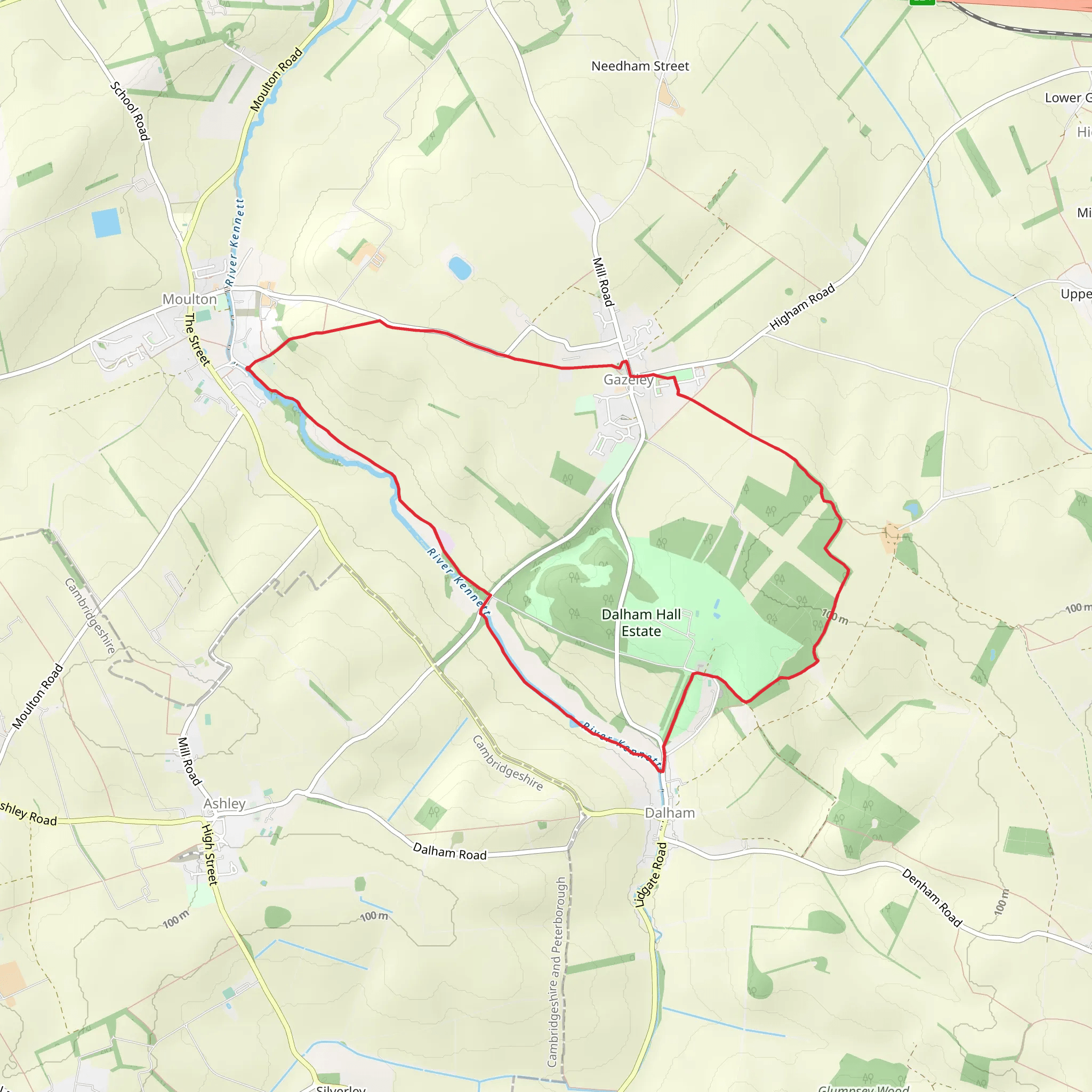
Starting near the charming village of Gazeley in Suffolk, England, the Gazeley to Dalham Circular Path offers a delightful 10 km (6.2 miles) loop with an elevation gain of approximately 100 meters (328 feet). This medium-difficulty trail is perfect for those looking to explore the picturesque English countryside, with its rolling hills, quaint villages, and rich history.
Getting There
To reach the trailhead, you can drive to Gazeley, which is easily accessible from nearby towns such as Newmarket and Bury St Edmunds. If you're using public transport, the nearest train station is in Newmarket, about 8 km (5 miles) away. From there, you can take a local bus or taxi to Gazeley.
Trail Overview
The trail begins near the village center of Gazeley, where you can find parking and basic amenities. As you set off, you'll be greeted by the serene beauty of the Suffolk countryside. The initial part of the trail takes you through open fields and meadows, offering expansive views of the surrounding landscape.
Points of Interest
Gazeley Village
Gazeley itself is a quaint village with a rich history dating back to the Domesday Book. Take a moment to explore the village church, St. Mary's, which features architecture from the 12th century.
Dalham Hall
Approximately 4 km (2.5 miles) into the hike, you'll reach the village of Dalham. Here, you can catch a glimpse of Dalham Hall, a historic manor house set within beautifully landscaped gardens. Although the hall is privately owned and not open to the public, the surrounding scenery is worth the visit.
Nature and Wildlife
As you continue along the trail, you'll traverse a variety of landscapes, including woodlands, hedgerows, and riverbanks. Keep an eye out for local wildlife such as deer, foxes, and a variety of bird species. The River Kennet, which you will cross at several points, is home to kingfishers and other waterfowl.
Navigation
The trail is well-marked, but it's always a good idea to have a reliable navigation tool. HiiKER is an excellent app for this purpose, providing detailed maps and real-time tracking to ensure you stay on course.
Elevation and Terrain
The elevation gain is moderate, with a total ascent of around 100 meters (328 feet). The terrain varies from flat meadows to gentle hills, making it accessible for most hikers with a reasonable level of fitness. Some sections can be muddy, especially after rain, so sturdy hiking boots are recommended.
Historical Significance
The region is steeped in history, with evidence of settlements dating back to the Roman era. The villages of Gazeley and Dalham have retained much of their historical charm, with several buildings and landmarks that offer a glimpse into England's past.
Final Stretch
As you loop back towards Gazeley, the trail takes you through more open fields and pastures. The final stretch offers a peaceful walk back into the village, where you can relax and perhaps enjoy a meal at one of the local pubs.
This trail offers a perfect blend of natural beauty, historical intrigue, and moderate physical challenge, making it a rewarding experience for any hiker.
What to expect?
Activity types
Comments and Reviews
User comments, reviews and discussions about the Gazeley to Dalham Circular Path, England.
4.45
average rating out of 5
11 rating(s)
