
Download
3D Flyover
Add to list
More
9.3 km
~1 hrs 53 min
13 m
Loop
“Big skies and wild marshes make this exposed Suffolk loop feel serene, shifting, and quietly dramatic.”
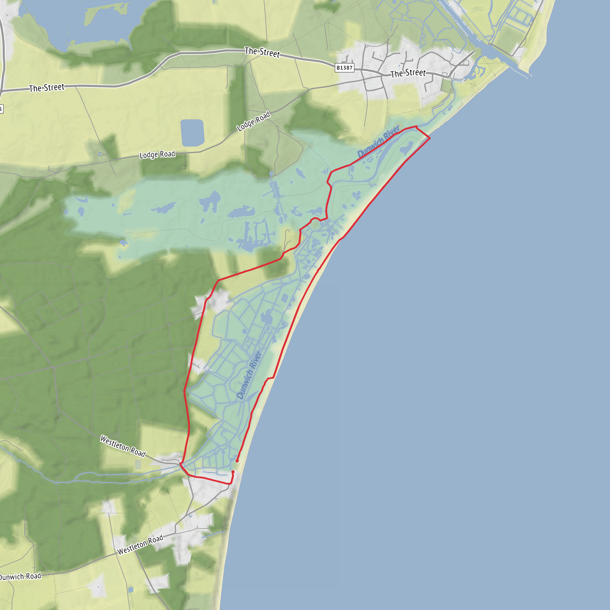
This easy loop of around 9 km / 5.6 miles is a low-lying coastal marsh walk with virtually no climbing, so the challenge comes less from elevation and more from exposure, underfoot conditions, and the openness of the landscape. Expect broad skies, reedbeds, shingle, grazing marsh, lagoons, and a strong sense of the Suffolk coast’s shifting edge, with the route typically associated with the Dunwich and Dingle Marshes area near Beach Road, Dunwich, Suffolk, IP17 3DZ, close to the Dunwich Beach car park and the entrance area used for Dingle Marshes access. (suffolkwildlifetrust.org)
The terrain is mostly flat at about 0 m / 0 ft of ascent, making it suitable for beginners, families, and anyone wanting a gentler day out, but “easy” should not be mistaken for effortless in all conditions. Coastal paths here can feel longer when there is wind coming off the North Sea, and sections near marsh, beach, or shingle can be slower going than the distance suggests. After rain, some stretches may be soft or muddy, while exposed shingle and sandy edges can also sap energy. (rspb.org.uk)
Getting to the start is most straightforward by car. The usual approach is via Dunwich village, continuing past the ruined Greyfriars Abbey and then forking right into the beach car park, which serves as the practical access point for Dingle Marshes. If using public transport, the nearest rail station is Darsham, and onward travel is limited, so planning ahead is important. The RSPB notes the Suffolk Link demand-responsive bus can connect from places such as Leiston and Saxmundham if booked in advance, and the reserve can also be reached on foot from Walberswick, including from Southwold via the seasonal foot ferry. (rspb.org.uk)
What the walk feels like
The character of the route is defined by contrast. One moment you are beside reed-fringed freshwater habitat, the next you are looking across shingle ridges and coastal marsh toward the sea. The landscape is open and horizontal, with long views rather than dramatic climbs, and that makes small details stand out: the movement of reeds in the wind, birds quartering low over the marsh, and the changing light over the lagoons and beach. Dingle Marshes is described by the RSPB as a patchwork of freshwater reedbed, shingle, coastal marsh, salty lagoons, and woodland, which gives the loop a varied feel despite the lack of elevation. (rspb.org.uk)
If your loop uses the paths between Dunwich, the marsh edge, and the forest margin, expect a mixture of firm tracks, coastal path sections, and potentially uneven ground near the shore. A route of around 9 km / 5.6 miles here is best approached as a leisurely half-day outing, especially if you plan to stop for birdwatching or photography. HiiKER is the best tool to use for checking the exact line of the loop, junctions, and any path variations before setting out.
Wildlife and natural highlights
This is one of the main reasons people come. Dingle Marshes supports important wetland and coastal habitats, and the birdlife is especially notable. The reserve is known for bitterns and marsh harriers, with reedbeds that support a significant share of the UK populations of those species, and visitors may also encounter other marsh and coastal birds depending on season. The wider area is also noted for species such as bearded tit, avocet, lapwing, redshank, and wintering geese, while mammals recorded in the reserve landscape include otter and water vole. (suffolkwildlifetrust.org)
Plant life is another highlight, particularly where the coastal strip meets the shingle. The reserve is noted for species such as yellow horned-poppy and sea kale, and the broader marsh system supports a rich wetland flora. Because this is a sensitive habitat mosaic, hikers should stay on established paths and avoid disturbing nesting or feeding birds, especially in spring and early summer. (rspb.org.uk)
Bring binoculars if wildlife is a priority, and dress for exposure rather than ascent. On a flat route like this, there may be little shelter from wind or sun. Waterproof footwear is often a good idea in cooler or wetter months, while in warmer weather insect repellent can be useful around reedbed and marsh edges.
Historical setting
The walk sits in a landscape shaped by both nature and centuries of coastal change. Dunwich is one of the most historically evocative places on the Suffolk coast: once a major medieval port, much of it was lost to the sea through erosion and storms over many centuries. Even approaching the trailhead, the presence of Greyfriars Abbey is a reminder that this coastline has been retreating and reshaping human settlement for generations. The marshes themselves are part of the
Surfaces
Unknown
Gravel
Dirt
Asphalt
Wood
Grass
Comments and Reviews
User comments, reviews and discussions about the Dingle Marshes Loop, England.
average rating out of 5
0 rating(s)

