
Download
3D Flyover
Add to list
More
12.5 km
~2 hrs 36 min
64 m
Loop
“Rolling Suffolk fields, big skies and medieval church towers lend this gentle loop a quietly historic charm.”
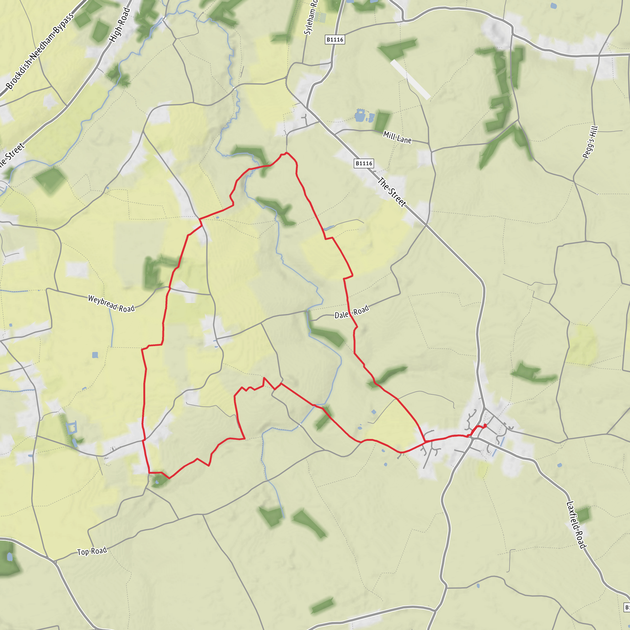
This easy loop of around 12 km (7.5 miles) near Bleach Green and Fressingfield in north Suffolk is a gentle countryside walk with roughly 100 m (328 ft) of total ascent, spread across rolling farmland rather than any sustained climb. The route sits in the Waveney-side landscape close to the Suffolk–Norfolk border, where quiet lanes, field-edge paths and broad views over arable land give it a very open, rural character. Fressingfield is noted in local planning and heritage records for its unexpectedly sloping approaches and steeper valley sides than many people associate with East Anglia, so even an “easy” rating still comes with a few short rises and dips. (fressingfield-pc.gov.uk)
The start is best understood as being near Bleach Green, a small hamlet in the Wingfield/Fressingfield area, with the nearest identifiable landmark being St Andrew’s Church, Wingfield, about 0.85 km away, and Fressingfield’s St Peter & St Paul Church about 2.85 km away. Bleach Green is associated with postcode IP21 5RG in Wingfield, near Diss, which is useful for car navigation when planning the approach. (ukcitymap.com)
If arriving by car, the usual approach is via the minor roads linking Fressingfield, Wingfield and Stradbroke, with parking generally easiest where there is obvious roadside space in or near the village rather than in the narrowest lanes. If using public transport, options are limited and should be checked carefully in advance: Suffolk County Council provides the county’s public transport information, while local material indicates that regular services in Fressingfield are sparse and largely not suited to spontaneous travel planning. Some nearby bus stops are listed around Bleach Green, but service frequency can be very limited, so this is a walk that is usually simplest by car. For route-finding on the ground, HiiKER is the best tool to use for checking the line of the loop and nearby access points. (suffolk.gov.uk)
What the walk feels like
Expect a mixture of quiet country lanes, farm tracks and public footpaths crossing open fields and skirting hedgerows. Because the total ascent is only about 100 m (328 ft), the effort is modest, but the route is long enough that footwear still matters, especially after rain when field margins and gateways can become muddy. In dry weather it should feel like a relaxed half-day outing; in winter or after prolonged wet spells, the same easy terrain can become slower going because of soft ground and slick grass.
The first part of a loop like this is typically defined by broad agricultural scenery: big Suffolk skies, gently undulating fields, and long views toward church towers and scattered farmsteads. The landscape here is not dramatic in a mountainous sense, but it is rich in texture—hedgebanks, old lanes, mature trees around farmhouses, and the subtle folds of the land that reveal why this part of Suffolk stands out from flatter districts farther east. (fressingfield-pc.gov.uk)
As the route works toward Fressingfield, the village becomes one of the main points of interest. The parish has medieval roots and appears in the Domesday Book, while the village core developed around its church and manorial buildings. That gives the walk a strong historic thread: even when you are simply moving between fields, you are crossing a settled landscape shaped over many centuries by farming, parish life and estate boundaries. (fressingfield-pc.gov.uk)
Landmarks and historical interest
The standout landmark in the area is the Church of St Peter and St Paul in Fressingfield, a listed medieval parish church on Church Street. Historic England dates the building to the medieval period, with later restoration in the 19th century, while local sources note construction spanning from the early 14th to the late 15th centuries. It is one of the most significant heritage features on or near the loop and gives the walk a strong sense of place. (historicengland.org.uk)
Fressingfield also has a notable ecclesiastical connection through Archbishop William Sancroft, whose grave is in the church. The village’s long history, old street pattern and surviving historic core make it more than just a waypoint; it is the cultural centrepiece of the route. (fressingfield-pc.gov.uk)
Around the wider area, Wingfield adds another layer of interest.
Surfaces
Unknown
Ground
Grass
Paved
Asphalt
Wood
Comments and Reviews
User comments, reviews and discussions about the Bleach Green and Fressingfield Loop, England.
average rating out of 5
0 rating(s)
