
Download
3D Flyover
Add to list
More
3.2 km
~43 min
59 m
Loop
“A breezy ridge wander blending sweeping Cotswold views, ancient earthworks, and a surprising sense of deep time.”
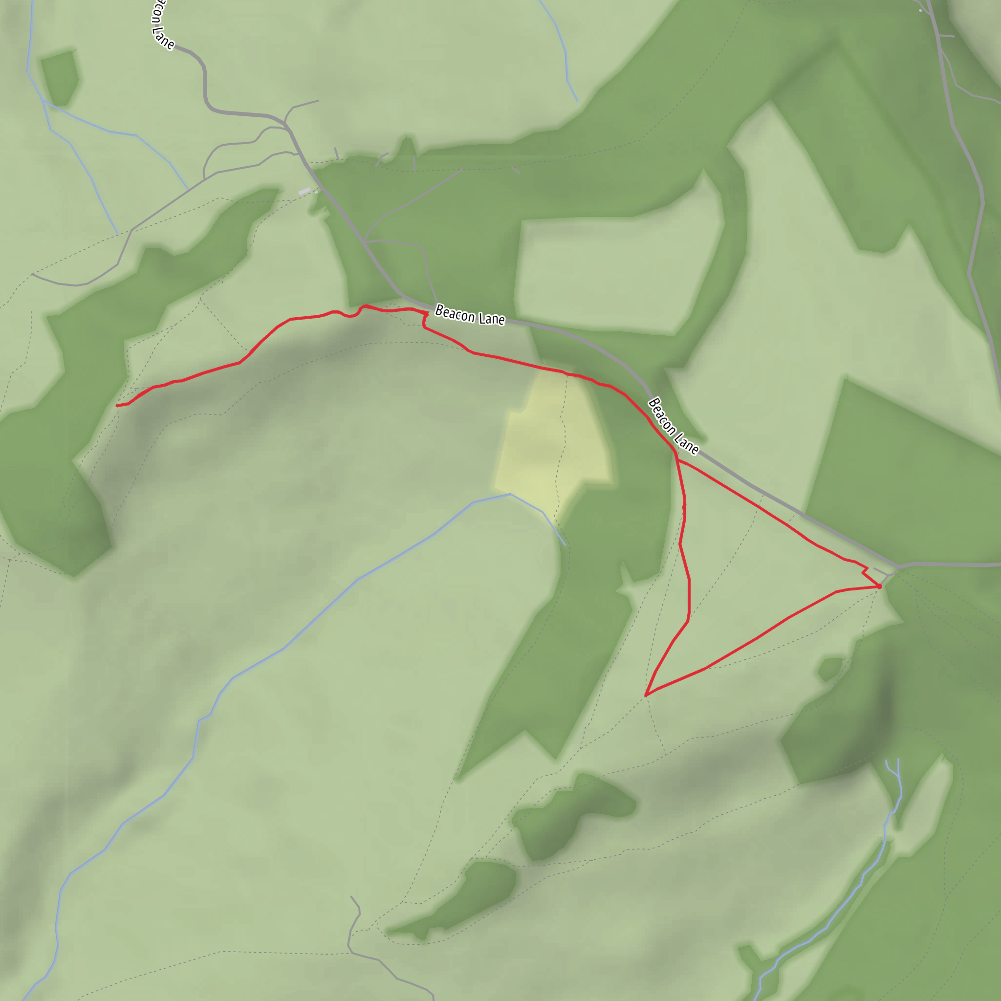
This short, easy circuit explores the open ridge around Haresfield Beacon, linking the topograph, Bunker’s Bank and Ring Hill in a walk of about 3 km / 1.9 miles with roughly 100 m / 330 ft of ascent. Although the mileage is modest, the route packs in wide escarpment views, prominent prehistoric earthworks and a good sense of the Cotswold edge landscape. The usual access point for this walk is the National Trust car park at Haresfield Beacon, near Whiteshill Village, Stroud, Gloucestershire GL6 6PP. The car park is signposted from the Whiteshill/Edge road and sits close to grid reference SO832086. (nationaltrust.org.uk)
The walking is generally straightforward, with grassy paths, broad tracks and short sections that can become uneven, muddy or slippery after rain. For most hikers, the main challenge is not distance but the exposed ridge, a few short rises and dips, and care around field edges, steps and worn ground near the hillfort earthworks. With an easy rating, it suits families and casual walkers, but sturdy footwear is still worthwhile because the grass can be slick in wet or windy weather. HiiKER is the best tool to check the route line and junctions before setting out. (osmaps.com)
What to expect on the route
From the start, the route quickly reaches the topograph, a viewpoint feature set out to help identify the surrounding landscape. This is one of the highlights of the walk, with broad views across the Severn Vale and toward landmarks such as May Hill, Gloucester and the Malvern Hills on a clear day. The terrain here is open and elevated, so even a short outing can feel expansive. (themodernantiquarian.com)
From the topograph, the route typically follows the ridge and nearby paths toward Bunker’s Bank and Ring Hill. Expect gentle undulations rather than a single sustained climb, with the total ascent adding up gradually to around 100 m / 330 ft. Bunker’s Bank forms part of the wooded and lightly sheltered section of the walk, creating a contrast with the open grassland around the beacon. Ring Hill then brings you back into the area’s archaeological core, where the shape of the land and surviving banks hint at much older use of the ridge. (leave-the-road-and.run)
Landmarks, history and landscape
This is a notably historic stretch of high ground. Historic England records the area around Haresfield Hill and Ring Hill as a complex of monuments including a slight univallate hillfort, a Romano-British settlement, a cross dyke known as the Bulwarks, a bowl barrow and a beacon. Archaeological evidence suggests the hillfort on Ring Hill was later reused in the Romano-British period, adding another layer to the site’s long occupation. (historicengland.org.uk)
Haresfield Beacon itself is especially significant. One of the circular mounds in the enclosed area is identified as a bowl barrow, while another supports the concrete triangulation pillar associated with the beacon. These features, together with the Bulwarks earthwork and the ridge-top setting, make this feel like far more than a simple viewpoint walk. Even if you are only out for an hour or so, you are moving through a landscape shaped over thousands of years. (historicengland.org.uk)
The scenery is classic Cotswold escarpment: open pasture, rough grassland, patches of woodland and long westward views. Because the ridge forms a watershed for tributaries feeding Daniel’s Brook and the River Frome, the topography is more dramatic than the short distance might suggest. (historicengland.org.uk)
Nature and wildlife
The Haresfield Beacon and Standish Wood estate is known for strong wildlife interest, with a mix of grassland and woodland habitats across the escarpment. Walkers can expect seasonal variation: open slopes can hold butterflies and grassland flowers in warmer months, while the wooded sections around Bunker’s Bank and nearby stands can be especially attractive in spring. The wider estate is described by the National Trust as having some of the best wildlife in the Cotswolds. (nationaltrust.org.uk)
Because this is exposed upland edge country, birds of prey and other soaring birds are worth watching for over the valley, especially in breezy conditions. Dawn and dusk can also bring more visible mammal activity along field margins and woodland edges. As always in grazed countryside, keep an eye out for livestock, shut gates behind you and give wildlife space. The open ground can also be windy enough to make conditions feel cooler than expected.
Getting to the start
By car, the simplest approach is to head for the National Trust car park at Haresfield Beacon, near Whiteshill Village, Stroud, Gloucestershire GL6 6PP. The National Trust notes that the small pay-and-display car park is reached by following the Whiteshill/Edge
What to expect?
Surfaces
Grass
Unknown
Comments and Reviews
User comments, reviews and discussions about the Haresfield Topograph, Bunker's Bank and Ring Hill, England.
average rating out of 5
0 rating(s)



